 BGS Data Catalogue
NERC_DDC
Type of resources
Available actions
Topics
Keywords
Contact for the resource
Provided by
Years
Formats
Representation types
Update frequencies
Service types
Scale
Resolution
-

Scanned collection of seismological journals and offprints. The original collection was compiled by John Wartnaby. John Wartnaby was a curator at the Science Museum, London, and wrote a historical survey of seismology and scientific instruments. His accumulated papers consist chiefly of offprints and articles, and many older British Association seismological reports. The collection is part of the National Seismological Archive.
-
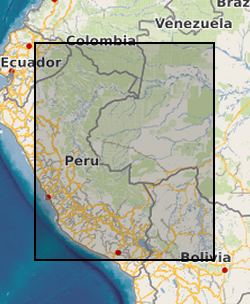
Chironomid calibration data set for tropical South America. Surface sediment samples from 59 Andean lakes across Bolivia (15 lakes), Peru (32 lakes), and Ecuador (12 lakes) over an altitudinal gradient from 150m above sea level to 4655m above sea level between 0-17 degrees South and 64-78 degrees West. Laguna Pindo is a small shallow lake on the Ecuadorian Andes (1 27.132 degrees South and 78 04.847 degrees West, 1248m above sea level). See published paper, Inferring late-Holocene climate in the Ecuadorian Andes using a chironomid-based temperature inference model by Frazer Matthews-Bird, Stephen J. Brooks, Philip B. Holden, Encarni Montoya, and William D. Gosling (2016), . Clim. Past, 12, 1263-1280, 2016. doi:10.5194/cp-12-1263-2016
-
The data presented in the Table 1 are U-Th chronology results of Siberian and Mongolian speleothems. This data is a basis for a scientific paper of Vaks, A. et al. (2013) "Speleothems Reveal 500,000-Year History of Siberian Permafrost." Science 340 (6129): 183-186. The table shows the ages of 111 layers of 36 speleothems taken from the six caves of Siberia and Mongolia. Vadose speleothems grow in caves of unsaturated zone when atmospheric water infiltrates into the caves from the surface. Therefore these speleothems cannot grow in permafrost, as well as in dry desert conditions. Therefore in Siberia the periods of speleothem growth show intervals during which the Siberian permafrost thawed and became discontinuous or absent. In Mongolian Gobi Desert the speleothem deposition periods show when the desert was both humid than present and warm enough to enable water infiltration into the caves. The data presented in tables 2 and 3 are OxCal-4.1 modeling results of the Table 1 chronology data for the Holocene (Table 2) and Marine Isotopic Stage (MIS) 5.5 (Table 3). The tables show exact durations of Holocene and MIS-5.5 permafrost thawing periods in Botovskaya and Okhotnichya Caves.
-
A range of footprint data collected specifically as part of a Natural Environment Research Grant [NE/H004211/1] held jointly between Bournemouth University (Professor Matthew Bennett) and Liverpool University (Professor Robin Crompton). A directory for each of the field sites investigated by the research team, as well as modern data from various laboratory and field simulations. Scans of individual footprints are an ASCII format, each of which contains the X, Y and Z for a digital elevation model. In most cases there is a site map in PDF format providing a key to the prints and file names. In some cases jpeg thumb nails of the scans are also provided. Most directories contain a PDF text file of additional information detailing the equipment used, collection methods, and precision/accuracy of the data, along with any available academic references.
-

2 papers and supplementary information produced from NERC Grant NE/I006427/1. Lear, C. H., H. K. Coxall, G. L. Foster, D. J. Lunt, E. M. Mawbey, Y. Rosenthal, S. M. Sosdian, E. Thomas, and P. A. Wilson (2015), Neogene ice volume and ocean temperatures: Insights from infaunal foraminiferal Mg/Ca paleothermometry, Paleoceanography, 30, 1437–1454, doi:10.1002/2015PA002833. Elaine M. Mawbey, Caroline H. Lear; Carbon cycle feedbacks during the Oligocene-Miocene transient glaciation. Geology ; 41 (9): 963–966. doi: https://doi.org/10.1130/G34422.1
-
Although the terrestrial mantle comprises ~80 vol.% of our planet, its compositional architecture is not well understood despite the importance such knowledge holds for constraining Earth's thermal and chemical evolution over ~4.5 billion years of geological time. Our lack of detailed insight into the mantle stems in part from the fact that it is rarely exposed at our planets surface, making direct observation and study difficult. It is clear from recent study, however, that the mantle cannot be assumed to be compositionally homogenous or static over geological time. Peridotites from the ocean basins (abyssal peridotites) and from ophiolites preserve evidence for a convecting upper mantle that is chemically and isotopically heterogeneous at regional (100's km) and small (cm-to-m) scales. Complex formation and alteration upper mantle histories involving processes of melt-depletion, refertilisation (whereby originally refractory residues such as harzburgites become lherzolites again via melt addition) and melt-rock reaction have been held responsible, but the causes, timing and distribution of such processes are poorly resolved. Ophiolites, which represent partially-to-wholly preserved slivers of obducted oceanic mantle, are particularly valuable resources for assessing the timing, causes and extent of mantle heterogeneity, as they allow field-based observation to be coupled with geochemical investigation on otherwise inaccessible mantle material. Furthermore, ophiolites preserve a range of oceanic mantle lithologies (e.g., harzburgites, lherzolite and dunite) and such variation allows detailed assessment of the distribution and relative timing of events acting upon the mantle that is preserved. A distinctive attribute of some ophiolites, which contrasts with abyssal peridotites, is the presence of podiform chromitite seams, typically in the region of the petrological Moho, which are often associated with Platinum-group element mineralization. The timing and genesis of ophiolite podiform chromitites is controversial, but it has been suggested that they represent zones of focused melt channeling in supra-subduction zone settings. The Shetland (UK) and Leka (Norway) supra-subduction zone ophiolites comprise oceanic lithosphere separated at ~620 Ma on either side of a mid-ocean ridge and subsequently obducted over continental crust ~130 Ma later, each on opposite sides of the northern Iapetus Ocean. A pilot study already carried out on the Shetland ophiolite by the PI and Project Partner reveals that it preserves evidence for a complex sequence of melt depletion, percolation and refertilisation events that occurred over the lifetime of the Iapetus mantle. The critical observation made from the pilot dataset is that later mantle events only partially overprint the compositional heterogeneities developed from earlier mantle processes and that the relatively high degrees of partial melting associated with the supra-subduction zone are very effective at generating such heterogeneity. This important observation will be tested in the proposed research by 1) extending the Shetland study to greater levels of detail; 2) inclusion of a comparative study of carefully selected samples from the well-preserved Leka ophiolite; 3) drawing comparisons with existing geochemical and isotopic datasets from ophiolites that formed in other (e.g., mid-ocean ridge) tectonic settings. In order to achieve this, the powerful combination of the Re-Os isotopic system and highly-siderophile element (Os, Ir, Ru, Rh, Pt, Pd, Re, Au) abundance measurements will be utilised to discriminate between the processes responsible for generating mantle heterogeneities such as melt depletion, refertilisation and melt-rock reaction. Thus, profound insight will be gained into the chemical evolution of a piece of oceanic mantle and the development of compositional heterogeneity therein, from outcrop to oceanic plate scales, over much of the lifetime of the Iapetus Ocean.
-
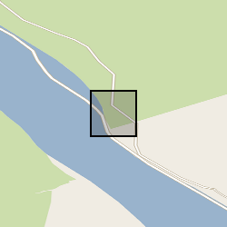
Geochemical data: %C, %OC, %IC, %N Physical Property data: Wet and dry bulk density, water content, porosity. Sediment cores extracted from Offshore Region: Loch Sunart NM 70277 63360, 56.705259, -5.7545471. For more information see published report, Substantial stores of sedimentary carbon held in mid-latitude fjords. / Smeaton, Craig; Austin, William; Davies, Althea; Baltzar, A.; Abell, R. E.; Howe, J. A. doi:10.5194/bg-13-5771-2016
-

Publication associated with NERC grant NE/I014039/1. In this paper, we discuss how the initial stages of mass gain are affected by the specific surface area (SSA) of the ceramic material. The paper provides guidance on experimental protocols to avoid dating results being distorted by relatively early-time mass gain data.
-

Publications linked to the Grant: Holwell DA, Keays RR, McDonald I and Williams MR. 2015. Extreme Enrichment of Se, Te, PGE and Au in Cu sulfide microdroplets: evidence from LA-ICP-MS analysis of sulfides in the Skaergaard Intrusion, East Greenland Contribution to Mineralogy and Petrology. doi: 10.1007/s00410-015-1203-y. 2) Smith JW, Holwell DA, McDonald I, Boyce AJ. 2016. The application of S isotopes and S/Se ratios in determining ore-forming processes of Magmatic Ni-Cu-PGE sulfide deposits: a cautionary case study from the northern Bushveld Complex Ore Geology Reviews, 73, 148–174 10.1016/j.oregeorev.2015.10.022. Jenkin GRT, Al-Bassam AZM, Harris, RC, Abbott, AP, Smith DJ, Holwell DA, Chapman RJ and Stanley CJ. 2015. The application of Deep Eutectic Solvent Ionic liquids for environmentally friendly dissolution and recovery of precious metals. Minerals Engineering, doi: 10.1016/j.mineng.2015.09.026. Hughes, H. S.R., McDonald, I., Faithfull, J. W., Upton, B. G..J., and Loocke, M. (2016) Cobalt and precious metals in sulphides of Peridotite Xenoliths and inferences concerning their distribution according to geodynamic environment: a case study from the Scottish lithospheric mantle. Lithos, 240-3, pp. 202-227. doi:10.1016/j.lithos.2015.11.007. Abbott, A.P., Harris, R.C., Holyoak, F., Frisch, G., Hartley, J. and Jenkin, G.R., 2015. Electrocatalytic recovery of elements from complex mixtures using Deep Eutectic solvents. Green Chemistry, 17(4), pp.2172-2179. DOI: 10.1039/C4GC02246G
-

The Terra-correlator: A computing facility for massive real-time data assimilation in environmental science. Two Application Framework Papers: 1) Report on Terra-Correlator Application Framework. 2) Use Cases and Requirements for Terra-Correlator Application Framework, plus the codes used for the work done.