 BGS Data Catalogue
1988
Type of resources
Topics
Keywords
Contact for the resource
Provided by
Years
Formats
Representation types
Update frequencies
Scale
-
The Borehole Geology database holds downhole lithological / lithostratigraphical data (with unit-bound lithological properties where appropriate) for boreholes identified within the Single Onshore Borehole Index (SOBI), which covers onshore and nearshore Great Britain. The database can store multiple interpretations for each borehole and properties assigned to each coded lithological unit. Available borehole geology properties include porosity, Munsell colour, grainsize, water struck, etc, and other valid property-types can be included when/if required.
-
New acquisitions of all forms of geological data received from external organisations are recorded in the accessions database and the digital or analogue data itself is then available to users. Data is in the form of reports, plans and digital information. This information comes from a wide variety of sources, including public bodies and agencies and commercial organisations. The data itself will be incorporated into existing corporate collections or may form a new collection in its own right. The rate of transfer will depend on priorities and requirements of both internal and external users. Data is continuously removed from the collection, all except recently received material will have been processed.
-

Index to the BGS collection of large scale or large format plans of all types including those relating to mining activity, including abandonment plans and site investigations. The Plans Database Index was set up c.1983 as a digital index to the collections of Land Survey Plans and Plans of Abandoned Mines. There are entries for all registered plans but not all the index fields are complete, as this depends on the nature of the original plan. The index covers the whole of Great Britain.
-

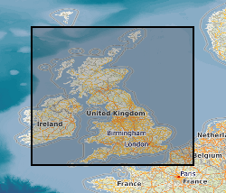
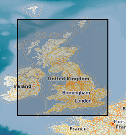
The Single Onshore Borehole Index (SOBI) is an index of over 1 million boreholes, shafts and wells and references collections of digital and analogue records from all forms of drilling and site investigation work held by the BGS. The index covers onshore and near shore boreholes from Great Britain dating back to at least 1790 and ranging from one to several thousand metres deep. Some 50,000 new boreholes are added each year. The majority of the records contain written descriptions of the ground encountered. The SOBI index database originated in 1988 from a number of existing tables and from data input from a variety of coding forms. Therefore not all fields in the database are populated and data that should be in some fields may currently form part of the entries in another. The index is available on the BGS website via the Geoindex
-

Index to the reports of work carried out by the BGS and its precursors. The index was set up in 1988 and has worldwide coverage. These reports cover a wide range of scientific and technical disciplines and were produced for a variety of purposes. The reports are not published but copies can be provided on demand subject to any restrictions. All registered Technical Reports held in collection are indexed. Start date of digital index circa 1988. Technical reports date from circa 1950 onwards.
-
The Land Survey Record Index was set up c.1988 to provide a digital database index to records and archives held by the Land Survey in Scotland and Northern England and contains over 46,600 records. Finding aid to the following record groups/data sets, is provided through a application query interface: Site Investigation Records (SE); Land Survey Archives (LSA); Land Survey Records (LSR); Mineral Resource Records (MR); Additional Information Files (AI); Enquiry Record Files (EE; EN); Opencast Coal Sites (OC).
-
Index to acquisitions and donations of all types of geological record data. This information has been received from a variety of external organisations including public bodies and commercial concerns. The Oracle index was set up in 1988 and holds basic index information about the donor and the donation. The index has been expanded in 2009 to include other sections of BGS and covers all their donations. The majority are from Great Britain.
-

Index to the statutory notifications of the intention to drill any boreholes, shafts or wells under the Mining Industry Act 1926 or the Water Resources Act 1991 for Great Britain. Index complete for all notifications since 1952, but record data will vary. Complete and current entries generally accurate to 10 metres . Earlier entries to map sheet level only. Digital capture from October 1988.
-

Index to reports of site investigations produced by external organisations carried out for all forms of site investigation. The Oracle index was setup in 1988 and covers the whole of Great Britain, all site investigation reports are indexed but the level of detail in the index for each record may vary. The reports date back to the 1950's and may contain information on boreholes, trial pits, laboratory tests and chemical analyses etc.