10000
Type of resources
Topics
Keywords
Contact for the resource
Provided by
Years
Formats
Representation types
Update frequencies
Scale
Resolution
-
The WellMaster database holds hydrogeological information on water wells for wells and boreholes identified within the Single Onshore Borehole Index (SOBI) within England Wales and Scotland. The database contains index details supplementary to SOBI, including information on the availability of more detailed hydrogeological information. Four main categories of data are held within the database; lithostratigraphic details, well/borehole construction including casing and screens, water information including depths and pumping rates and water quality information.
-
Collection of individually registered specimens and cuttings from onshore boreholes drilled in England and Wales by BGS, commercial and public bodies since the establishment of BGS in 1835. The collection has been developed as part of the BGS responsibility to establish and maintain a National Borehole Collection. The collection is updated on a daily basis by the addition of new data and by the modification of existing data. The collection contains all registered borehole samples for England and Wales, Scottish borehole samples are excluded. Details of the collection are held on the 'Borehole Materials Database', and may be accessed over the internet from the BGS web site.
-
Paper records and photos used to create the Nottingham Caves digital register and maps. Includes archival material of the caves known to BGS, around northern and central Nottingham. Data mainly captured in 1989, infrequent since then approximately 1 per year.
-
GIS Data Layer and Database including maps and detailed Indexes. Paper records and photographs, descriptive register is paper version from which the digital version was created. Data mainly captured in 1989, infrequent additions (approximately 1 entry per year) since then. Includes all man-made caves known to BGS in Nottingham, but there are many more to be located in the future.
-
Database of hydrogeological properties measured on core samples. Contains most determinations generated by BGS Wallingford Physical Properties Lab but some data is only available on paper. High quality data produced to strict laboratory quality standards.
-
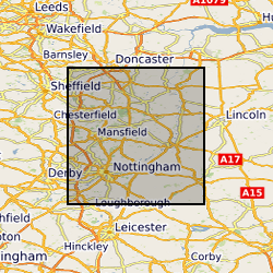
Descriptive register with detailed indexes of the Nottingham man-made caves. Data mainly captured 1989, infrequent additions (approximately 1 per year) since then
-
Index to borehole material held chiefly as continuous drillcore, bulk samples, unwashed cuttings and processed material from onshore UK.
-
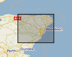
The database contains a range of geochemical data for metamorphosed limestones from the Dalradian of Scotland and Northern Ireland. The data include a) whole-rock geochemical analyses by XRF (X-Ray Fluorescence) for major oxides and a range of trace elements for several hundred samples, b) a number of whole-carbonate O (oxygen) and C (carbon) stable isotope and Sr (strontium) data, c) electron microprobe mineral data on carbonates and calc-silicate minerals and d) ion-probe O stable isotope and mineral trace element data for calcites in a small number of samples. The samples from which the data have been derived were collected from a wide range of outcrops within the Scottish and Irish Dalradian, mainly concentrated in the North East Grampian Highlands of Scotland. The data have been collected mainly to support the mapping and scientific work being undertaken in the Grampian Highlands by BGS since the early 1980s. The database includes some data from the literature. All samples are located by British National Grid coordinates to the nearest 10m or better. The isotope data were acquired as part of a PhD study by C W Thomas in the late 1990s. The database is not currently being added to, but is still being used in various studies. The combined data provide wide-ranging insights into marine chemistry contemporary with deposition of the limestones and the way in which this chemistry changed with time during the Neoproterozoic, and they elucidate subsequent effects of diagenesis and metamorphism and the outcrop and grain-scale. The data set is largely complete with regard to geochemical data, but still requires some editing to bring all fields up to date, particularly with regard to lithostratigraphical assignation. The data are currently held in MS Access tables and can conveniently be displayed via GIS or abstracted in tabular form and used in spreadsheets, statistical analysis and graphing software.
-
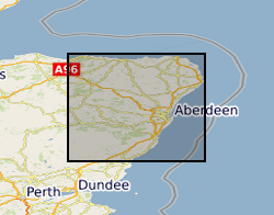
The database contains basic tabulated field data resulting from the work of the BGS East Grampians Project in the early 1980s to mid 1990s. Records include the locations of stations at which field observations were made, structural measurements and sample locations. To this end, the database provides an index to locations and structural data. However, it needs to be stated clearly that labels given to structural elements are largely subjective beyond the identification of bedding. This means that the structural data are largely unusable without a clear understanding of their context and with regard to the primary paper record on which descriptions of the observed structures are recorded. The data are held in MS ACCESS tables which are related via the Station number as the primary key. The coverage is mainly confined to the North East Grampian Highlands of Scotland. The database is currently unused and has not been added to since the end of the East Grampians Project. The station location and structural data are effectively complete. However, fields in the sample database, such as the sample stratigraphy, are largely incomplete because, at the time the data were acquired, the stratigraphy at each station was formally undefined. The most effective way of presenting and investigating the data is via GIS.
-
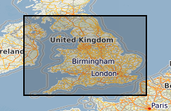
Data on the physical properties (transmissivity, storage coefficient, porosity and permeability) of aquifers in England and Wales. Compiled by BGS staff from paper records of field and laboratory testing held by BGS, the Environment Agency and other organisations. Contains summary data on approximately 20,000 pump tests at over 2000 discrete locations. Raw data may be available on request. The majority of BGS and EA pump test data is included for both major and minor aquifers, but in minor aquifers this is complemented by data on specific yield. Laboratory determinations of porosity and permeability are limited to open file BGS data only. All data subject to similar processing and interpretation, but raw data highly variable.
 BGS Data Catalogue