Boreholes
Type of resources
Available actions
Topics
Keywords
Contact for the resource
Provided by
Years
Formats
Representation types
Update frequencies
Service types
Scale
Resolution
-
The Single Onshore Borehole Index (SOBI) is an index of over 1 million boreholes, shafts and wells and references collections of digital and analogue records from all forms of drilling and site investigation work held by the BGS. The index covers onshore and near shore boreholes from Great Britain dating back to at least 1790 and ranging from one to several thousand metres deep. Some 50,000 new boreholes are added each year. The majority of the records contain written descriptions of the ground encountered. The SOBI index database originated in 1988 from a number of existing tables and from data input from a variety of coding forms. Therefore not all fields in the database are populated and data that should be in some fields may currently form part of the entries in another. The index is available on the BGS website via the Geoindex
-
The Geotechnical Database contains information about site investigation reports, boreholes and samples. It contains geotechnical measurements taken over borehole intervals and on samples. Some of the data is obtained digitally from AGS files (Association of Geotechnical and Geoenvironmental Specialists - File Transfer Format), some is obtained manually from Site Investigation Reports stored in the National Geoscience Data Centre. The database currently contains geotechnical data from over 450 000 laboratory test samples and core descriptions, borehole observations and in situ tests from over 96 000 boreholes extracted from over 4800 site investigation reports. The database underpins BGS Geo-engineering properties and processes research and is an important information resource for answering enquiries and providing for the data needs of external customers.
-
Site investigation and geotechnical data received by BGS from 3rd party organisations in AGS file format. When received by BGS the data is validated against predefined rules, processed and stored in the BGS AGS agnostic store. This data is delivered as received e.g. no interpretative values or observations are added to the data by the BGS. For more details about the Association of Geotechnical & Geoenvironmental Specialists (AGS) see: https://www.ags.org.uk For more details on depositing AGS data with BGS see: http://www.bgs.ac.uk/data/ags To access AGS data held by BGS: http://mapapps2.bgs.ac.uk/geoindex/home.html?layer=AGSBoreholes
-
The Land Survey Record Index was set up c.1988 to provide a digital database index to records and archives held by the Land Survey in Scotland and Northern England and contains over 46,600 records. Finding aid to the following record groups/data sets, is provided through a application query interface: Site Investigation Records (SE); Land Survey Archives (LSA); Land Survey Records (LSR); Mineral Resource Records (MR); Additional Information Files (AI); Enquiry Record Files (EE; EN); Opencast Coal Sites (OC).
-
The collection of over 19,000 site investigation reports for Scotland and Northern England consists of records of boreholes, trial pits, geotechnical results and interpretative reports acquired from various sources. The collection started c.1960 to cater for the increasing amount of post-war shallow drilling for building and road construction which was kept separately by the Survey from the Borehole Journal collection reserved for deeper geologist examined mineral bores. The site investigation reports are available for consultation on microfilm. Only the factual parts of reports are available for public inspection. Reports for Northern England are held in the Shallow Borehole File (SB), now no longer added to. All site investigation reports (except SB files) are indexed on the Land Survey Record Index (LSRI) and all boreholes and trial pits contained in the reports (those with adequate site plans) are indexed on the Single Onshore Borehole Index (SOBI).
-
New acquisitions of all forms of geological data received from external organisations are recorded in the accessions database and the digital or analogue data itself is then available to users. Data is in the form of reports, plans and digital information. This information comes from a wide variety of sources, including public bodies and agencies and commercial organisations. The data itself will be incorporated into existing corporate collections or may form a new collection in its own right. The rate of transfer will depend on priorities and requirements of both internal and external users. Data is continuously removed from the collection, all except recently received material will have been processed.
-
The Geophysical Borehole Log index provides details of hardcopy geophysical logs known to BGS. The index provides the storage location of the logs and details of the format they are available in, eg. paper, at a scale of 1:200. The data is updated when new data becomes available. Contains most geophysically logged bores known to BGS National Geological Records Centre. Scattered distribution of boreholes, locally dense coverage, few logs from Scotland.
-
This database stores down-hole stratigraphic data to complement the seismic surface picks stored in the Seismic Locations And Sections Database (LOCSEC). Because these surfaces are chosen for their visibility on seismic data, they may not be directly equivalent to established BGS lithostratigraphic and/or choronstratigraphic divisions. However, the local coding system is based on and can relate to the BGS stratigraphic LEXICON. Stratigraphic picks are stored in terms of depth and seismic one-way travel time. Local borehole summary information (location, elevation, etc.) is used because both onshore and offshore boreholes are stored in this database. These data can be related to the BGS onshore borehole database by borehole registration, and to the offshore well database by DTI well-id. Additional tables (under development) provide information on hydrocarbon tests and their results. Almost all data are within the UK Onshore area; although there are some UK near-shore and offshore (North Sea, Irish Sea).
-
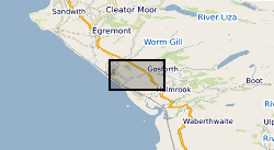
During the period from 1989 to 1997, Nirex undertook extensive geological investigations at sites near Sellafield, in Cumbria, and Dounreay, in Caithness, to examine whether or not they were suitable locations for a deep repository for radioactive waste. At Sellafield, thirty deep boreholes, and a further thirty-five shallow boreholes, were drilled. The majority of the deep boreholes were drilled to obtain continuous core and some 18.7km of rock core arose from the investigations. Two deep boreholes were drilled at Dounreay, totalling 2,286 metres of drilling. Again, much of the drilling was to obtain continuous core. In most of the boreholes a suite of data acquisition techniques were used, including: continuous coring, geophysical wireline logging, hydraulic testing, sampling and analysis of groundwaters. Mineralogical data were acquired by detailed core observation, petrographic analysis, fluid inclusion analysis and stable and radiogenic isotope studies. Testing on samples from the rock cores was undertaken to determine petrological, mineralogical, hydrogeological, geophysical and geotechnical parameters. The ownership of NIREX (Nuclear Industry Radioactive Waste Executive) was transferred from the nuclear industry to the UK Government departments DEFRA and DTI in April 2005, and then to the UK's Nuclear Decommissioning Authority (NDA) in November 2006.
-
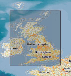
The UK Sand and Gravel Database was compiled during the production of the Industrial Mineral Assessment Reports. The Department of the Environment commissioned this Report series from the British Geological Survey. Data collection extended from the first IMAU report in 1969 to the last report in 1990. The dataset is complete and is derived from reports with some additional boreholes that were never published. Standard procedures were adopted for whole project. Each report studied the sand and gravel resources of an area of between one hundred and two hundred square kilometres. Specially commissioned boreholes on a one kilometre grid basis were used in conjunction with existing geological knowledge to make a resource level assessment of the volume and quality of sand and gravel resource available. A total of 12,563 boreholes were drilled, 53,721 Lithological units described and 54,128 samples collected and graded. This information is presented in the appendixes of the individual reports and as a single database. Data collection is complete. Only factual corrections to the data are occasionally made. The dataset includes the borehole location, total depth, unit thickness, unit lithologies, and grading information.
 BGS Data Catalogue