1972
Type of resources
Topics
Keywords
Contact for the resource
Provided by
Years
Formats
Representation types
Update frequencies
Scale
-
**This dataset has been withdrawn and is no longer avaible from BGS** The database contains satellite images of the UK purchased by the BGS or on its behalf by NERC. It includes data from the Lansdat, SPOT, Radarsat and ERS satellites. The images are stored in proprietary format on various types of magnetic media. The data are currently stored by path-row scene numbers and as mosaics on tapes, CDs and drives. Entire UK is covered by the dataset, however, there are gaps in coverage from individual sensors. Coverage exists for countries (or parts of countries) where work has been carried out.
-
The Mineral Reconnaissance Programme (MRP), funded by the DTI (Department of Trade and Industry) carried out baseline mineral exploration in Great Britain between 1972 and 1997. Its main aim was to stimulate private-sector exploration and the development of indigenous mineral resources. It has been subsumed into the new BGS Minerals Programme, also funded by the DTI. The Programme provides information and advice to industry, enables technology transfer and promotes wealth creation through the effective sustainable development of Britain's mineral resources. The database contains information from the MRP together with some from earlier programmes and the new Minerals Programme. Information from the early 1970s was largely concerned with the search for uranium and base-metals, while since the 1980s gold and platinum-group elements (PGEs) have dominated. A range of pathfinder elements have also been determined. Data is held on the geochemistry of drainage stream sediments, panned concentrates, soil, deep overburden, rock and drillcore samples. All geochemical results are used to populate corporate Geochemistry Database.
-
The register lists Lower Palaeozoic microfaunas (including "small shelly" faunas), but occasionally mentions small trilobites and various fragments. SAQ1-259 are used, although several numbers have no details assigned to them. Sample number, sheet number, NGR, fossil identification, borehole names & depths are given.
-
Reports of 267 mineral exploration projects carried out in the UK under the Mineral Exploration and Investigation Grants Act (MEIGA). Produced by external mineral exploration companies between 1971 and 1984. Includes project files kept on behalf of DTI (Department of Trade and Industry). All reports are held in hard copy and all are now on openfile.
-
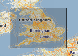
Records of some 3500 waste sites in England and Wales identified by BGS as part of a survey carried out on behalf of the Department of the Environment in 1973. Information is included on the extent of the site, geology, wastes and risks to aquifers It should be noted that the assessments were carried out when the data was collected and may not reflect current interpretation. There are not records for all of the sites listed.
 BGS Data Catalogue