 BGS Data Catalogue

Type of resources
Available actions
Topics
Keywords
Contact for the resource
Provided by
Years
Formats
Representation types
Update frequencies
Service types
Scale
Resolution
-

The purpose of Joule II Project Number CT92-0031 'The Underground Disposal of Carbon Dioxide' was to examine the potential for reducing CO2 emissions to the Earth's atmosphere from fossil fuel fired power plant by disposing of this CO2 underground. The report discusses whether this could be done practically, safely and economically, with minimal long term effects on man or the global environment. The report concentrates on the CO2 disposal process but also includes a detailed study of the technical and economic optimisation of CO2-removal in a lignite-fired IGCC power plant. The report is available for download at http://nora.nerc.ac.uk/502763/.
-

Final SACS 1 Report - Saline Aquifer CO2 Storage : a demonstration project at the Sleipner Field. Work area 1 (geology). The report can be downloaded from http://nora.nerc.ac.uk/512807/.
-
This report forms part of the international SACS (Saline Aquifer CO2 Storage) project. The project aims to monitor and predict the behaviour of injected CO2 in the Utsira Sand reservoir at the Sleipner field in the northern North Sea, to assess the regional storage potential of the Utsira reservoir, and to simulate and model likely chemical interactions of CO2 with the host rock. This is the final report of Work Area 1 in SACS, whose aims were to provide a full geological characterisation of the Utsira Sand and its caprock. The report summarises the key findings of the component subtasks of Work Area 1. The report also provides references to the various SACS Technical Reports wherein the full details of the scientific work can be found. The report can be downloaded from http://nora.nerc.ac.uk/511461/.
-

This document is part of the second phase of the Saline Aquifer CO2 Storage (SACS2) project. It describes the results of Task 5.6 of Work Area 5 (Geophysics): Feasibility of multicomponent data acquisition. The aim of this Task is to evaluate the feasibility of multicomponent seismic data for monitoring the development and movement of the CO2 bubble during CO2 injection into the Utsira Sand at the Sleipner Field, North Sea. The report can be downloaded from http://nora.nerc.ac.uk/10270/.
-

This poster on the UKCCSRC Call 2 project CO2 Flow Metering through Multi-Modal Sensing and Statistical Data Fusion was presented at the CSLF Call project poster reception, London, 27.06.16. Grant number: UKCCSRC-C2-218. Measurement and monitoring of CO2 flows across the Carbon Capture and Storage (CCS) chain are essential to ensure accurate accounting of captured CO2 and help prevent leaking during transportation to storage sites. The significant changes in physical properties of CO2 depending on its state (gas, liquid, two-phase or supercritical) mean that CO2 flows in CCS pipelines are complex by their nature. Meanwhile, impurities in a CO2 pipeline also make the flow more likely in the form of two-phase mixture. Despite difficulties due to the changes in CO2 properties, there has been very little research into metering issues of CO2 flows. The aim of this project is to develop a cutting-edge technology for CO2 flows metering in CCS pipelines. The objectives are as follows: • To establish a mass reference platform for CO2 flowmeter calibration; • To develop a prototype multi-modal sensing system and data fusion algorithms for mass flow metering of CO2; • To evaluate the performance of the multi-modal sensing system under single-phase and two-phase CO2 flow conditions.
-
This is continuous raw data from 3-component broad-band (30 sec to 100 Hz) Guralp 6TD seismometer deployments around Askja in the central region of Iceland.
-

This poster on the UKCCSRC Call 2 project Towards more flexible power generation with CCS was presented at the UKCCSRC Manchester Biannual Meeting, 13.04.2016. Grant number: UKCCSRC-C2-214.
-

Technical briefing report, August 2013. This briefing summarises the most recent published report addressing the scope for CCS in European industry (ZEP, 2013), adds further information from public sources and gives some new analysis of the implications. Available for download at http://hdl.handle.net/1842/16474.
-
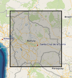
Each file contains four columns of data representing: column 1: UTM Zone 19S Easting coordinate for survey location along the Rio Beni, Bolivia. column 2: UTM Zone 19S Northing coordinate for survey location along the Rio Beni, Bolivia. column 3: Measurment range from observer to bank in m column 4: Bank height in m (the difference between bank top and low flow water level) UTM coordinates were measured using a Trimble Global Position System with OmniSTAR HP correction Measurement range and bank height were measured using a GPS supported laser range finder (Impulse 200 LR< Laser Technology inc) Survey 1 was carried out between 15th and 19th September 2011, when the flow discharge within the Beni was in the range 453-530 cumecs Survey 2 was carried out between 20th and 23rd September 2011, when the flow discharge within the Beni was in the range 762-892 cumecs
-

The data in this file represent measurements of the the depth, grain size characteristics and sedimentation rate for sediment cores collected from the floodplain of the Rio Beni in 2011, 2012, and 2013. The age of floodplain sediments was determined from measurements of the Pb-210 activity of floodplain sediments within the cores. The sample collection and laboratory techniques and data analysis procedures used to obtain these data are described in: Aalto, R & Nittrouer, C.A. (2012) Phil. Trans. Royal. Society., vol 370, p 2040-2074. This is an ascii text comma delimited file. Each row in the file represents a sediment core. The file contains 12 columns of data representing: column 1: The core name column 2: The latitude of the core location in digital degrees column 3: The longitude of the core location in digital degrees column 4: The year in which the core was collected column 5: The depth of the floodplain core (in cm) column 6: The age of the oldest sediment in the core (in years) column 7: The depth to the oldest sediment in the core (in cm) column 8: The estimated mean sedimentation rate for the core (in cm per year) column 9: The percentage of the core comprised of clay column 10: The percentage of the core comprised of silt column 11: The percentage of the core comprised of sand column 12: The mean density of sediment in the core (in g per cubic cm)