 BGS Data Catalogue
2022
Type of resources
Topics
Keywords
Contact for the resource
Provided by
Years
Formats
Representation types
Update frequencies
-

The Seabed Geology 10k: Bristol Channel is a digital geological map portraying the distribution of the different geological substrate units (either of bedrock or unlithified deposits) present on the seabed at a 1:10 000 scale. Additionally, to the Seabed Substrate layer, this dataset also includes i) a Geomorphology layer, revealing the presence and distribution of seabed morphological and geomorphological features and ii) a Structural Geology layer, that delineates the principal structural features observed at rockhead. The bedrock geology is divided into seven stratigraphical units: Pembroke Limestone Group (PEMB); Mercia Mudstone Group (MMG); Penarth Group (PNG); the Lias Groups' St Mary’s Well Bay (STM), Lavernock Shales (LVN) and the Porthkerry (PO) members; and the Inferior Oolite Group (INO). The Lexicon code of the stratigraphical units is provided in parentheses, as defined in the ‘BGS Lexicon of Named Rock Units’. The superficial deposits mapped are comprised of only marine sediments that were classified based on their grain size. However, Folk classification was not used to define the sediment classes. The sediments are divided into Gravel (V); Sand and Gravel (XSG); Sand (S); Sand and Mud (XSM); Mud (M); and Gravel, Sand and Mud (XVSM). The RCS code of the stratigraphical units is provided in parentheses, as defined in the ‘BGS Rock Classification Scheme’.
-
The BGS Debris Flow Susceptibility Model for Great Britain v6.1 is a 1:50 000 scale raster dataset of Great Britain providing 50 m ground resolution information on the potential of the ground, at a given location, to form a debris flow. It is based on a combination of geological, hydrogeological and geomorphological data inputs and is primarily concerned with potential ground stability related to natural (rather than man-made) geological conditions and slopes. The dataset is designed for those interested specifically in debris flow susceptibility at a regional or national planning scale such as those involved in construction or maintenance of infrastructure networks (road or rail or utilities), or other asset managers such as for property (including developers and home owners), loss adjusters, surveyors or local government. The dataset builds on research BGS has conducted over the past 15 years investigating debris flows. The model was designed to identify potential source-areas for debris flows rather than locate where material may be deposited following a long-run-out failure i.e. the track and flow of debris. This work focuses on natural geological and geomorphological controls that are likely to influence the initiation of debris flows. It therefore, does not consider the influence of land use or land cover factors.
-
The BGS GeoCoast Dataset is a Geographic Information System (GIS)-based analysis for indicating multi-hazards and interdependencies within the coastal zone of Great Britain (not including Orkney and Shetland). GeoCoast represents the natural geological coastline (around the mainland of Great Britain) as if no coastal defences or made ground are present. This will be of particular value in areas where coastal defences are no longer maintained. GeoCoast will offer anyone with assets, or an interest in the coastline around Great Britain, access to easy-to-use datasets linked to geohazard data. This will allow users to interpret potential interdependencies in terms of erosion, flooding, habitat and other vulnerabilities. These datasets are divided into two data packages: Premium and Open datasets, which include the following information: The data is delivered in GIS ESRI point, polyline and polygon format (other formats available on request).
-

BGS GeoScour v2 provides river scour susceptibility information for Great Britain using a three-tiered data provision allowing increasing levels of understanding at different resolutions from catchment to local (channel/reach) scales. GeoScour v2 includes 18 GIS layers, providing information on the natural characteristics and properties of catchment and riverine environments for the assessment of river scour in Great Britain. The dataset product fills a gap in current scour modelling, with the input of geological properties. It provides an improved toolkit to more easily assess and raise the profile of scour risk, now and in the future, to help infrastructure providers and funders prioritise resources, identify remedial works to preclude costly and prevent disruptive failures. The product has broad applications through its adaptation to suit multiple types of asset susceptible to fluvial erosion. GeoScour looks specifically at the geological factors that influence scour and does not consider any hydraulic or hydrodynamic factors. The GeoScour Dataset Product is designed to be used by multiple stakeholders with differing needs and therefore, can be interrogated at a number of levels. Tier 1 A catchment stability dataset provides a summary overview of the catchment characteristics, typical response type, and evolution. It can be used as a high-level overview for incorporation into catchment management plans, national reviews and catchment comparisons using Tier 2 datasets are available as smaller catchment areas and focusses on providing data for more detailed catchment management, natural flood management and similar uses. It analyses geological properties such as flood accommodation space, catchment run-off potential, geomorphology types, and additional summary statistics for worst, average, and best-case scenarios for underlying surface geology scour susceptibility, as well as additional summary statistics of key environmental parameters such as protected sites and urban coverage. Tier 3 datasets provide the detailed riverine information that is designed to be incorporated into more complex river scour models. It provides the baseline geological context for river scour development and processes and identifies important factors that should be considered in any scour model. Factors such as material mineralogy, strength and density are key properties that can influence a river’s ability to scour. In addition, an assessment of river fall, sinuosity and flood accommodation space is also provided. This data is of use to those assessing the propensity for river scour for any given reach of a river across Great Britain and can be used as an input into hydraulic/hydrodynamic models. Tier 1 and 2 datasets are Open Government Licence (OGL), Tier 3 is licenced.
-
**This dataset has been superseded** The newGeoSure Insurance Product (newGIP) provides the potential insurance risk due to natural ground movement. It incorporates the combined effects of the 6 GeoSure hazards on (low-rise) buildings: landslides, shrink-swell clays, soluble rocks, running sands, compressible ground and collapsible deposits. These hazards are evaluated using a series of processes including statistical analyses and expert elicitation techniques to create a derived product that can be used for insurance purposes such as identifying and estimating risk and susceptibility. The evaluated hazards are then linked to a postcode database - the Derived Postcode Database (DPD), which is updated biannually with new releases of Ordnance Survey Code-Point® data (current version used: 2022.1). The newGIP is provided for national coverage across Great Britain (not including the Isle of Man). This product is available in a range of GIS formats including Access (*.dbf), ArcGIS (*.shp) or MapInfo (*.tab) on request. The newGIP is produced for use at 1:50 000 scale providing 50 m ground resolution.
-
The BGS Property Subsidence Assessment (PSA) dataset provides insurers and homeowners access to a better understanding of the shrink-swell hazard at both the individual property and/or postcode level for England and Wales. It builds upon the GeoSure shrink-swell data by mapping the hazard to the individual building polygon and considering the other susceptibility factors of building type, foundation depth, and drainage and tree proximity. The user receives GIS building polygons with an overall susceptibility to subsidence score between 1-100. Scores are also classified from non-plastic to very high. Each building polygon is also scored from 1-10 for each subsidence factor (geology, foundation, drainage, building type, building storey and tree proximity). Postcode data is also available as a table showing the ‘average’ PSA score for all buildings within the postcode. The identification of shrink-swell related subsidence prone areas, alongside the inclusion of potential sources to exacerbate this phenomena, can better inform insurers and homeowners and form the basis to make decisions concerning prevention and remediation. The product enhances geological information obtained from GIP and GeoSure via the inclusion of the crucial shrink-swell susceptibility factors (proximity to trees and foundation depth). This therefore allows the derivation of a risk element for the housing stock at Building level, which is then generalised to Postcode level.
-

A core scanning dataset from part of the Ellesmere Port-1 drill core that was drilled for unconventional hydrocarbons in 2014. Approximate 40 m of core from the Bowland Shale Formation in the Ellesmere Port-1 (1532.7 – 1663.15 m) was scanned for high-resolution optical images and X-ray fluorescence (XRF) downcore point measurements using the Itrax MC core scanner (Cox Analytical Systems) at the Core Scanning Facility (CSF) at the British Geological Survey. Core scanning was utilised as part of the commission phase of this facility.
-
The borehole is located at the UK Centre for Ecology and Hydrology (UKCEH), screened between 2 and 4.5 m in the Thames gravels, and drilled to a total depth of 4.8m. It is located on an actively managed grass verge with popular and sycamore trees within 10 m. The stilling well is positioned 420 m west of the borehole in the River Thames. Both stage and groundwater level were monitored at 1-minutre frequency to investigate hydrological fractal scaling of high frequency data between 2012 and 2016. An automatic weather station is present between the borehole and stilling well and the data are available separately from UKCEH (stetur@ceh.ac.uk). Further site description is provided in: Habib, A. et al. 2017. Journal of Hydrology, 549, 715-730. Habib, A. et al. 2022. Hydrological Sciences Journal
-
Reflectance Transformation Imaging files of specimen BGS GSM106352, a large (1.0 x 1.2m) display cast, made from Jesmonite AC-300 and coloured dark gray and showing several species typical of the fossil biota on the Bed B surface of Wilby et al. (2011) in Charnwood Forest. Wilby. P, Carney, J.N, Howe, M.P.A 2011 A rich Ediacaran assemblage from eastern Avalonia: Evidence of early widespread diversity in the deep ocean. https://doi.org/10.1130/G31890.1
-
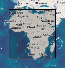
A geographic information system (GIS) containing geo-data for the energy transition across continental Africa created by extracting data from open sources into a series of shapefiles and rasters containing information on culture, geology, geothermal and geophysical data. This data is stored in the World Geodetic System (WGS) 1984 Geographic Projection System.