 BGS Data Catalogue
1990
Type of resources
Topics
Keywords
Contact for the resource
Provided by
Years
Formats
Representation types
Update frequencies
Scale
-
This dataset (GSE_REFERENCES) is a list of specimens held in the Type and Stratigraphical Collection of Scotland and Northern England, and the publications in which they are featured or illustrated. This database along with GSE_SPECIMENS (Index To The UK (North) Type And Stratigraphical Collection Of Fossils) and to some extent SMITH_GSE (Index To Specimens Transferred From The John Smith Collection To The UK (North) Type and Stratigraphical Collection) are the digital equivalents of the analogue card index (held in BGS Edinburgh).The latter contains c.16k records, of which perhaps 25% have now been transcribed. The MS Access database BGS_GSE_REFS presently contains 431 records (but does not include specimens from the John Smith Collection). This represents an unknown, but probably small, proportion of the Type and Stratigraphical Collection of Scotland and Northern England featured in publications. The database links with GSE_SPECIMENS, and can also provide species, authors and nomenclatural status. Many of the publications referred to are held in an extensive paper reprint collection.
-
The Seismic Line Index database stores summary administrative information about the collection of printed seismic sections, Original Seismic Sections dataset (ORIGSEISECS). This includes: details of data ownership or source, date of acquisition, purpose of survey, confidentiality, media, survey acquisition and processing parameters, and storage location in BGS. Almost all data are within the UK Onshore area; although there are some UK near-shore and offshore (North Sea, Irish Sea) and foreign data. Most data were acquired for commercial hydrocarbon exploration and subsequently provided to BGS for use on specific projects. Some data were acquired by BGS and other public-sector bodies, e.g. BIRPS (British Institutes Reflection Profiling Syndicate), for academic research. There is also scope to add relevant information about the data held in Copy Seismic Sections (COPYSEISECS) and Original Seismic Shotpoint Location Maps (ORIGSPMAPS) datasets.
-
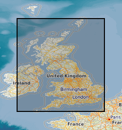
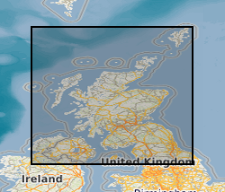
The data shows the extent of mining within Great Britain it was captured in 1990 by OVE ARUP on behalf of the Department of Environment as a series of paper maps and no updates have been carried out. The data has been converted to a digital format (ESRI shape file) by BGS in 1995. The original scale of the data was 1km square. The dataset has limited attribution indicating type i.e. metalliferous, rock, coal, deneholes (chalk), evaporites or ironstone, and whether definitive evidence was found. Although every effort has been made to attribute the digital data to the original maps some inconstancies may have arisen due to data conversion process.
-
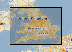
Oracle index to records of some 3500 waste sites in England and Wales identified by BGS as part of a survey carried out on behalf of the Departement of the Environment in 1973. The index has been corrected and updated to a limited extent, but the data itself has not been changed. The data was collected in 1972 and the information reflects the knowledge at that time. It does not reflect current interpretation. Not all authorities made returns and there are not records for all of the sites listed. However, the data is an invaluable source of information about pre-1974 sites. Information includes site name, location and risks to aquifers. It should be noted that the assessments were carried out when the data was collected and may not reflect current interpretation.
-
BGS holds a disaster recovery copy of the microfiche of the statutory mine abandonment plans for the Coal Authority. This collection is an incomplete copy of the mine plans deposited with the Coal Authority and held on behalf of the Health and Safety Executive under statutory legislation. Not for public use.
-

The Seismic Locations and Sections database (LOCSEC) stores digitised seismic reflection survey location and line-interpretation data. Supplementary data stored includes map projection information and rock-unit seismic velocity data. The data are grouped by interpretation project area. Location data are input from digitised seismic shotpoint (SP) or common depth point (CDP) maps, or from direct input of digital navigation data. [See: Original Seismic Shotpoint Location Maps (ORIGSPMAPS) and Digital Seismic Shotpoint Location Maps (DIGSPMAPS) datasets]. Line-interpretation data are input from digitised pick-lines on manually interpreted printed seismic sections. [See: Copy Seismic Sections dataset (COPYSEISECS)]. In-house software is used for data management and display, to perform interpretation related tasks, e.g. depth-conversion, and to merge data into X, Y, Z form for input to 3D mapping and modelling packages such as EarthVision. Data in LOCSEC may also be related to the borehole interpretations held in the Stratigraphic Surfaces Database (SSD). Almost all data are within the UK Onshore area; although there are some UK near-shore and offshore (North Sea, Irish Sea) and foreign data. Most data were acquired for commercial hydrocarbon exploration and subsequently provided to BGS for use on specific projects. Some data were acquired by BGS and other public-sector bodies, e.g. BIRPS, for academic research.
-
This is a simple Oracle table holding sample numbers, locations (UK National Grid) and illite crystallinity values measured for pelitic (mudrock) samples from Lower Palaeozoic terranes in the UK. Though intended for use by a BGS collaborative project with Birkbeck College, London, data may be made available to others on request.
-

Index to manuscript geological maps produced by the Survey geologists or other recognised geologists on County Series (1:10560) and National Grid (1:10560 & 1:10000) Ordnance Survey base maps. The index was set up in 1991. Current holdings for Great Britain are over 35,000. There are entries for all registered maps but the level of detail depends on nature of original Survey, ie not all fields are complete for all entries.
-

This index is a list of specimens and slides taken from the John Smith Collection and placed in the Type and Stratigraphical (T&S) Collection of Scotland and Northern England. To some extent it is the digital equivalent to part of the T&S analogue card index which is held in BGS Edinburgh. The data, however, appears to have been derived from the 5 leather bound volumes of the T&S register. The latter are held in BGS Keyworth, but equivalent information (microfilm and paper records) is held in BGS Edinburgh. The MS Access database (BGS_SMITH_GSE) contains 1123 records, it links the T&S register with that of the John Smith Collection (8 bound volumes held at BGS Edinburgh) and provides limited information on taxonomy, nomenclatural status and chronostratigraphy. It also has provision for stating where the specimen is housed. The repository of BGS John Smith specimens is the Edinburgh office.