1995
Type of resources
Available actions
Topics
Keywords
Contact for the resource
Provided by
Years
Formats
Representation types
Update frequencies
Service types
Scale
-
BGS have collected environmental radioactivity data for various purposes over several decades. This is being drawn together to produce a database of baseline gamma radioactivity and radon. Data includes the relevant portions of airborne and ground gamma spectrometer surveys, mineral exploration, baseline geochemistry and environmental radiometric surveys along with lithogeochemical and borehole log data. It is predominantly a specialist subset of other existing BGS databases. Incomplete UK coverage.
-
Data from the DiGMap covering the whole of the United Kingdom at a scale of 1:625 000 is available in this OGC WMS service for personal, non-commercial use only. The service is a contribution to the OneGeology-Europe initiative. The layers can be displayed either by age or by lithology. For more information about the digital maps available from the British Geological Survey, please visit https://www.bgs.ac.uk/datasets/bgs-geology/
-
Data from the DiGMap covering the whole of the United Kingdom at a scale of 1:625 000 is available in this OGC WMS service for personal, non-commercial use only. The service is a contribution to the OneGeology-Europe initiative. The layers can be displayed either by age or by lithology. For more information about the digital maps available from the British Geological Survey, please visit https://www.bgs.ac.uk/geological-data/.
-
This service is an INSPIRE download WFS service, providing UK onshore bedrock geological data at 1:625 000 scale. This map data is collected as part of an ongoing BGS project: Digital Geological Map of Great Britain (DiGMapGB). GeoServer software is used to provide this WFS service. This service is delivering MappedFeatures specified by GeologicUnits, the geological history of which is recorded by GeologicEvents.
-
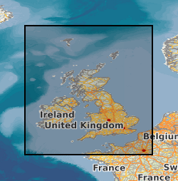
UK continental shelf seabed sediment data at 1:1 million scale. This data layer is the BGS contribution to the OneGeology project, providing UK onshore geological data at 1:625 000 scale and UK continental shelf seabed sediment data at 1:1 million scale.
-
A collection of large-size, representative hand samples of building stones from current and historic quarries in the UK, together with specimens from historic buildings supplied by conservation architects and contractors, currently c.680 samples. The sample coverage extends across the whole of the UK and supplements material in the Keyworth BGS BRITROCKS collection (Petrological Collection Database). The data included with the samples includes quarry and building locations and relevant lithostratigraphic information. The collection is ongoing and new material is added on a regular basis. The collection was created to mitigate the massive gap in knowledge resulting from the non-transferral of the main BGS Building Stone Collection to Keyworth from the Geological Museum in London, when the original move by BGS from London took place. The samples have been collected to assist in the sourcing, identification and matching of buildings stones from historic buildings throughout the UK. The collection provides essential support for the numerous enquiries the BGS receives through its GEOREPORTS Building Stone Assessment programme.
-
The 1:50 000 scale GeoSure (natural ground stability) data covering the map sheets for Loughborough and Kilmarnock are available in this OGC WMS service for personal, non-commercial use only. This service is a contribution to the OneGeology-Europe initiative. For information about more of the British Geological Survey's maps and other digital products please visit http://www.bgs.ac.uk/products. MapServer software is used to provide this OGC WMS service.
-
This service is the BGS contribution to the OneGeology project, providing UK onshore geological data at 1:625 000 scale and UK continental shelf seabed sediment data at 1:1 million scale. This map data is collected as part of an ongoing BGS project: Digital Geological Map of Great Britain (DiGMapGB). MapServer software is used to provide these OGC WMS and WFS services.
-
The Geophysical Properties dataset consists of density, velocity, magnetic susceptibility and thermal conductivity values, with related source, location and geology data. The data have been collected on a project basis, therefore the quality and completeness of the database coding is variable. The data is currently from the UK and Ireland although this may be extended. The data consists of samples with related data values - (1,000s), Density Values - Laboratory Measurements - (1,000s); Velocity Values - Laboratory Measurements - (1,000's), Magnetic Susceptibility Values - Laboratory Measurements - (1,000s); Magnetic Susceptibility Values - Field Measurements - (10,000s measurements on 1,000s samples). Borehole information for data obtained as Downhole profiles with related data values; British Rock Densities Project - Insitu density values obtained from the analysis of formation density logs - (10s boreholes with 100s values). Downhole Magnetic Susceptibility - Obtained for a confidential project with some offshore - (10s boreholes with 10,000s samples) . Thermal Conductivity - (100s boreholes with 1,000s samples), Mean Data Values derived from a data source such as published literature for a site or rock formation; Density - (100s), Magnetic Susceptibility - (100s). Information about the source from which data is obtained, Engineering Geology Laboratory Reports - (100s), Literature which may be published or unpublished - (100s). The database is not maintained and no new data has been added since 2004.
-
This database stores down-hole stratigraphic data to complement the seismic surface picks stored in the Seismic Locations And Sections Database (LOCSEC). Because these surfaces are chosen for their visibility on seismic data, they may not be directly equivalent to established BGS lithostratigraphic and/or choronstratigraphic divisions. However, the local coding system is based on and can relate to the BGS stratigraphic LEXICON. Stratigraphic picks are stored in terms of depth and seismic one-way travel time. Local borehole summary information (location, elevation, etc.) is used because both onshore and offshore boreholes are stored in this database. These data can be related to the BGS onshore borehole database by borehole registration, and to the offshore well database by DTI well-id. Additional tables (under development) provide information on hydrocarbon tests and their results. Almost all data are within the UK Onshore area; although there are some UK near-shore and offshore (North Sea, Irish Sea).
 BGS Data Catalogue