 BGS Data Catalogue
irregular
Type of resources
Topics
Keywords
Contact for the resource
Provided by
Years
Formats
Representation types
Update frequencies
Scale
-
The British Geological Survey has collected over 50000 offshore samples using grabs, dredges and shallow coring devices (to a maximum depth of 6m below the sea bed). The collection also includes additional third party data and has assisted in the creation of BGS Marine Geology Maps. The distribution is variable, but in general there are sample stations spaced about every 5 - 10km across the entire UK Continental Shelf (UKCS). In some localised areas the sampling density is much higher. The data held includes digital data and analogue records (sample data sheets), plus associated physical sample material. Sample data sheets which have been scanned contain index information and geological descriptions and are more detailed from 1983 onwards. Coded geological descriptions were entered on sheets which were subsequently digitised, and this information is available for about 10,000 samples. The data also includes results of analyses such as micropalaeontological examination or age dating. Particle Size Analysis, geochemistry and geotechnical data are described in separate metadata entries. Sample material are managed as part of the BGS Materials collection and are available for examination and subsampling. The data are stored within the National Geoscience Data Centre (NGDC) and Marine Environmental Data and Information Network (MEDIN) Data Archive Centre (DAC) for Geology and Geophysics. Data are delivered via the BGS Offshore GeoIndex www.bgs.ac.uk/GeoIndex/offshore.htm.The activity and scan layers contains location information, metadata and links to scanned sample datasheets/core logs, and the geological, geotechnical, geochemical and sea-bed sediment data layers contain observations and/or measurements as digital values. The data are applicable to a wide range of uses including environmental, geotechnical and geological studies. Reference: Fannin, NGT. (1989) Offshore Investigations 1966-87. British Geological Survey Technical Report WB/89/2, British Geological Survey.
-
The British Geological Survey hold a collection of data recorded during marine geophysical surveys which includes digital data and analogue records. These data result from approximately 350,000 line kilometres of multi-instrument geophysical survey lines. The data include seismic, sonar, magnetic, gravity, echo sounder, multibeam bathymetry and navigation data. The seismic data are mainly for airgun, sparker, boomer and pinger. The data were primarily collected by BGS and the collection also includes additional third party data. The data are primarily from the UKCS (United Kingdom Continental Shelf). The data are stored within the National Geoscience Data Centre (NGDC) and the Marine Environmental Data and Information Network (MEDIN) Data Archive Centre (DAC) for Geology and Geophysics. The majority of legacy geophysical paper records are available as scanned images viewable via the BGS Offshore GeoIndex www.bgs.ac.uk/GeoIndex/offshore.htm. Other records can be scanned on request. Older records are of variable quality. Data not yet available online including segy are available on request enquiries@bgs.ac.uk. The data are applicable to a wide range of uses including environmental, geotechnical, geophysical and geological studies. Reference: Fannin, NGT. (1989) Offshore Investigations 1966-87. British Geological Survey Technical Report WB/89/2, British Geological Survey.
-
The SEA portal is managed by the BGS on behalf of DECC and provides free access to downloadable data, information and reports which have been produced through the SEA process. The Department of Trade and Industry (now DECC) began a sequence of sectoral SEAs of the implications of further licensing of the UK Continental Shelf (UKCS) for oil and gas exploration and production in 1999. The SEA Process subdivided the UKCS into eight areas shown; beginning in 2008, integrated Offshore Energy SEAs have been undertaken that cover the whole UKCS. An integral part of the SEA programme has been a series of research and monitoring surveys commissioned to acquire new data about the offshore environment and used to help inform the relevant SEAs. Many files can be downloaded directly from portal. Those that are too large to download can be ordered via the website for postal delivery from BGS.
-
This data set contains the following original data for the deep seismic reflection surveys conducted by the BGS in various parts of the UK. The data consists of observers' logs, surveyors' reports, location data tapes, field data recording tapes and processed data tapes. The processed tapes are at various stages of processing from demultiplexed field data to migrated stack (not all available for all profiles) These data are kept as archive copies. They are generally available for academic and commercial use, subject to payment of fees (and, in a few cases, the agreement of co-owners of the data rights). There are Approximately 20 files of written records and 200 tapes.
-

The data set consists of the results of particle size analysis (PSA) performed on approximetaly 29,000 sea-bed sediment samples collected by BGS from the UK Continental Shelf and adjacent deep water areas, mostly using sediment grabs, but also sediment corers on occasions. Measurements were also made on approximately 8000 downhole sub-samples from shallow cores and boreholes. Data from other UK organisations have also been added to the PSA dataset. The data are stored as part of the National Geoscience Data Centre (NGDC) and the Marine Environmental Data and Information Network (MEDIN) Data Archive Centre (DAC) for Geology and Geophysics. Data are delivered via the BGS Offshore GeoIndex www.bgs.ac.uk/GeoIndex/offshore.htm Seabed Sediment Data layers.
-
The data consist of the results of geotechnical testing carried out at various depth intervals on shallow cores or boreholes collected BGS from the UK Continental Shelf. The bulk of the data north of 56N are in digital form and result from testing carried out on board survey vessels using hand-held test equipment (penetrometers and shear vanes). These values are averaged for each test interval, and are expressed in kiloPascals. There are approximately 6000 test results in the data set. Some more detailed test information, in non-digital and report form is held for selected sites. Also for most sites where digital data is not available, geological descriptions of core material will also contains semi-quantitative information on the stiffness of the material. Geotechnical knowledge is required to understand and interpret the results if they are to be used as a basis for engineering studies. Core material are managed as part of the BGS Materials collection and are available for examination, testing or subsampling. The data are stored as part of the National Geoscience Data Centre (NGDC) and the Marine Environmental Data and Information Network (MEDIN) Data Archive Centre (DAC) for Geology and Geophysics. Data are delivered via BGS Offshore GeoIndex www.bgs.ac.uk/GeoIndex/offshore.htm geotechnical layers. Reference: Fannin, NGT. (1989) Offshore Investigations 1966-87. British Geological Survey Technical Report WB/89/2, British Geological Survey.
-
BGS has drilled almost 600 boreholes to prove seismic interpretations of the marine Quaternary geology and bedrock from the UK Continental Shelf (UKCS). The collection also includes additional third party data and has assisted in the creation of BGS Marine Geology Maps. The boreholes penetrate beneath the sea bed to depths ranging from about 10m to over 300m depending on the target depth or technical problems associated with drilling the borehole. The data includes descriptive geological core logs and data which has been captured from these and in some cases natural gamma logs. A variety of analyses has been conducted on the core material such as Particle Size Analysis, micropalaeontological, geotechnical, palaeomagnetic and age dating. Core material are managed as part of the BGS Materials collection and are available for examination and subsampling. The data are stored as part of the National Geoscience Data Centre (NGDC) and the Marine Environmental Data and Information Network (MEDIN) Data Archive Centre (DAC) for Geology and Geophysics. Data are delivered via the BGS Offshore GeoIndex http://www.bgs.ac.uk/GeoIndex/offshore.htm. The activity and scan layers contains location information, metadata and links to scanned borehole logs, and the geological data layers contain observations and/or measurements as digital values. The data are applicable to a wide range of uses including environmental, geotechnical and geological studies. Reference: Fannin, NGT. (1989) Offshore Investigations 1966-87 British Geological Survey Technical Report WB/89/02, British Geological Survey.
-
The M2M Thematic Programme funded 17 scientific investigation projects leading to more unified physical understanding of fluid flow distributions in heterogeneous rock. The programme focused on developing an understanding of the relationships between measured and modelled subsurface fluid flows spanning the range of spatial and temporal scales relevant to fluid resource management. The programme was motivated by the growing recognition that assumptions of uniformity at certain scales are inadequate for extrapolating fluid behaviour both in time and space. Research spanning a wide spectrum of observation and simulation scales was undertaken by the programme which can be divided into four themes: (1) understanding the natural processes which lead to scaling relationships between size and magnitude of rock and flow heterogeneity; (2) quantification of essential fluid flow properties and their spatial pattern from measurements;(3) identification of appropriate statistical models and scaling laws describing rock property heterogeneity and fluid-rock interactions in geological media;(4) understanding the relationships between rock property distributions and flow model parameter distributions.
-

The Britrocks database provides an index to the BGS mineralogical & petrological collection. The computer database covers samples in the UK onshore mapping collection together with world wide reference minerals and the Museum Reserve collection. Currently circa 200k out of circa 300k samples are recorded in the computer database. A collection audit is ongoing, so availability of any particular sample is not guaranteed. The first England and Wales collection sample is from circa 1877, Threshthwaite Comb, Cumbria (collected by the Reverend Clifton Ward). The addition of new samples, transfer of records from registers and updates of existing records is ongoing on a regular basis. Internet access to the database is provided on the BGS web site.
-
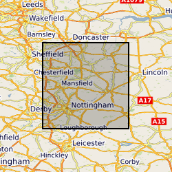
GIS Data Layer and Database including maps and detailed Indexes. Paper records and photographs, descriptive register is paper version from which the digital version was created. Data mainly captured in 1989, infrequent additions (approximately 1 entry per year) since then. Includes all man-made caves known to BGS in Nottingham, but there are many more to be located in the future.