notApplicable
Type of resources
Topics
Keywords
Contact for the resource
Provided by
Years
Formats
Representation types
Update frequencies
Scale
Resolution
-
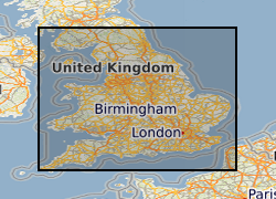
Between 2001 and 2003 BGS received approximately 1400 1:25 000 paper maps and associated card index from the Office of the Deputy Prime Minister (now Department for Communities and Local Government (CLG)). The maps, originally compiled by the Minerals Division of the Ministry of Housing and Local Government (CLGs historic predecessor), contain hand drawn boundaries for permitted, withdrawn and refused mineral planning permissions, and worked ground. They also contain hand drawn boundaries for land use at each site. These 'MHLG' maps show information collated from the 1940s (retrospectively to 1930) to the mid 1980s. The index cards provide supplementary information regarding name, operator, dates and relevant local authority. Data depicted on the maps are for England only and include; [a] all planning appeals, departures and called in cases whether permitted or refused; [b] all planning permission and refusal data for various local authority areas which were obtained by Departmental officials through visits to authorities in a staged programme spread over many years. Priority was placed on areas that were giving rise to then current casework issues thus at the time when the maintenance of the maps ended (mid 1985), some authority information had been updated recently but other areas had not been visited for many years. [c] land use present at each site. Categories include: derelict areas, restored quarries (filled and unfilled), tip heaps and spoil heaps, and wet areas. The variable completeness of the data sets should be kept in mind when this material is being used. Land use polygons have been digitised from the MHLG maps and attribute information has been provided from the map legend and the appropriate card in the card index. The principal aim of the data is to show land use present in areas of land that have been affected by the extraction of minerals.
-

The potential for leakage of CO2 from a storage reservoir into the overlying marine sediments and into the water column and the impacts on benthic ecosystems are major challenges The potential for leakage of CO2 from a storage reservoir into the overlying marine sediments and into the water column and the impacts on benthic ecosystems are major challenges associated with Carbon Capture and Storage (CCS) in subseafloor reservoirs. To investigate the consequences of CO2 leakage for the marine environment, a field-scale controlled CO2 release experiment was conducted in shallow, unconsolidated marine sediments. Changes of the chemical composition of the sediments, their pore waters and overlying water column were monitored before, during and up to 1 year after the 37-day long CO2 release from May 2012 to May 2013. In particular this focused on changes in the solid phase (physical properties, major and minor elemental composition, inorganic and organic carbon content), the pore water chemical composition (cations, anions, nutrients and the carbonate system parameters total alkalinity, dissolved inorganic carbon and isotopic signature of DIC) and the water column chemical composition (oxygen, nutrients, total alkalinity and dissolved inorganic carbon). This dataset was collected by the National Oceanography Centre (NOC) under the program QICS (Quantifying and monitoring environmental impacts of geological carbon storage) which was funded by the Natural Environment Research Council (NERC), with support from the Scottish Government. The results are contained in an Excel file. QICS project website: www.bgs.ac.uk/qics/home.html. Lichtschlag et al. (2014) Effect of a controlled sub-seabed release of CO2 on the biogeochemistry of shallow marine sediments, their pore waters, and the overlying water column, http://www.sciencedirect.com/science/article/pii/S1750583614003090 (doi:10.1016/j.ijggc.2014.10.008).
-

The QICS project (Quantifying and Monitoring Potential Ecosystem Impacts of Geological Carbons Storage) was established to improve our understanding of the potential impacts of CO2 release on the environment and to develop tools and best practice for monitoring sub-seabed CCS reservoirs. To monitor the potential impact of a CO2 leak to surficial benthic megafauna, cages of bivalves (the common mussel Mytilus edulis Linnaeus, 1758 and the king scallop Pecten maximus (Linnaeus, 1758)) were deployed at the gas release site and at a reference site in the QICS experiment - both within Ardmucknish Bay, Oban, Scotland. Replicate individuals were sampled at six time points over a 125-day period, which spanned both the 37-day injection and recovery phases of the experiment, in order to establish impacts to molecular physiology. Samples of bivalves were also simultaneously sampled from a reference site within the bay in order to contrast changes in physiology induced by the gas release with naturally variability in the physiological performance of both species. There was no evidence of gene regulation of either selected carbonic anhydrases (CAx genes) or the alpha subunit of sodium potassium ATPAses (ATP1A genes) in individual bivalves collected from the CO2 gas release site, in either species. In the common mussel Mytilus edulis there was only evidence for changes with time in the expression of genes coding for different classes of carbonic anhydrase. It was concluded that the effects of the plume of elevated pCO2 on ion-regulatory gene transcription were negligible in both species. Pratt et al. 2015. No evidence for impacts to the molecular ecophysiology of ion or CO2 regulation in tissues of selected surface-dwelling bivalves in the vicinity of a sub-seabed CO2 release. International Journal of Greenhouse Gas Control. DOI:10.1016/j.ijggc.2014.10.001. QICS project website: www.bgs.ac.uk/qics/home.html.
-

The potential for leakage of CO2 from a storage reservoir into the overlying marine sediments and into the water column and the impacts on benthic ecosystems are major challenges associated with Carbon Capture and Storage (CCS) in subseafloor reservoirs. A field-scale controlled CO2 release experiment was conducted in shallow, unconsolidated marine sediments. Changes were monitored of the chemical composition of the sediments and overlying water column before, during and up to 1 year after the 37-day long CO2 release from May 2012 to May 2013 in Ardmucknish Bay. Meiofaunal samples were collected and meiofauna higher taxa and the nematodes species (where possible) were identified by Plymouth Marine Laboratory. This dataset was collected under the program QICS (Quantifying and monitoring environmental impacts of geological carbon storage) which was funded by the Natural Environment Research Council (NERC), with support from the Scottish Government. The results are contained in an Excel file. QICS project website: www.bgs.ac.uk/qics/home.html. This data is currently under embargo until publication of the dataset in research article (estimated end of 2015).
-

CO2 was injected into shallow unconsolidated marine sediments in Ardmucknish Bay, Oban. 2D seismic reflection data were collected pre-release (15/05/2012), syn-release (17/05/2012, 18/05/2012, 19/052012, 29/05/2012, 30/05/2012, 20/06/2012) and after release stages (23/04/2014 and 24/04/2014) of CO2 help to better understand the spatial and temporal evolution of free gas anomalies within the overburden. The impact of CO2 on sediment acoustic properties, namely seismic reflectivity and attenuation, was also investigated. This dataset was collected by the National Oceanography Centre Southampton (NOCS) and the British Geological Survey (BGS) under the program QICS (Quantifying and monitoring environmental impacts of geological carbon storage) which was funded by the Natural Environment Research Council (NERC), with support from the Scottish Government. The dataset includes segy files, a presentation which summarises the main results and a map showing the spatial extent of the seismic data collected after gas release. QICS project website: http://www.bgs.ac.uk/qics/home.html. Cevatoglu et al., 2015. Gas migration pathways, controlling mechanisms and changes in sediment acoustic properties observed in a controlled sub-seabed CO2 release experiment. Int J Greenhouse Gas Control. DOI:10.1016/j.ijggc.2015.03.005. The post-release data is currently restricted. NERC grant NE/H013873/1
-
During 2010-11, as part of the Carbon Capture & Storage (CCS) Demonstration Competition process, E.ON undertook a Front End Engineering Design (FEED) study for the development of a commercial scale CCS demonstration plant at Kingsnorth in Kent, South East England. The study yielded invaluable knowledge and the resulting material is available for download here. This chapter is devoted to the transportation and injection infrastructure requirements of the Kingsnorth Carbon Capture and Storage development. This encompasses a 36 inch (outside diameter) pipeline which runs onshore for approx 10 km and offshore in the Southern North Sea for 260 km, a platform in the vicinity of the Hewett field location, and appropriate facilities both for the conditioning of CO2 before pipeline entry and the processing of the CO2 stream prior to injection into the sequestration site. The chapter highlights in particular the following areas:- Critical assumptions; Platform Concept Selection; Transport Solution Selection; Pipeline Key Issues; Pipeline Pre-Commissioning; Temperature; Emergency Shutdown; Personnel Safety; Venting; Flow Assurance Modelling. Throughout the execution of the work described in this chapter significant opportunity was taken to ensure that the interfaces from capture (and compression) to pipeline/platform and to wells/storage were managed closely. This was achieved by cross system interface management meetings organized to consider interface issues and to compare issues raised in separate HAZIDs. The purpose of conceptual design has been to identify the problems to be addressed comprehensively by the next stage of FEED and this suite of reports provides valuable insights to the challenges faced. All aspects of establishing an agreed philosophy for design and operation of a storage and transport system for CCS begin with understanding what the initial CO2 flow conditions will be at the interface between the well perforations and the reservoir (i.e. at the sandstone face at the bottom of the well). Further supporting documents for chapter 6 of the Key Knowledge Reference Book can be downloaded.
-
In March 2010, the Scottish CCS (Carbon Capture & Storage) Consortium began an extensive Front End, Engineering and Design (FEED) study to assess what would be required from an engineering, commercial and regulatory, perspective in order to progress the CCS demonstration project at Longannet Power station in Scotland through to construction. The study yielded invaluable knowledge and the resulting material are available for download here. This section of the report provides details on the organisation and management of the design as well as key design information for the End-to-End CCS chain. This includes the following: Organisation of the design teams; The End-to-End Basis of Design; The design life; The End-to-End CCS chain process; Piping and instrumentation diagrams; Plant and site layout drawings for the various sites; Equipment; Plant and equipment specifications; Subsurface engineering design reports; No attempt has been made to generalise design data. All of the design information presented is specific to the ScottishPower Consortium Project and has been presented to provide an insight into the development of the End-to-End CCS solution. The FEED design study was based on the Outline Solution developed by the Consortium prior to FEED. The Outline Solution was a conceptual design for the End-to-End CCS chain that was considered to be technically feasible within the constraints of the knowledge available at the time. It included a series of optioneering studies to identify the preferred design for this particular project. During FEED, the Outline Solution design was developed in greater detail to reduce the cost and technical uncertainty, and consequently reduce the financial, programme and technical risks prior to commencing the implementation stage of the project. It must be stressed that a FEED study is carried out to develop a design to the degree that the technical and programme risks are reduced to the agreed limits to better inform the project cost estimate. The current status is that the design has been progressed as far as is practicable within the time and cost constraints of the FEED study. Specifications and datasheets for major equipment have been developed in order that they can be issued to potential suppliers during the implementation phase of the project. The FEED study identified further activities that cannot be performed at the FEED stage of the project but which have been recorded as actions for further investigation during the implementation stage. The FEED study has advanced the development of the application of CCS technology considerably. Though research and conceptual studies are essential to the development of any new technology, they cannot identify many of the difficult design issues that are identified and addressed during a FEED study. Similarly the progress from FEED to the implementation phase is expected to present further challenges for a project of this novel nature. However, the advantage of a FEED study is that the main issues that could present high cost or programme difficulties or even potential 'show stoppers' should already have been identified and, where possible, addressed. Key decisions and design changes taken during the FEED study are explained in Section 11 of the report. The FEED study indicates that CCS remains technically feasible. The appropriate summary section from the Feed Close Out Report can be downloaded as a PDF (Design.pdf). The main text of the FEED Close Out Report, together with the supporting appendix for this section can be downloaded as PDF files.
-
In March 2010, the Scottish CCS (Carbon Capture & Storage) Consortium began an extensive Front End, Engineering and Design (FEED) study to assess what would be required from an engineering, commercial and regulatory, perspective in order to progress the CCS demonstration project at Longannet Power station in Scotland through to construction. The study yielded invaluable knowledge and the resulting material are available for download here. This section of the report aims to inform potential developers of CCS of the impact of risks on the design of large-scale CCS. It discusses the ScottishPower CCS Consortium approach to risk management, looking particularly at the identification and mitigation of specific areas of risks during FEED and the mitigating actions required for the major residual risks. The section covers five key areas: Overview of the risk assessment process through FEED, including mitigation measures, major movement of the Top 50 risks on the Risk Register, and current active risks; Mitigation strategies for major project risks; Mitigation strategies for those risks with the potential to cause significant delay to the Overall Project Programme; Allocation and insurability of risks; Integrity and risk assessment of existing plant to be integrated; From the outset of FEED, risk management was co-ordinated by the Risk Workstream. The Risk Workstream included representatives of each of the Consortium Partners and Aker Clean Carbon. The Risk Workstream had a remit to capture, codify and report on progress with risk management throughout the study. The management of the risks themselves remained with the risk owners. The Consortium's risk management strategy was based on the provision of a cross-Consortium, over-arching risk management framework. This was developed to: Provide visibility of the Consortium's risk exposure Make best use of the Consortium Partners' risk management experience Facilitate the assessment of the impact of changes within the scope of one Partner's risk profile to the others Encourage the identification of risks at Partner interfaces Provide consistent risk reporting across the Consortium in line with agreed requirements Each Consortium Partner was responsible for reporting monthly on their risks to the Consortium risk lead, who in turn collated the Consortium Partner updates and reported the overall Consortium risk status to the Consortium Management Office and DECC to show how the total risk value changed over the course of FEED. The appropriate summary section from the Feed Close Out Report can be downloaded as a PDF (Risk management.pdf). The main text of the FEED Close Out Report, together with the supporting appendix for this section can be downloaded as PDF files. Note this dataset is a duplicate of the reports held at the National Archive which can be found at the following link - http://webarchive.nationalarchives.gov.uk/20121217150421/http://decc.gov.uk/en/content/cms/emissions/ccs/ukccscomm_prog/feed/scottish_power/risk/risk.aspx
-
In March 2010, the Scottish CCS (Carbon Capture & Storage) Consortium began an extensive Front End, Engineering and Design (FEED) study to assess what would be required from an engineering, commercial and regulatory, perspective in order to progress the CCS demonstration project at Longannet Power station in Scotland through to construction. The study yielded invaluable knowledge and the resulting material are available for download here. This section provides information on how the Consortium approaches the health, safety and environmental aspects of the End-to-End CCS chain. The key components of the Health and Safety (H&S) Policies already in place for each Consortium Partner include: Commitment from top level management; Systematic approach to ensure legal compliance; Provision of training to develop H&S awareness and competence; Providing a safe and healthy work environment; Identify, assess and control hazards and risks; Set targets and objectives for improvement; Monitor, measure and review H&S performance; Report on H&S performance, both internally and externally; Extend the policy to contractors and monitor their compliance; Include H&S performance in staff appraisal and reward accordingly; Achieve continuous improvement; This section gives some background and the key drivers to health, safety and environmental aspects of carbon capture, transportation and storage. The narrative describes the Consortium's method of integrating process safety activities with the overall design process. In the appendices, the full End-to-End CCS safety report is provided, followed by detailed summaries of all the CCS chain specific health, safety and environmental work undertaken during FEED. The appropriate summary section from the Feed Close Out Report can be downloaded as a PDF (Health, safety and environment.pdf). The main text of the FEED Close Out Report, together with the supporting appendix for this section can be downloaded as PDF files. Note this dataset is a duplicate of the reports held at the National Archive which can be found at the following link - http://webarchive.nationalarchives.gov.uk/20121217150421/http://decc.gov.uk/en/content/cms/emissions/ccs/ukccscomm_prog/feed/scottish_power/health_safety/health_safety.aspx
-
In March 2010, the Scottish CCS (Carbon Capture & Storage) Consortium began an extensive Front End, Engineering and Design (FEED) study to assess what would be required from an engineering, commercial and regulatory, perspective in order to progress the CCS demonstration project at Longannet Power station in Scotland through to construction. The study yielded invaluable knowledge and the resulting material are available for download here. This section of the report contains a high-level monthly summary of the total costs incurred performing the Consortium's FEED study. This information is provided with the aim of enabling potential developers of CCS projects to estimate up front FEED costs. A detailed cost breakdown is also provided for each of the key parties within the Consortium in the form of Cost, Time and Resource (CTR) information in PDFs below, under the following references: UKCCS - KT - S1.0 - SP - 001 ScottishPower CTR Summary; UKCCS - KT - S1.0 - ACC - 001 Aker Clean Carbon CTR Summary; UKCCS - KT - S1.0 - NG - 001 National Grid CTR Summary; UKCCS - KT - S1.0 - Shell - 001 Shell CTR Summary; The detailed CTR information provides a breakdown of the actual labour effort used for the totality of the FEED scope of work, presented by month and by CTR activity, the type of expertise used, the number of hours worked and the associated costs. The split between internal and external costs is shown, together with the original budget estimates developed for each CTR prior to commencing FEED. The appropriate summary section from the Feed Close Out Report can be downloaded as a PDF (FEED cost.pdf). The main text of the FEED Close Out Report, together with the supporting appendix for this section can be downloaded as PDF files. Note this dataset is a duplicate of the reports held at the National Archive which can be found at the following link - http://webarchive.nationalarchives.gov.uk/20121217150421/http://decc.gov.uk/en/content/cms/emissions/ccs/ukccscomm_prog/feed/scottish_power/feed_cost/feed_cost.aspx
 BGS Data Catalogue