50000
Type of resources
Topics
Keywords
Contact for the resource
Provided by
Years
Formats
Representation types
Update frequencies
Scale
-
Geological model comprising artificial ground and superficial deposits in the city of Cardiff. Undifferentiated bedrock is included beneath the superficial deposits. This model provides a geological framework model and calculated surfaces for the superficial deposits for the city of Cardiff, principally Till, Glaciofluvial deposits, Alluvium and Tidal Flat Deposits.
-
Sometimes known as the "One-Inch Collection", this is an archival collection of rock samples collected by BGS field staff during surveys within England and Wales, arranged by 1-inch (or 50 K) scale BGS geological map sheet area. It was intended as a representative suite of the lithologies present in each sheet, although this was only partially achieved. Documentation is via archive of rock sample collection sheets (see COLLECTIONSHEETS) but is poorly coordinated at present.
-
Old card index of quarries in England, Wales and Scotland dating mostly from 1939 to 1963: about 7000 cards, each referring to one quarry. England & Wales cards are arranged by BGS 1-inch (now 50k scale) geological sheet, Scottish cards by county. At best, cards indicate county, geol-sheet, rock type, name, grid reference, locality, owner, date of record and cross references to BGS samples.
-
This database stores down-hole stratigraphic data to complement the seismic surface picks stored in the Seismic Locations And Sections Database (LOCSEC). Because these surfaces are chosen for their visibility on seismic data, they may not be directly equivalent to established BGS lithostratigraphic and/or choronstratigraphic divisions. However, the local coding system is based on and can relate to the BGS stratigraphic LEXICON. Stratigraphic picks are stored in terms of depth and seismic one-way travel time. Local borehole summary information (location, elevation, etc.) is used because both onshore and offshore boreholes are stored in this database. These data can be related to the BGS onshore borehole database by borehole registration, and to the offshore well database by DTI well-id. Additional tables (under development) provide information on hydrocarbon tests and their results. Almost all data are within the UK Onshore area; although there are some UK near-shore and offshore (North Sea, Irish Sea).
-
An important paper archive of a wide variety of miscellaneous geological information organised on the basis of its location within 1:50 000 scale geological map sheet areas in Great Britain. The majority of the data has been produced or collected by BGS staff since 1835 as part of the mapping programme. The data may not fit into any of the main collections, but is valuable for future projects and answering enquiries.
-
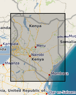
The Samburu - Marsabit Geological Mapping and Mineral Exploration Project was a joint Kenyan and British technical co-operation project, carried out by staff of the Mines and Geological Department, Ministry of Environment and Natural Resources, Kenya and staff from the British Geological Survey. The first phase of the project commenced in 1980, and covered the area between 36degrees and 38degrees E and from the equator to 2degrees N. The second phase, carried out between 1984 and 1986 covered the area between 36degrees and 38degrees E and from 2degrees N to the Ethiopian border. Sampling was carried out concurrently with geological mapping and was largely constrained by the requirements of that exercise. Little or no sampling was done in areas previously mapped by other bodies. Sampling was mainly confined to areas underlain by basement rocks of the Mozambique Belt and was very sparse over most of the Tertiary and Quaternary volcanic cover. Chemical analyses for the stream sediments were: Ag, Ba, Co, Cu, Fe, Li, Mn, Mo, Ni, Pb, Sr, and Zn. Raw data is available from the Mines and Geological Survey Department, Ministry of Environment and Natural Resources, Nairobi, Kenya. Sampling densities varied considerably across the Phase 1 project area, but generally a stream sediment sample density of one per 4 to 8 km2 and a panned concentrate density of one per 13 to 16 km2 was achieved. In the Phase 2 area, which was mainly very arid, a few samples were collected from dry stream beds, as part of a helicopter survey of the area, to provide some idea of the geochemistry of the major lithological units. Stream sediments were collected by combining grab samples from 5 to 10 points within a 10m radius of the selected site. If necessary the samples were dried before being sieved and the fine (-80 mesh B.S.) fraction retained for analysis. Heavy mineral concentrates were obtained by taking 2 to 5kg of material from the sample site and panning at the base camp, where water was available, or at the Mines and Geological Department headquarters at Nairobi.
-
The joint PHE-BGS digital radon potential dataset provides the current definitive map of radon Affected Areas in England and Wales. It will also allow an estimate to be made of the probability that an individual property in England and Wales is at or above the Action Level for radon. This information also provides an answer to one of the standard legal enquiries on house purchase in England and Wales, known as CON29 standard Enquiry of Local Authority; 3.13 Radon Gas: Location of the Property in a Radon Affected Area. The radon potential dataset will also provide information on the level of protection required for new buildings under as described in the latest Building Research Establishment guidance on radon protective measures for new buildings (BR 211 2007). This radon potential hazard information for England and Wales is based on Public Health England (PHE) indoor radon measurements and BGS digital geology information. This product was derived from DigMap50 V3.14 and PHE in-house radon measurement data. The indoor radon data is used with the agreement of the PHE. Confidentiality of measurement locations is maintained through data management practices. Access to the data is restricted. This dataset has been superseded by PHE-BGS Joint Radon Potential Dataset For Great Britain. Radon is a natural radioactive gas, which enters buildings from the ground. Exposure to high concentrations increases the risk of lung cancer. The Health Protection Agency recommends that radon levels should be reduced in homes where the annual average is at or above 200 becquerels per cubic metre (200 Bq m-3). This is termed the Action Level. The Health Protection Agency defines radon Affected Areas as those with 1% chance or more of a house having a radon concentration at or above the Action Level of 200 Bq m-3. The dataset was originally developed by BGS with the Health Protection Agency (HPA) which is now part of Public Health England.
-
BGS have collected environmental radioactivity data for various purposes over several decades. This is being drawn together to produce a database of baseline gamma radioactivity and radon. Data includes the relevant portions of airborne and ground gamma spectrometer surveys, mineral exploration, baseline geochemistry and environmental radiometric surveys along with lithogeochemical and borehole log data. It is predominantly a specialist subset of other existing BGS databases. Incomplete UK coverage.
-
A series of tiled models of superficial thickness covering the UK. The models are derived by direct modelling (natural neighbour interpolation) of BGS Borehole records and BGS Digmap. For the purposes of modelling, superficial deposits include sediments deposited during the Quaternary, subsequent Holocene rivers and coastal systems and also modern anthropogenic material. i.e. deposits that are less than 2.6 million years old. Grids are overprinted with a minimum value so that areas where no bore data is present, but drift is known to occur are given a minimum 1.5m thickness. The superficial thickness models have been created as baseline datasets for the BGS Geohazard programme. They represent the first attempt by BGS to create nationwide models of such data and the models provide only a simple, mathematical interpretation of reality. The complexity of Superficial deposits in Great Britain is such that it is only possible to model indicative values of thickness and elevation. The models should never be used as a substitute for thorough site investigation.
-
The dataset indicates the potential for hazard in Great Britain as a result of mineral extraction. It excludes areas of Coal mining as these are covered by the Coal Authority. It is based on a simple A-E rating scale indicating the increasing likelihood of an underground mining hazard. The data was created using expert knowledge, detailed literature searches, local knowledge and a series of rule based geological constraints applied to the DigMapGB50k (Digital Geological Map of Great Britain) data.
 BGS Data Catalogue