 BGS Data Catalogue

Type of resources
Topics
Keywords
Contact for the resource
Provided by
Years
Formats
Representation types
Update frequencies
-

The UK Geoenergy Observatories (UKGEOS) Glasgow facility, baseline soil geochemistry dataset released from the BGS comprises an excel file with two spreadsheets. The first spreadsheet contains information on the chemical composition of 90 topsoil (0 - 20 cm) samples collected from seven initially proposed borehole sites for the UKGEOS Glasgow facility, and from two control sites, in February-March 2018 (03-18). Ten samples were collected from each site prior to installation of the UKGEOS Glasgow facility, and underwent laboratory analysis. Chemical data for pH and the total concentrations of 54 inorganic and 75 organic substances in the soil samples are presented. In addition, the dataset contains locational and descriptive information about the samples noted during sampling. The analyte name, element chemical symbols, analytical method, units of measurement and limits of quantification are recorded in header rows at the top of the spreadsheet. The dataset includes qualifiers, highlighting any quality control issues reported with the data. The data qualifiers are explained in the second spreadsheet released with the data. Further details about the dataset can be found in the accompanying report http://nora.nerc.ac.uk/id/eprint/527798/.
-

UKGEOS and Core Sample Analysis. Geomechanical testing was performed to determine triaxial compressional strength, tensile strength, frictional strength and permeability of sandstones, siltstones, mudstones and coals from eleven depth intervals within the GGC01 borehole, UK Geoenergy Observatories (UKGEOS), Glasgow, United Kingdom. Frictional strength tests were also performed on cuttings samples of sandstones, siltstones, mudstones and coals from the GGA08 borehole, Glasgow, United Kingdom. In total twenty-three tensile strength tests were performed on ten sampled intervals, and seven porosity measurements pre-and post-failure were taken. Nine triaxial compressive strength tests and twenty-one frictional strength tests were performed, with permeability measured both before and after failure or shear respectively. From compressive strength tests we also determined the Young’s modulus and Poisson’s ratio. Results of X-Ray Diffraction are also included in the dataset.
-

The borehole information pack from borehole GGA05, site 02 of the UK Geoenergy Observatories (UKGEOS) Glasgow facility. This release from the British Geological Survey (BGS) contains BGS and Drillers’ logs, cased hole and open hole wireline data, optical camera data, a listing of archived rock chips and a descriptive report. The mine water characterisation and monitoring borehole was drilled between 1st July and 11th October 2019 (start of drilling to casing installation date) to 88.5 m drilled depth. The cased borehole was wireline logged and hydrogeologically tested in January 2020. Rock chip samples were taken during the drilling process and have been archived at the National Geological Repository at BGS Keyworth. Further details can be found in the accompanying report http://nora.nerc.ac.uk/id/eprint/528052 DOI https://dx.doi.org/10.5285/714fe9fc-ce77-4479-8053-1c5fd4e86f06
-

The borehole information pack from borehole GGA04, site 02 of the UK Geoenergy Observatories (UKGEOS) Glasgow facility. This release from the British Geological Survey (BGS) contains BGS and Drillers’ logs, cased hole and open hole wireline data, a listing of archived rock chips and a descriptive report. The mine water characterisation and monitoring borehole was drilled between 28th June and 22nd October 2019 (start of drilling to casing installation date) to 53.63 m drilled depth. The cased borehole was wireline logged and hydrogeologically tested in January 2020. Rock chip samples were taken during the drilling process and have been archived at the National Geological Repository at BGS Keyworth. Further details can be found in the accompanying report http://nora.nerc.ac.uk/id/eprint/528078 DOI https://dx.doi.org/10.5285/83ab3481-45d9-475d-8814-008edc9fb1cb
-

The borehole information pack from borehole GGA01, site 01 of the UK Geoenergy Observatories (UKGEOS) Glasgow facility. This release from the British Geological Survey (BGS) contains BGS and Drillers’ logs, cased hole wireline data, a listing of archived rock chips and a descriptive report. The mine water characterisation and monitoring borehole was drilled between 11th June and 21st August 2019 (start of drilling to casing installation date) to 52 m drilled depth. The cased borehole was wireline logged and hydrogeologically tested in January 2020. Rock chip samples were taken during the drilling process and have been archived at the National Geological Repository at BGS Keyworth. Further details can be found in the accompanying report http://nora.nerc.ac.uk/id/eprint/528075, DOI https://dx.doi.org/10.5285/0d496c68-f79b-4956-8cd2-4970d1e86145.
-
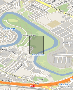
This summary borehole information release is for ‘as-built’ mine water and environmental baseline monitoring boreholes of the UK Geoenergy Observatories (UKGEOS) Glasgow facility at Cuningar Loop. The information pack from BGS contains a brief report with summary tables of locations, drilled depths, screened intervals and illustrative interpretations, and is accompanied with a spreadsheet and shapefile of the borehole locations and drilled depths. The purpose is to give potential users of the Glasgow Observatory an outline of the as-built infrastructure including condition of the target mine workings, as a summary of the more detailed information packs for each borehole. This dataset was updated in June 2020. Further details can be found in the accompanying report http://nora.nerc.ac.uk/id/eprint/526889
-

The borehole information pack from borehole GGA06r, site 02 of the UK Geoenergy Observatories (UKGEOS) Glasgow facility. This release from the British Geological Survey (BGS) contains BGS and Drillers’ logs, a listing of archived rock chips and a descriptive report. The environmental baseline characterisation and monitoring borehole was drilled between 3rd July and 2nd August 2019 (start of drilling to casing installation date) to 16 m drilled depth. The cased borehole was hydrogeologically tested in January 2020. Rock chip samples were taken during the drilling process and have been archived at the National Geological Repository at BGS Keyworth. Further details can be found in the accompanying report http://nora.nerc.ac.uk/id/eprint/528079 DOI https://dx.doi.org/10.5285/ccb1aabe-6062-4cb7-9731-535229316246
-

The UK Geoenergy Observatories (UKGEOS) Glasgow baseline surface water chemistry dataset1 released from the BGS comprises an excel file with two spreadsheets. The first spreadsheet contains information on the chemical composition of 98 surface water samples (84 samples and 14 field duplicates) collected monthly for 14 months between February 2019 and March 2020 from six sampling locations. These comprised three on the River Clyde at the UKGEOS Glasgow Cuningar Loop borehole cluster and three from control sites (two on the River Clyde and one on the Tollcross Burn). Field measurements of pH, redox potential, specific electrical conductance, temperature, dissolved oxygen and alkalinity and laboratory chemical data for concentrations of 71 inorganic and 10 organic substances in the surface water samples are presented. The dataset contains locational and descriptive information about the samples also. The analyte name, element chemical symbols, analytical method, units of measurement and long-term limits of detection are recorded in header rows at the top of the spreadsheet. The limits of detection/quantification for each monthly batch of samples are documented in rows at the head of each batch. The dataset includes abbreviations documenting quality control issues such as missing values. A guide to abbreviations used in the dataset is provided in the second excel spreadsheet released with the data. Further details about the dataset can be found in the accompanying report http://nora.nerc.ac.uk/id/eprint/529818.
-
The data represent ground motion results obtained from Interferometric Synthetic Aperture Radar (InSAR) for the UKGEOS – Glasgow site. The InSAR techniques used is called Interferometric Point Target Analysis (IPTA) and the BGS processing is based on Sentinel-1 radar satellite data for the period August 2015 - June 2017. The results include time series of displacement (in mm) during this interval and average velocity across the whole period (in mm/yr) along the satellite Line of Sight (Hanssen, 2001). InSAR has provided information on the baseline conditions of ground stability ahead of any underground activity planned in at the Glasgow Geothermal Energy Research Field Site (GGERFS) as described in Bateson and Novellino (2019). References: Bateson, L.; Novellino, A.. 2019 Glasgow Geothermal Energy Research Field Site : ground motion survey report. Nottingham, UK, British Geological Survey, 35pp. (OR/18/054) (Unpublished). Available at http://nora.nerc.ac.uk/id/eprint/524555/ Hanssen, R., 2001. Radar Interferometry: Dordrecht Kluwer Academic Publishers, The Netherlands (2001) (308 pp.)
-

The borehole information pack from borehole GGA08, site 03 of the UK Geoenergy Observatories (UKGEOS) Glasgow facility. This release from the British Geological Survey (BGS) contains BGS and Drillers’ logs, cased hole and open hole wireline data, optical camera, CCTV data, a listing of archived rock chips and a descriptive report. The mine water characterisation and monitoring borehole was drilled between 25th June and 6th December 2019 (start of drilling to casing installation date) to 91.37 m drilled depth. The cased borehole was wireline logged in January 2020 and hydrogeologically tested in February 2020. Rock chip samples were taken during the drilling process and have been archived at the National Geological Repository at BGS Keyworth. Further details can be found in the accompanying report http://nora.nerc.ac.uk/id/eprint/528081 DOIhttps://dx.doi.org/10.5285/b19497aa-75a5-4f51-8089-299f9229b9ca