 BGS Data Catalogue
daily
Type of resources
Topics
Keywords
Contact for the resource
Provided by
Years
Formats
Representation types
Update frequencies
Scale
-
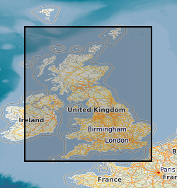
The WellMaster database holds hydrogeological information on water wells for wells and boreholes identified within the Single Onshore Borehole Index (SOBI) within England Wales and Scotland. The database contains index details supplementary to SOBI, including information on the availability of more detailed hydrogeological information. Four main categories of data are held within the database; lithostratigraphic details, well/borehole construction including casing and screens, water information including depths and pumping rates and water quality information.
-
Collection of individually registered specimens and cuttings from onshore boreholes drilled in England and Wales by BGS, commercial and public bodies since the establishment of BGS in 1835. The collection has been developed as part of the BGS responsibility to establish and maintain a National Borehole Collection. The collection is updated on a daily basis by the addition of new data and by the modification of existing data. The collection contains all registered borehole samples for England and Wales, Scottish borehole samples are excluded. Details of the collection are held on the 'Borehole Materials Database', and may be accessed over the internet from the BGS web site.
-
Index to borehole material held chiefly as continuous drillcore, bulk samples, unwashed cuttings and processed material from onshore UK.
-
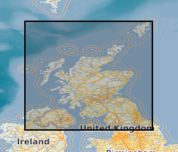
The Land Survey Record Index was set up c.1988 to provide a digital database index to records and archives held by the Land Survey in Scotland and Northern England and contains over 46,600 records. Finding aid to the following record groups/data sets, is provided through a application query interface: Site Investigation Records (SE); Land Survey Archives (LSA); Land Survey Records (LSR); Mineral Resource Records (MR); Additional Information Files (AI); Enquiry Record Files (EE; EN); Opencast Coal Sites (OC).
-
Index to acquisitions and donations of all types of geological record data. This information has been received from a variety of external organisations including public bodies and commercial concerns. The Oracle index was set up in 1988 and holds basic index information about the donor and the donation. The index has been expanded in 2009 to include other sections of BGS and covers all their donations. The majority are from Great Britain.
-
This dataset of paper records holds details of analysis of all the sample batches (from both internal and external customers) analysed by the Analytical Geochemistry Laboratory of the BGS since June 1996. It was installed to underpin the UKAS (United Kingdom Accreditation Service) accreditation of the geochemistry laboratories at Keyworth, which was awarded in August 1999. There is a file for each batch of samples submitted for analysis. The file documents the progress of the samples through the laboratories, including sample registration, sample processing, raw data from analytical instruments and the data reported to the client. The records are archived to provide supporting evidence for any query regarding geochemical data provided by the laboratories.
-

The K-index scale summarises geomagnetic activity at an observatory by assigning a code, an integer in the range 0 to 9 (0 being the least active field and 9 the most active field) to each 3-hour Universal Time (UT) interval. K-Indices are available for Lerwick, Eskdalemuir, Greenwich, Abinger and Hartland Magnetic Observatories. From 1954-90 the values are hand scaled, from 1991 to the present day they are automatically scaled. The data not only aids scientific research into rates of change of the magnetic field and increases the accuracy of the BGS Global Geomagnetic Model, but also provides data to exploration geophysicists engaged in current and future oil exploration.
-
The collection of over 19,000 site investigation reports for Scotland and Northern England consists of records of boreholes, trial pits, geotechnical results and interpretative reports acquired from various sources. The collection started c.1960 to cater for the increasing amount of post-war shallow drilling for building and road construction which was kept separately by the Survey from the Borehole Journal collection reserved for deeper geologist examined mineral bores. The site investigation reports are available for consultation on microfilm. Only the factual parts of reports are available for public inspection. Reports for Northern England are held in the Shallow Borehole File (SB), now no longer added to. All site investigation reports (except SB files) are indexed on the Land Survey Record Index (LSRI) and all boreholes and trial pits contained in the reports (those with adequate site plans) are indexed on the Single Onshore Borehole Index (SOBI).
-

Index to the BGS collection of large scale or large format plans of all types including those relating to mining activity, including abandonment plans and site investigations. The Plans Database Index was set up c.1983 as a digital index to the collections of Land Survey Plans and Plans of Abandoned Mines. There are entries for all registered plans but not all the index fields are complete, as this depends on the nature of the original plan. The index covers the whole of Great Britain.
-

The dataset comprises plans of various types relating to mining activity, including abandonment plans, gathered since the 1800s. Most were collected as part of the BGS mapping programme and the type and amount of data available will vary considerably. The coverage for Northern England and Scotland is more comprehensive than for the rest of the country. The plans include working copies, compilations and interpretations which may be copyright or confidential. The general nature of some of the plans means that they may not be applicable to a specific site. Current holdings over 60,000.