 BGS Data Catalogue
2018
Type of resources
Topics
Keywords
Contact for the resource
Provided by
Years
Formats
Representation types
Update frequencies
Scale
-
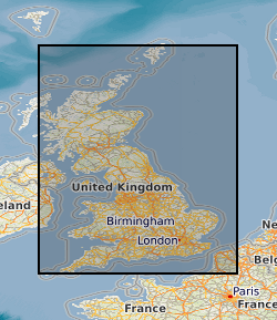
**This dataset has been superseded** The newGeoSure Insurance Product (newGIP) provides the potential insurance risk due to natural ground movement. It incorporates the combined effects of the 6 GeoSure hazards on (low-rise) buildings: landslides, shrink-swell clays, soluble rocks, running sands, compressible ground and collapsible deposits. These hazards are evaluated using a series of processes including statistical analyses and expert elicitation techniques to create a derived product that can be used for insurance purposes such as identifying and estimating risk and susceptibility. The evaluated hazards are then linked to a postcode database - the Derived Postcode Database (DPD), which is updated biannually with new releases of Ordnance Survey Code-Point® data (current version used: 2017.3). The newGIP is provided for national coverage across Great Britain (not including the Isle of Man). This product is available in a range of GIS formats including Access (*.dbf), ArcGIS (*.shp) or MapInfo (*.tab). The newGIP is produced for use at 1:50 000 scale providing 50 m ground resolution.
-

High frequency (100 Hz) data from two horizontal induction coils measuring the Earth's magnetic field at the Eskdalemuir Observatory in the United Kingdom. The data covers the period from September 2012 to December 2012. Also included are examples of Matlab code and the frequency calibration files to convert to the raw data to SI units. Thumbnail spectrograms and metadata about the setup and equipment is also supplied.
-

High frequency (100 Hz) data from two horizontal induction coils measuring the Earth's magnetic field at the Eskdalemuir Observatory in the United Kingdom. The data covers the period from January 2014 to December 2014. Also included are examples of Matlab code and the frequency calibration files to convert to the raw data to SI units. Thumbnail spectrograms and metadata about the setup and equipment is also supplied.
-

High frequency (100 Hz) data from two horizontal induction coils measuring the Earth's magnetic field at the Eskdalemuir Observatory in the United Kingdom. The data covers the period from January 2017 to September 2017. Also included are examples of Matlab code and the frequency calibration files to convert to the raw data to SI units. Thumbnail spectrograms and metadata about the setup and equipment is also supplied.
-

High frequency (100 Hz) data from two horizontal induction coils measuring the Earth's magnetic field at the Eskdalemuir Observatory in the United Kingdom. The data covers the period from January 2015 to December 2015. Also included are examples of Matlab code and the frequency calibration files to convert to the raw data to SI units. Thumbnail spectrograms and metadata about the setup and equipment is also supplied.
-

High frequency (100 Hz) data from two horizontal induction coils measuring the Earth's magnetic field at the Eskdalemuir Observatory in the United Kingdom. The data covers the period from January 2016 to December 2016. Also included are examples of Matlab code and the frequency calibration files to convert to the raw data to SI units. Thumbnail spectrograms and metadata are also supplied.
-

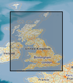
**This dataset has been superseded** The newGeoSure Insurance Product (newGIP) provides the potential insurance risk due to natural ground movement. It incorporates the combined effects of the 6 GeoSure hazards on (low-rise) buildings: landslides, shrink-swell clays, soluble rocks, running sands, compressible ground and collapsible deposits. These hazards are evaluated using a series of processes including statistical analyses and expert elicitation techniques to create a derived product that can be used for insurance purposes such as identifying and estimating risk and susceptibility. The evaluated hazards are then linked to a postcode database - the Derived Postcode Database (DPD), which is updated biannually with new releases of Ordnance Survey Code-Point® data (current version used: 2018.1). The newGIP is provided for national coverage across Great Britain (not including the Isle of Man). This product is available in a range of GIS formats including Access (*.dbf), ArcGIS (*.shp) or MapInfo (*.tab). The newGIP is produced for use at 1:50 000 scale providing 50 m ground resolution.
-
Gridded model estimates of nitrate-N stored in the vadose (unsaturated) zone. This dataset presents annual gridded estimates of nitrate stored in the vadose zone for 1900 - 2000 on a 0.5 degree grid (units: kg N/grid cell). Data are supplied as a single netCDF for all years. This data was derived by Ascott et al. (2017). Global models of depth to groundwater table, subsurface porosity and groundwater recharge were used to derive estimates of nitrate travel time in the vadose zone. The travel time was combined with annual estimates of nitrate leaching from the base of the soil zone for 1900 - 2000 to estimate total nitrate stored in the vadose zone. For full details of the dataset derivation, please refer to Ascott et al. (2017). Ascott, M.J., Gooddy, D.C., Wang, L., Stuart, M.E., Lewis, M.A., Ward, R.S. and Binley, A.M. (2017) Global patterns of nitrate storage in the vadose zone. Nature Communications 8(1), 1416.
-
Reflectance Transformation Imaging files for the type specimen GSM105875 [IGSN:UKBGSGSM105875] and two paratypes GSM106040 [IGSN:UKBGSGSM106040] , GSM106112 [IGSN:UKBGSGSM106112] of Hylaecullulus fordi, a new species of rangeomorph from the Bradgate Formation (Ediacaran) of Charnwood Forest, UK. Supporting information for Kenchington, Dunn and Wilby - Modularity and overcompensatory growth in rangeomorphs (late Ediacaran, approx. 580-541 Ma): adaptations for coping with environmental pressures. Current Biology.
-
GeoSure Basic is a single, combined GeoSure model, based on the 6 geohazard layers produced for the GeoSure dataset package. The methodology behind GeoSure Basic uses only the highest score of all the GeoSure layers, which cover: Collapsible Deposits, Compessible Ground, Landslides, Running Sand, Shrink Swell, and Dissolution. The resulting model has been re-classified to show 'Negligible - Very Low', 'Low', and 'Moderate - High' potential for natural geohazards. Complete Great Britain national coverage is available.