2023
Type of resources
Topics
Keywords
Contact for the resource
Provided by
Years
Formats
Representation types
Update frequencies
-
Concentrations of total organic carbon (TOC), total petroleum hydrocarbons, polycyclic aromatic hydrocarbons (PAHs) and polychlorinated biphenyls (PCBs) were determined in 84 near-surface soils (5-20 cm depth) taken from a 255 km2 area of Glasgow in the Clyde Basin, UK, during July 2011. Total petroleum hydrocarbon ranged from 79-2,505 mg kg-1 (mean 388 mg kg-1; median 272 mg kg-1) of which the aromatic fraction was 13-74 % (mean 44 %, median 43 %) and saturates were 28-87 % (mean 56 %, median 57 %). Σ16 PAH varied from 2-653 mg kg-1 (mean 32.4 mg kg-1; median 12.5mg kg-1) and Σ31 PAH range was 2.47-852 mg kg-1 (mean 45.4 mg kg-1; median 19.0 mg kg-1). PCB tri-hepta range was 2.2-1052 mg kg-1 (mean 32.4 mg kg-1; median 12.7 mg kg-1) and the ΣPCB7 was 0.3-344 mg kg-1 (mean 9.8 mg kg-1; median 2.7 mg kg-1). This data is associated with the published research paper https://doi.org/10.1017/S1755691018000324 Kim, A.W., Vane, C.H., Moss-Hayes, V. Berriro, D.B., Fordyce, F., Everrett, P. Nathanail, P.C. 2018. Polycyclic aromatic hydrocarbons (PAH) and polychlorinated biphenyls (PCB) in urban soils of Glasgow, UK. Earth and Environmental Science Transactions of the Royal Society of Edinburgh 108, 2-3, 231-248.
-
3D laser surface scan of a fossil held within the BGS Type and Stratigraphical Reference Collection. Sample number: BGS GSM 37292 Species: Metrolytoceras metretum (Ammonite) Age: Inferior Oolite Group, Jurassic Location: near Sherborne, Dorset
-
The newGeoSure Insurance Product (newGIP) provides the potential insurance risk due to natural ground movement. It incorporates the combined effects of the 6 GeoSure hazards on (low-rise) buildings: landslides, shrink-swell clays, soluble rocks, running sands, compressible ground, and collapsible deposits. These hazards are evaluated using a series of processes including statistical analyses and expert elicitation techniques to create a derived product that can be used for insurance purposes such as identifying and estimating risk and susceptibility. The evaluated hazards are then linked to a postcode database - the Derived Postcode Database (DPD), which is updated biannually with new releases of Ordnance Survey Code-Point® data (current version used: 2023.1). The newGIP is provided for national coverage across Great Britain (not including the Isle of Man). This product is available in a range of GIS formats including Access (*.dbf), ArcGIS (*.shp) or MapInfo (*.tab) on request. The newGIP is produced for use at 1:50 000 scale providing 50 m ground resolution.
-

The final borehole information pack from the TH0424 Ground Investigation Borehole drilled as part of the UK Geoenergy Observatories (UKGEOS) Cheshire facility. TH0424 was drilled to TD of 101 m between the 08-Nov-2021 and 30 Nov-2021. Drill core was collected from 2 m – 101 m with 100 mm diameter. This final data release pack from BGS contains composite and digital wireline logs alongside daily driller's borehole records, sedimentary and discontinuity logging and core analysis data. This information pack also contains the Initial and additional Core Scanning datasets from the BGS Core Scanning Facility (https://doi.org/10.5285/b06d44e6-324d-4e19-bf78-a4520b9b87c8 and https://doi.org/10.5285/381e9664-0f43-4e4c-90ae-1b16ba83681b).
-
Concentrations of gaseous and aqueous fixed nitrogen products and isotopic measurements of aqueous nitrite and nitrate in spark discharge experiments. Spark experiments were conducted at the University of St Andrews in the St Andrews Isotope Geochemistry Lab (StAIG) between November 2020 and February 2022. Analysis of gaseous products was carried out with a quadrupole mass spectrometer (Hiden Analytical ExQ Quantitative Gas Analyser) in St Andrews. Measurement of concentrations of aqueous nitrite and nitrate and their isotopic composition were carried out for one part of the samples in St Andrews and for the other part at Brown University, Rhode Island, USA. The data was collected to investigate the efficiency of nitrogen fixation by lightning in different gas compositions, resembling the atmospheres of modern and early Earth. The isotope data was used to determine the role of lightning in the delivery of nutrients to the earliest ecosystems on Earth by comparing our results to measurements of sedimentary rock samples from the Archean. The experimental set up was built by Patrick Barth and Eva E. Stüeken, the experiments were conducted by Patrick Barth, Lukas Rossmanith, and Yuqian Peng, the analysis conducted by Patrick Barth, Lukas Rossmanith, Yuqian Peng, and Wendell Walters with support from Mark Claire, and the data was analysed by Patrick Barth, Eva E. Stüeken, Christiane Helling, and Wendell Walters. This dataset includes all data that is reliable and was used in the accompanying publication.
-
Macrostrat.org is a live database project collecting geochemical, geospatial, and geochronological data associated with specific rock units within stratigraphic columns with a geographic footprint. The data in Macrostrat is an aggregate of previously reported measurements in the literature. The database is constantly updated, expanded, and improved. Hence, data are archived (5-2-23) in this file for posterity in support of the manuscript titled "Evolution of the crustal phosphorus reservoir" (Walton et al., 2023). In all measurements in the data file: ages are in millions of years (Ma) and elemental compositions are in wt%. Further details of all definitions and standards in Macrostrat data reporting are permanently available at https://macrostrat.org/api/defs. Macrostrat data are useful for weighting geochemical data by the relative areal and volume abundance of the rock units from which they derive, helping to address questions of (over/under) sampling-induced bias. Data in these files represent direct exports from Macrostrat.org via the API root, supplemented with data from Reinhard et al (2017). Unit areal extents for data from Reinhard et al 2017) are approximated with the relevant Eon average from Macrostrat.org. Macrostrat.org is maintained by Shanan Dr Peters, Dr Daven Quinn, and the hard work of many others (https://macrostrat.org/#people).
-
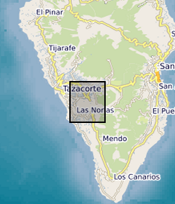
Major and trace element data of lava and tephra samples from the 2021 Tajogaite eruption. Major and select trace element collected by XRF, trace elements collected by ICPMS, both at the University of Granada. Data collected as part of NERC Urgency Grant led by K Chamberlain (Liverpool), in collaboration with M Pankhurst (INVOLCAN), J Scarrow (Granada), D Morgan (Leeds), J Hickey (Exeter), D Neave (Manchester), for understanding how eruptions begin, evolve and end. Samples analysed span the entire September - December 2021 eruptive sequence of Tajogaite, and data were collected between December 2021 and August 2022.
-
3D models of Ediacaran organisms generated using NURBS modelling for use in computer simulations of fluid flow. Models built between 2021 and 2023 using the computer-aided design program Rhinoceros 3D. File names refer to different fossil taxa and surfaces. STP files can be opened with most CAD software, including freely available programs such as Autodesk Fusion 360 and FreeCAD.
-
This data set contains micromagnetic simulation results of magnetosome chains with different bending or collapse degrees, including finite element models and various magnetic parameters (hysteresis loops, isothermal remanent magnetism curves, and first-order reversal curves and energy barriers). Published in Pei et al. (2022; doi: 10.1029/2021JB023447)
-
The data consists of Fe-isotope ratio measurements, expressed in permil notation (δ57Fe) relative to the international standard IRMM-014 following standard practise. The measurements are of bulk rock samples and the sample set consisted of a suite of well-characterized basalts and picrites from three periods in the evolution of the Galápagos plume, from the approximately 70- to 90-Ma plume head [Tortugal, Curaçao (Lesser Antilles), and Gorgona Island (Colombia)], 60- to 70-Ma head-tail transitional accreted terranes [Quepos (Costa Rica) and Azuero Peninsula (Panama)], and modern (<2 Ma) steady-state plume. The samples were provided by collaborators Esteban Gazel (Central American samples) and Dennis Geist (Galapagos) in powder form. Original data on the samples can be found in the following references: D. J. Geist, T. R. Naumann, J. J. Standish, M. D. Kurz, K. S. Harpp, W. M. White, D. J. Fornari, Wolf Volcano, Galápagos Archipelago: Melting and magmatic evolution at the margins of a mantle plume. J. Petrol. 46, 2197–2224 (2005). M. D. Kurz, J. Curtice, D. Fornari, D. J. Geist, M. Moreira, Primitive neon from the center of the Galápagos hotspot. Earth Planet. Sci. Lett. 286, 23–34 (2009). J. Trela, E. Gazel, A. V. Sobolev, L. Moore, M. Bizimis, B. Jicha, V. G. Batanova, The hottest lavas of the Phanerozoic and the survival of deep Archaean reservoirs. Nat. Geoscience 10, 451–456 (2017). J. Trela, C. Vidito, E. Gazel, C. Herzberg, C. Class, W. Whalen, B. Jicha, M. Bizimis, G. E. Alvarado, Recycled crust in the Galápagos Plume source at 70 Ma: Implications for plume evolution. Earth Planet. Sci. Lett. 425, 268–277 (2015). Iron separation and isotope measurements were performed at the Department of Earth Sciences, University of Cambridge following established procedures such as those described in the following papers: H. M. Williams, M. Bizimis, Iron isotope tracing of mantle heterogeneity within the source regions of oceanic basalts. Earth Planet. Sci. Lett. 404, 396–407 (2014). C. R. Soderman, S. Matthews, O. Shorttle, M. G. Jackson, S. Ruttor, O. Nebel, S. Turner, C. Beier, M.-A. Millet, E. Widom, M. Humayan, H. M. Williams, Heavy δ57Fe in ocean island basalts: A non-unique signature of processes and source lithologies in the mantle. Geochim. Cosmochim. Acta 292, 309–332 (2021). Measurements were made on a Neptune Plus multicollector inductively coupled plasma mass spectrometer (MC-ICPMS) in wet plasma, with typical 2 SEs on multiple δ57/54Fe measurements of the same sample better than 0.02‰ and measurements of reference materials in agreement with accepted values. Data table S1 gives the measured Fe isotope data, along with a compilation of selected literature major and trace element used in this study. Data table S2 gives the measured Fe isotope data for the geological reference materials used during analytical sessions. Data table S3 gives the range of calculated primary Fe isotope compositions for each locality. For more information see published paper, Caroline R. Soderman et al. ,The evolution of the Galápagos mantle plume. Sci. Adv.9,eadd5030(2023).DOI:10.1126/sciadv.add5030
 BGS Data Catalogue