100000
Type of resources
Topics
Keywords
Contact for the resource
Provided by
Years
Formats
Representation types
Update frequencies
Scale
-
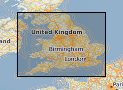
Digitised versions of a set of 1:100,000 scale maps of aquifer vulnerability for England and Wales. The dataset identifies the vulnerability to pollution of major and minor aquifers as defined by the Environment Agency, utilising a combination of geological, hydrogeological and soils data. The maps are designed to be used by planners, developers, consultants and regulatory bodies to ensure that developments conform to the Policy and Practice of the Environment Agency for the protection of Groundwater. Please note that these maps are based on data from the late 1980's and early 1990's, more up-to-date digital data may now be available from the Environment Agency. Flat maps may be purchased from the BGS, some sheets are now out of print.
-
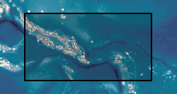
Two geochemical surveys were undertaken in the Solomon Islands between 1976 and 1983 as part of a combined geological mapping and mineral exploration project. The survey of Choiseul and the Shortland Islands was carried out between 1976 and 1979 by the Institute of Geological Sciences (now the British Geological Survey) with support from staff of the Geology Division of the Ministry of Land, Energy and Natural Resources, Solomon Islands. The project produced 12 geological maps at 1:50,000 scale as well as a series of unpublished reports. The survey of the New Georgia Group of islands was undertaken between 1979 and 1983. The project produced 7 geological maps at a scale of 1:100,000 and a regional map of the entire island group at a scale of 1:250,000. A series of multielement geochemical anomaly maps were produced at a scale of 1:100,000 to accompany each of the published geological maps. Master copies of these are held at the Geological Survey in Honiara. Full descriptions of the methods used are described in the margins of the anomaly maps. A total of 8848 stream sediment samples were collected from Choiseul and 7441 from the New Georgia Group, resulting in an average sampling density for the two areas of 2.68 samples per km2 and 1.47 samples per km2 respectively. Sampling in the Shortland Islands was confined to the larger islands, 187 were collected from the Fauro Island group, 148 from Alu and 69 from Mono. The samples were dry sieved and the fraction passing -80 mesh B.S. (177 microns) was analysed. A hot concentrated nitric acid digestion was used prior to analysis by atomic absorbtion spectrophotometry (AAS) for Co, Cu, Pb, Zn, Ni, Ag, and Mn. Samples from the vicinity of the Siruka Ultramafic Complex were determined for Cr by AAS after digestion by a bisulphate fusion technique. Raw data can be obtained from the Geology Division, Ministry of Mines and Energy, PO Box G37, Honiara, Solomon Islands.
-
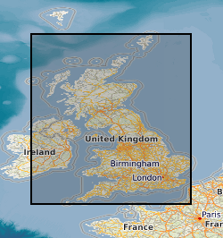
Coal resource maps for the whole of the UK have been produced by the British Geological Survey as a result of joint work with Department of Trade and Industry and the Coal Authority. The Coal Resources Map is a Map of Britain depicting the spatial extent of the principal coal resources. The map shows the areas where coal and lignite are present at the surface and also where coal is buried at depth beneath younger rocks. The maps are intended to be used for resource development, energy policy, strategic planning, land-use planning, the indication of hazard in mined areas, environment assessment and as a teaching aid. In addition to a general map of coal resources for Britain data also exists for the six inset maps: Scotland; North-East; North-West; East Pennines; Lancashire, North Wales and the West Midlands; South Wales, Forest of Dean and Bristol. Available as a paper map, flat or folded, from BGS Sales or as a pdf on a CD if requested.
-
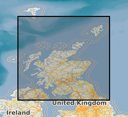
The dataset describes the potential of bedrock aquifers across Scotland to sustain various levels of borehole water supply, and the dominant groundwater flow type in each aquifer. There are five aquifer productivity classes: very high, high, moderate, low and very low, and three groundwater flow categories: significant intergranular flow; mixed fracture/intergranular flow; and fracture flow. The dataset is a tool to indicate the location and productivity of bedrock aquifers across Scotland. It may have several uses, including in policy analysis and development; to prioritise aquifer and site investigations; to inform planning decisions; and to improve awareness of groundwater in general. The complexity and heterogeneity of geological formations means that the dataset is only a guide. It is designed to be used at a scale of 1:100,000, and not to assess aquifer conditions at a single point. Latest version: Bedrock aquifer productivity Scotland version 2
-
The dataset describes the potential of superficial deposit aquifers across Scotland to sustain various levels of borehole water supply, based on four productivity classes: high; moderate to high; moderate; and a category to signify that a deposit is 'not a significant aquifer'. All superficial deposits aquifers in Scotland are assumed to have primarily intergranular groundwater flow. The dataset is a tool to indicate the location and productivity of superficial deposit aquifers across Scotland. It may have several uses, including in policy analysis and development; to prioritise aquifer and site investigations; to inform planning decisions; and to improve awareness of groundwater in general. The complexity and heterogeneity of geological formations means that the dataset is only a guide. It is designed to be used at a scale of 1:100,000, and not to assess aquifer conditions at a single point. Latest version : Superficial Aquifer Productivity Scotland version 2
-
The dataset describes the relative vulnerability of groundwater to contamination across Scotland, by means of five relative classes ranging from 1 (lowest vulnerability) to 5 (highest vulnerability). The dataset is a screening tool that can be used to show the relative threat to groundwater quality from contamination across Scotland. It can provide guidance on the vulnerability of groundwater at a regional scale, highlighting areas at comparatively higher risk of groundwater contamination, and can help indicate the degree of specific site investigation required for a new development or activity. It is designed to be used at a scale of 1:100,000 and should be regarded as a tool to aid groundwater risk assessment rather than a complete solution. Latest version: Groundwater Vulnerability Scotland version 2
-
The UK Onshore Geophysical Library was established in 1994 in conjunction with the Department of Trade and Industry (DTI) and the UK Onshore Operators Group (UKOOG). The Library manages the archive and official release of seismic data recorded over landward areas of the UK. By agreement with the DTI and HMSO, the Library operates as a registered charity, funded by revenues raised from data sales and donations, with the long term objective of bringing all available UK onshore digital seismic data into secure archival storage, whilst providing efficient access to all interested parties. BGS has access to the data at cost of copying only for science budget work. Data index on the BGS Geoscience Data Index.
-
The National Soil Parent Material dataset is a GIS describing the geological material from which topsoils and subsoils (A and B horizons) develop (i.e. from the base of pedological soil down to c. 3m). These deposits display a variable degree of weathering, but still exhibit core geological characteristics relating to their lithologies. The dataset covers England, Scotland and Wales and characterises parent material lithology, texture, mineralogy, strength and a range of other soil/parent related properties.
-
This layer of the Map based index (GeoIndex) shows the location of records of boreholes, shafts and wells from all forms of drilling and site investigation work. Some 850,000 records dating back over 200 years and ranging from one to several thousand metres deep. Currently some 50,000 new records are being added to the collection each year. The dataset available via the GeoIndex is a snapshot, taken at a particular date, of the Single Onshore Borehole Index. Although the GeoIndex is updated at regular intervals more information may be available than is shown.
-
This layer of the map based index (GeoIndex) shows the location of available Hydrogeological Maps which have been published at various scales, covering areas ranging in size from the whole of England and Wales, Northern Ireland and to Jersey. They display information on surface water features, the three dimensional geometry of aquifers, groundwater levels, abstractions and quality including saline intrusion in varying amounts of detail.
 BGS Data Catalogue