annually
Type of resources
Available actions
Topics
Keywords
Contact for the resource
Provided by
Years
Formats
Representation types
Update frequencies
Scale
-
Collection of annual publications from the global network of magnetic observatories. They typically contain tabulations of hourly, monthly and annual mean values of the geomagnetic elements. Contains all magnetic observatory year books held by the World Data Centre for Geomagnetism (Edinburgh).
-
The British Geological Survey has one of the largest databases in the world on the production and trade of minerals. The dataset contains annual production statistics by mass for more than 70 mineral commodities covering the majority of economically important and internationally-traded minerals, metals and mineral-based materials. For each commodity the annual production statistics are recorded for individual countries, grouped by continent. Import and export statistics are also available for years up to 2002. Maintenance of the database is funded by the Science Budget and output is used by government, private industry and others in support of policy, economic analysis and commercial strategy. As far as possible the production data are compiled from primary, official sources. Quality assurance is maintained by participation in such groups as the International Consultative Group on Non-ferrous Metal Statistics. Individual commodity and country tables are available for sale on request.
-
The official BGS photographic archive contains an estimated 300,000 photographs. The archive has been built up systematically since its founding in 1891 and is becoming a very popular educational resource for images of the geology of the UK and overseas. A wide range of topics is represented: field geology, landscapes, oblique aerial photographs, geohazards, marine operations, fossil, rocks and photomicrographs of rocks and minerals in thin section. In addition there are an estimated 225,000 photographs held with former groups, projects and individual geoscientists. The collections hold a diverse range of photographic material which includes black and white or colour negatives, transparencies and prints. The film formats range from 35mm to 10"X8" which includes both film and large format glass plates.
-
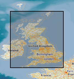
Laboratory results for the analysis of geochemical samples (stream sediments, soil and water) collected for the high resolution geochemical mapping of mainland Britain. The programme of regional geochemical sampling began in 1968 in the northern Highlands of Scotland. Sample sites are described on field slips. Chemical results are subjected to high level of quality control in the laboratory. Results are the raw data processed (standardisation and normalisation) to give seamless geochemical images and the value added G-BASE (Geochemical Baseline Survey of the Environment ) data in the BGS geochemistry database.
-
Laboratory results for the analysis of soil samples collected from urban areas during the baseline geochemical mapping programme of Britain. Sample sites are described on field slips. Chemical results are subjected to high level of quality control in the laboratory. Results are the raw data processed (standardisation and normalisation) to give seamless geochemical images and the value added G-BASE (Geochemical Baseline Survey of the Environment) data in the BGS geochemistry database.
-
The G-BASE programme involves systematic sampling and the determination of chemical elements in samples of stream sediment, stream water and soil, to build up a picture of the surface chemistry of the UK. The average sample density for stream sediments and water is about one site per 1.5-2km square, and for soils one site per 2km square. Analytical precision is high with strict quality control to ensure countrywide consistency. Results have been standardised to ensure seamless joins between geochemical sampling campaigns. The data provide baseline information on the natural abundances of elements, against which anomalous values due to such factors as mineralisation and industrial contamination may be compared. Analytical data for the 150 microns fraction of soil and stream sediment samples are available for some or all of: Ag, As, B, Ba, Bi, Be, Ca, Ce, Cd, Co, Cr, Cs, Cu, Fe, Ga, K, La, Li, Mg, Mn, Mo, Nb, Ni, P, Pb, Rb, Sb, Se, Sn, Sr, Th, Ti, U, V, Y, Zn, and Zr. Most water samples have been analysed for alkalinity, pH, conductivity, F and U and some for multi-element analyses including Al, Cl, Na, Si, SO4,NO4, and TOC. The project now routinely determines the elements listed in the <2mm fraction of surface soils.
-
A series of tiled models of superficial thickness covering the UK. The models are derived by direct modelling (natural neighbour interpolation) of BGS Borehole records and BGS Digmap. For the purposes of modelling, superficial deposits include sediments deposited during the Quaternary, subsequent Holocene rivers and coastal systems and also modern anthropogenic material. i.e. deposits that are less than 2.6 million years old. Grids are overprinted with a minimum value so that areas where no bore data is present, but drift is known to occur are given a minimum 1.5m thickness. The superficial thickness models have been created as baseline datasets for the BGS Geohazard programme. They represent the first attempt by BGS to create nationwide models of such data and the models provide only a simple, mathematical interpretation of reality. The complexity of Superficial deposits in Great Britain is such that it is only possible to model indicative values of thickness and elevation. The models should never be used as a substitute for thorough site investigation.
-
The GeoSure data sets and reports from the British Geological Survey provide information about potential ground movement or subsidence in a helpful and user-friendly format. The reports can help inform planning decisions and indicate causes of subsidence. Complete Great Britain national coverage is available. The Insurance Data give an index level assessment of the potential for a geological deposit to create financial insurance loss. The methodology is based on the 6 GeoSure individual hazard assessments. The storage formats of the data are ESRI and MapInfo but other formats can be supplied.
-
The data comprises a GIS layers representing the permeability of Superficial geological deposits for Great Britain. The permeability data has been derived from DiGMap-GB (Digital Geological Map Data of Great Britain), and therefore reflects the scale of DiGMap-GB. For the majority of the Great Britain, the scale is 1:50,000, however in areas where the geology is not mapped to this scale, the next best available scale, 1:625:000, is used. The data is updated annually, or after a major new release of DiGMap-GB. The permeability data describes the fresh water flow through geological deposits and the ability of a lithostratigraphical unit to transmit water. Maximum and minimum permeability indices are given for each geological unit to indicate the range in permeability likely to be encountered and the predominant flow mechanism (fracture or intergranular). Neither of the assigned values takes into account the thickness of either the unsaturated or saturated part of the lithostratigraphical unit. The data can be used freely internally, but is licensed for commercial use. It is best displayed using a desktop GIS, and is available in vector format as ESRI shapefiles and MapInfo TAB files.
-
The data comprises GIS layers representing the permeability of artificial deposits for Great Britain. The permeability data has been derived from DiGMap-GB (Digital Geological Map Data of Great Britain), and therefore reflects the scale of DiGMap-GB. For the majority of the Great Britain, the scale is 1:50,000. The data is updated annually, or after a major new release of DiGMap-GB. The permeability data describes the fresh water flow through these deposits and the ability of a lithostratigraphical unit to transmit water. Maximum and minimum permeability indices are given for each geological unit to indicate the range in permeability likely to be encountered and the predominant flow mechanism (fracture or intergranular). Neither of the assigned values takes into account the thickness of either the unsaturated or saturated part of the lithostratigraphical unit. The data can be used freely internally, but is licensed for commercial use. It is best displayed using a desktop GIS, and is available in vector format as ESRI shapefiles and MapInfo TAB files.
 BGS Data Catalogue