 BGS Metadata Catalogue
Geophysical logs database
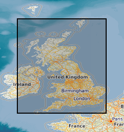
The British Geological Survey Geophysical Logs Database provides an index into downhole geophysical log data from onshore UK boreholes held by BGS within the National Geoscience Data Centre (NGDC). Geophysical log data may be used to understand stratigraphy, aid mapping work, assess resources like groundwater and quantify subsurface variability, so they are critical to many projects across the geoscience sector in the UK, including those which contribute towards net zero objectives such as the assessment of geothermal resources, storage of heat and waste materials, and the identification of mineral resources. The database includes hardcopy records (with digital scans) as well as digital wireline data in lis, las and dlis format. The data are linked to the Single Onshore Borehole Index and may be queried by borehole and spatial location. Hardcopy records are held in NGDC at BGS Keyworth. Some of the digital wireline data are in binary file formats, including .lis, .dlis, .tap and .tif (not an image format), which require specialist logging software to use. The database represents the combination of three historic databases which date from 1985 onwards, and the primary data were collected by different drilling companies and for different purposes, so the data have varying provenance and therefore quality. Not all data in the database are provided externally. Some data remain confidential, and because of the aggregate nature of the dataset, a small amount of the data are considered suspect and are not provided publicly. Significant collections within the database are: 1. Data acquired by the former National Coal Board and British Coal during their exploration for coal in the UK. Ownership of UK coal exploration data was transferred to the Coal Authority (now the Mining Remediation Authority) following privatisation of the UK coal industry, with British Geological Survey as custodian of the data. These data are in general publicly available; however, access to data within active mining licences is restricted in that it requires the consent of the mining licensee. The Coal Authority data archive includes digital data for some of the geophysical borehole logging. These are mainly in the form of original field tapes; however, also available are some data transcribed onto more modern media during BGS projects. 2. Data from onshore hydrocarbon wells regulated by the North Sea Transition Authority (NSTA; formerly known as DECC – Department of Energy and Climate Change and OGA – Oil and Gas Authority). These oil and gas wells deeply penetrate the crust (often over 1 km deep) under the UK mainland and are geographically widespread.
Simple
- Date (Creation)
- 2024
- Citation identifier
- http://data.bgs.ac.uk/id/dataHolding/13480158
- Point of contact
-
Organisation name Individual name Electronic mail address Role British Geological Survey
Enquiries
Distributor British Geological Survey
Enquiries
Point of contact British Geological Survey
Enquiries
Distributor British Geological Survey
Enquiries
Point of contact
- Maintenance and update frequency
- As needed
-
GEMET - INSPIRE themes, version 1.0
-
BGS Thesaurus of Geosciences
-
-
Coal
-
Geophysical logs
-
Coal exploration
-
Boreholes
-
Down hole geophysics
-
Hydrogeology
-
Geophysics
-
- dataCentre
- Keywords
-
-
NERC_DDC
-
- Access constraints
- Other restrictions
- Other constraints
- restricted
- Use constraints
- Other restrictions
- Other constraints
-
The copyright of materials derived from the British Geological Survey's work is vested in the Natural Environment Research Council [NERC]. No part of this work may be reproduced or transmitted in any form or by any means, or stored in a retrieval system of any nature, without the prior permission of the copyright holder, via the BGS Intellectual Property Rights Manager. Use by customers of information provided by the BGS, is at the customer's own risk. In view of the disparate sources of information at BGS's disposal, including such material donated to BGS, that BGS accepts in good faith as being accurate, the Natural Environment Research Council (NERC) gives no warranty, expressed or implied, as to the quality or accuracy of the information supplied, or to the information's suitability for any use. NERC/BGS accepts no liability whatever in respect of loss, damage, injury or other occurence however caused.
- Other constraints
-
Available under the Open Government Licence subject to the following acknowledgement accompanying the reproduced NERC materials "Contains NERC materials ©NERC [year]"
- Other constraints
-
Either: (i) the dataset is made freely available, e.g. via the Internet, for a restricted category of use (e.g. educational use only); or (ii) the dataset has not been formally approved by BGS for access and use by external clients under licence, but its use may be permitted under alternative formal arrangements; or (iii) the dataset contains 3rd party data or information obtained by BGS under terms and conditions that must be consulted in order to determine the permitted usage of the dataset. Refer to the BGS staff member responsible for the creation of the dataset if further advice is required. He / she should be familiar with the composition of the dataset, particularly with regard to 3rd party IPR contained in it, and any resultant use restrictions. This staff member should revert to the IPR Section ( ipr@bgs.ac.uk) for advice, should the position not be clear.
- Spatial representation type
- Vector
- Language
- English
- Topic category
-
- Geoscientific information
- Geographic identifier
-
GB
ISO 3166_1 alpha-3 2009 revision
- Geographic identifier
-
UK [id=139300]
British Geological Survey Gazetteer: Geographical hierarchy from Geosaurus 1979 creation
- Geographic identifier
-
UKM
ISO 3166_2 2009 revision
))
- Begin date
- 1893
- Unique resource identifier
- OSGB 1936 / British National Grid (EPSG::27700)
- Unique resource identifier
- WGS 84 (EPSG::4326)
- Distribution format
-
Name Version Log ASCII Standard (LAS)
Log Information Standard (LIS)
SEG-Y
PDF
Image (TIFF)
Paper hard-copy records
Comma-separated values (CSV)
Microsoft Word
Microsoft Excel
- Distributor contact
-
Organisation name Individual name Electronic mail address Role British Geological Survey
Enquiries
Distributor
- Distributor contact
-
Organisation name Individual name Electronic mail address Role British Geological Survey
Enquiries
Distributor
- OnLine resource
-
Protocol Linkage Name WWW:LINK-1.0-http--link
https://shop.bgs.ac.uk/Shop/Department/GeoRecords GeoRecords service
- OnLine resource
-
Protocol Linkage Name be scanned via the GeoRecords service. WWW:LINK-1.0-http--link
https://mapapps2.bgs.ac.uk/geoindex/home.html?layer=BGSGeophysicallogs&_ga=2.84585309.598599685.1778165344-920702539.1778165344 Geoindex Geophysical Borehole Logs layer
- Hierarchy level
- Dataset
- Other
-
dataset
Conformance result
- Title
-
INSPIRE Implementing rules laying down technical arrangements for the interoperability and harmonisation of Geology
- Date (Publication)
- 2011
- Explanation
-
See the referenced specification
- Pass
- No
Conformance result
- Title
-
Commission Regulation (EU) No 1089/2010 of 23 November 2010 implementing Directive 2007/2/EC of the European Parliament and of the Council as regards interoperability of spatial data sets and services
- Date (Publication)
- 2010-12-08
- Explanation
-
See http://eur-lex.europa.eu/LexUriServ/LexUriServ.do?uri=OJ:L:2010:323:0011:0102:EN:PDF
- Pass
- No
- Statement
-
The database represents an aggregation of the geophysical log data held by BGS which originate from various sources, with different lineages, processing and quality control steps.
Metadata
- File identifier
- 9df8df51-62ef-37a8-e044-0003ba9b0d98 XML
- Metadata language
- English
- Hierarchy level
- Dataset
- Date stamp
- 2026-07-02
- Metadata standard name
- UK GEMINI
- Metadata standard version
-
2.3
- Metadata author
-
Organisation name Individual name Electronic mail address Role British Geological Survey
Point of contact
- Dataset URI
)))
