 BGS Metadata Catalogue
Dalradian Carbonate Rock Geochemistry Database
The database contains a range of geochemical data for metamorphosed limestones from the Dalradian of Scotland and Northern Ireland. The data include a) whole-rock geochemical analyses by XRF (X-Ray Fluorescence) for major oxides and a range of trace elements for several hundred samples, b) a number of whole-carbonate O (oxygen) and C (carbon) stable isotope and Sr (strontium) data, c) electron microprobe mineral data on carbonates and calc-silicate minerals and d) ion-probe O stable isotope and mineral trace element data for calcites in a small number of samples. The samples from which the data have been derived were collected from a wide range of outcrops within the Scottish and Irish Dalradian, mainly concentrated in the North East Grampian Highlands of Scotland. The data have been collected mainly to support the mapping and scientific work being undertaken in the Grampian Highlands by BGS since the early 1980s. The database includes some data from the literature. All samples are located by British National Grid coordinates to the nearest 10m or better. The isotope data were acquired as part of a PhD study by C W Thomas in the late 1990s. The database is not currently being added to, but is still being used in various studies. The combined data provide wide-ranging insights into marine chemistry contemporary with deposition of the limestones and the way in which this chemistry changed with time during the Neoproterozoic, and they elucidate subsequent effects of diagenesis and metamorphism and the outcrop and grain-scale. The data set is largely complete with regard to geochemical data, but still requires some editing to bring all fields up to date, particularly with regard to lithostratigraphical assignation. The data are currently held in MS Access tables and can conveniently be displayed via GIS or abstracted in tabular form and used in spreadsheets, statistical analysis and graphing software.
Simple
- Date (Creation)
- 1984
- Citation identifier
- http://data.bgs.ac.uk/id/dataHolding/13480107
- Point of contact
-
Organisation name Individual name Electronic mail address Role British Geological Survey
Enquiries
Distributor British Geological Survey
Enquiries
Point of contact British Geological Survey
Enquiries
Distributor British Geological Survey
Enquiries
Custodian
- Maintenance and update frequency
- Irregular
-
GEMET - INSPIRE themes, version 1.0
-
BGS Thesaurus of Geosciences
-
-
Geochemistry
-
Geology
-
Trace elements
-
Stable isotopes
-
Strontium isotopes
-
- dataCentre
- Keywords
-
-
NERC_DDC
-
- Access constraints
- Other restrictions
- Use constraints
- Other restrictions
- Other constraints
-
The copyright of materials derived from the British Geological Survey's work is vested in the Natural Environment Research Council [NERC]. No part of this work may be reproduced or transmitted in any form or by any means, or stored in a retrieval system of any nature, without the prior permission of the copyright holder, via the BGS Intellectual Property Rights Manager. Use by customers of information provided by the BGS, is at the customer's own risk. In view of the disparate sources of information at BGS's disposal, including such material donated to BGS, that BGS accepts in good faith as being accurate, the Natural Environment Research Council (NERC) gives no warranty, expressed or implied, as to the quality or accuracy of the information supplied, or to the information's suitability for any use. NERC/BGS accepts no liability whatever in respect of loss, damage, injury or other occurence however caused.
- Other constraints
-
Either: (i) the dataset is made freely available, e.g. via the Internet, for a restricted category of use (e.g. educational use only); or (ii) the dataset has not been formally approved by BGS for access and use by external clients under licence, but its use may be permitted under alternative formal arrangements; or (iii) the dataset contains 3rd party data or information obtained by BGS under terms and conditions that must be consulted in order to determine the permitted usage of the dataset. Refer to the BGS staff member responsible for the creation of the dataset if further advice is required. He / she should be familiar with the composition of the dataset, particularly with regard to 3rd party IPR contained in it, and any resultant use restrictions. This staff member should revert to the IPR Section ( ipr@bgs.ac.uk) for advice, should the position not be clear.
- Spatial representation type
- Grid
- Denominator
- 10000
- Language
- English
- Topic category
-
- Geoscientific information
- Geographic identifier
-
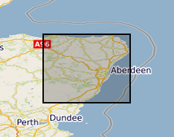
EAST GRAMPIANS, NORTH OF CAIRNGORMS [id=146911]
British Geological Survey Gazetteer: Geographical hierarchy from Geosaurus 1979 creation
))
- Begin date
- 1980
- End date
- 1990
- Supplemental Information
-
Part of East Grampians project initially, now Dalradian-wide, including Northern Ireland. A working database, although maintenance is now sporadic and little new data have been added in recent years. The project task from which these data arose is no longer active. The whole-rock analyses have been used particularly to aid lithostratigraphical correlation. All samples are located by British National Grid coordinates to the nearest 10m or better. The isotope data were acquired as part of a PhD study by C W Thomas in the late 1990s. The database is not currently being added to, but is still being used in various studies. It is likely that data will continue to be added sporadically in the coming years; the database may be extended via collaboration with academic colleagues. The combined data provide wide-ranging insights into marine chemistry contemporary with deposition of the limestones and the way in which this chemistry changed with time during the Neoproterozoic, and they elucidate subsequent effects of diagenesis and metamorphism and the outcrop and grain-scale. Thus there are some data which are missing and there are some inconsistencies in the way some of the geochemical data in the whole-rock section are treated (e.g. with regard to `not analysed? and `below detection? flags). The data are stand-alone, in that they are not included in any current corporate geochemical database. However, there are sufficient administrative data attributes attached to the geochemical data to allow integration with any other data set, especially in a GIS environment. An advance would be to include Lextrat codes within the database to allow for linkages with the BGS Lexicon of named rock units, but this has not been done because of lack of funds and incompleteness of the stratigraphical assignations of all samples.
- Unique resource identifier
- OSGB 1936 / British National Grid (EPSG::27700)
- Distribution format
-
Name Version ESRI Files
witheld
Delimited ASCII
witheld
Microsoft Access
witheld
- Distributor contact
-
Organisation name Individual name Electronic mail address Role British Geological Survey
Enquiries
Distributor
- Distributor contact
-
Organisation name Individual name Electronic mail address Role British Geological Survey
Enquiries
Distributor
- OnLine resource
-
Protocol Linkage Name WWW:LINK-1.0-http--link
https://www.bgs.ac.uk/ BGS Homepage
- Hierarchy level
- Dataset
- Other
-
dataset
Conformance result
- Title
-
INSPIRE Implementing rules laying down technical arrangements for the interoperability and harmonisation of Geology
- Date (Publication)
- 2011
- Explanation
-
See the referenced specification
- Pass
- No
Conformance result
- Title
-
Commission Regulation (EU) No 1089/2010 of 23 November 2010 implementing Directive 2007/2/EC of the European Parliament and of the Council as regards interoperability of spatial data sets and services
- Date (Publication)
- 2010-12-08
- Explanation
-
See http://eur-lex.europa.eu/LexUriServ/LexUriServ.do?uri=OJ:L:2010:323:0011:0102:EN:PDF
- Pass
- No
- Statement
-
The database contains a range of geochemical data for metamorphosed limestones from the Dalradian of Scotland and Northern Ireland. Data entry via ACCESS forms to RDBMS. Form include some validation traps.
Metadata
- File identifier
- 9df8df51-6327-37a8-e044-0003ba9b0d98 XML
- Metadata language
- English
- Hierarchy level
- Dataset
- Date stamp
- 2026-07-28
- Metadata standard name
- UK GEMINI
- Metadata standard version
-
2.3
- Metadata author
-
Organisation name Individual name Electronic mail address Role British Geological Survey
Point of contact
- Dataset URI
)))
