1984
Type of resources
Topics
Keywords
Contact for the resource
Provided by
Years
Formats
Representation types
Update frequencies
Scale
-

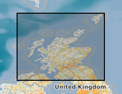
The Land Survey Plans collection of c.1,520 plans consists largely of mine plans acquired by the Survey, including 492 non-coal mine plans deposited by the National Coal Board 1984-87, and copies of mine plans derived from various sources including '6-inch reductions'. The collection also contains about 500 miscellaneous plans extracted from other Land Survey records in order to benefit from specialised systems of archival storage. The Survey's collection of Northern England mine plans are being added to the LSP collection. The collection supplements the Plans Of Abandoned Mines (Other than Coal & Oil Shale) in Scotland (NONCOALPLANSCO) providing an index to plans other than coal and oil shale for Scotland. Indexed on BGS Plans Database Index. Coal Authority hold some non-coal plans for Scotland. All non-confidential data held by NGRC(N) is available to users. Mainly coalfield areas of Central Scotland.
-

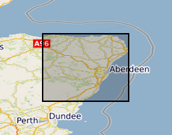
The database contains a range of geochemical data for metamorphosed limestones from the Dalradian of Scotland and Northern Ireland. The data include a) whole-rock geochemical analyses by XRF (X-Ray Fluorescence) for major oxides and a range of trace elements for several hundred samples, b) a number of whole-carbonate O (oxygen) and C (carbon) stable isotope and Sr (strontium) data, c) electron microprobe mineral data on carbonates and calc-silicate minerals and d) ion-probe O stable isotope and mineral trace element data for calcites in a small number of samples. The samples from which the data have been derived were collected from a wide range of outcrops within the Scottish and Irish Dalradian, mainly concentrated in the North East Grampian Highlands of Scotland. The data have been collected mainly to support the mapping and scientific work being undertaken in the Grampian Highlands by BGS since the early 1980s. The database includes some data from the literature. All samples are located by British National Grid coordinates to the nearest 10m or better. The isotope data were acquired as part of a PhD study by C W Thomas in the late 1990s. The database is not currently being added to, but is still being used in various studies. The combined data provide wide-ranging insights into marine chemistry contemporary with deposition of the limestones and the way in which this chemistry changed with time during the Neoproterozoic, and they elucidate subsequent effects of diagenesis and metamorphism and the outcrop and grain-scale. The data set is largely complete with regard to geochemical data, but still requires some editing to bring all fields up to date, particularly with regard to lithostratigraphical assignation. The data are currently held in MS Access tables and can conveniently be displayed via GIS or abstracted in tabular form and used in spreadsheets, statistical analysis and graphing software.
 BGS Data Catalogue