 BGS Data Catalogue
1983
Type of resources
Topics
Keywords
Contact for the resource
Provided by
Years
Formats
Representation types
Update frequencies
Scale
-
The database contains basic tabulated field data resulting from the work of the BGS East Grampians Project in the early 1980s to mid 1990s. Records include the locations of stations at which field observations were made, structural measurements and sample locations. To this end, the database provides an index to locations and structural data. However, it needs to be stated clearly that labels given to structural elements are largely subjective beyond the identification of bedding. This means that the structural data are largely unusable without a clear understanding of their context and with regard to the primary paper record on which descriptions of the observed structures are recorded. The data are held in MS ACCESS tables which are related via the Station number as the primary key. The coverage is mainly confined to the North East Grampian Highlands of Scotland. The database is currently unused and has not been added to since the end of the East Grampians Project. The station location and structural data are effectively complete. However, fields in the sample database, such as the sample stratigraphy, are largely incomplete because, at the time the data were acquired, the stratigraphy at each station was formally undefined. The most effective way of presenting and investigating the data is via GIS.
-
Database of water levels in selected observation boreholes: daily, weekly or monthly measurements. Consistent set of boreholes in catchments relatively undisturbed by pumping distributed across most significant aquifer units in the UK. Most sites have more than 30 years of data, and some sites have considerably longer time series. The dataset represents only 5% of active groundwater monitoring networks run by UK measuring agencies. BGS holds other, historical, groundwater level data, including one off measurements and time series.
-
3200 mineral veins (i.e. lead, fluorspar) of the Southern Pennine Orefield within the Peak District National Park captured as a single dataset in 1983 from BGS 1:10 560 published maps with additional veins from referenced literature. The data covers a small, very limited area. Also includes several pipe and flat deposits. Also includes mapped faults. The dataset is approximately 99.5% complete. Uses for the data include economic geology, mineral resources, mine hazards. Veins are numbered but not named.
-
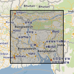
This dataset is an archive of the following original data for the seismic reflection surveys conducted by the BGS in Bangladesh for PetroBangla (Bangladesh state oil & gas company) and the UK Overseas Development Agency (funding body): Observers' logs, Surveyors' reports, Location data tapes, Field data recording tapes, Processed data tapes and various stages of processing: demultiplexed field data to migrated stack (not all available for all profiles). These data are kept as archive copies. They are only available with the agreement of PetroBangla and the ODA. Approx. written records and approx. 1200 tapes.