 BGS Metadata Catalogue
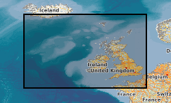
Strategic Environmental Assessment (SEA) Data and Related Information (1999-)
The SEA portal is managed by the BGS on behalf of DECC and provides free access to downloadable data, information and reports which have been produced through the SEA process. The Department of Trade and Industry (now DECC) began a sequence of sectoral SEAs of the implications of further licensing of the UK Continental Shelf (UKCS) for oil and gas exploration and production in 1999. The SEA Process subdivided the UKCS into eight areas shown; beginning in 2008, integrated Offshore Energy SEAs have been undertaken that cover the whole UKCS. An integral part of the SEA programme has been a series of research and monitoring surveys commissioned to acquire new data about the offshore environment and used to help inform the relevant SEAs. Many files can be downloaded directly from portal. Those that are too large to download can be ordered via the website for postal delivery from BGS.
Simple
- Date (Creation)
- 1999
- Citation identifier
- http://data.bgs.ac.uk/id/dataHolding/13605657
- Point of contact
-
Organisation name Individual name Electronic mail address Role Department for Business, Energy and Industrial Strategy (BEIS)
not available
Owner British Geological Survey
Enquiries
Distributor British Geological Survey
Enquiries
Point of contact British Geological Survey
Enquiries
Custodian British Geological Survey
Enquiries
not available
Custodian British Geological Survey
Enquiries
not available
Distributor
- Maintenance and update frequency
- Irregular
-
GEMET - INSPIRE themes, version 1.0
-
BGS Thesaurus of Geosciences
-
-
Marine geology
-
- dataCentre
- Keywords
-
-
NERC_DDC
-
- Access constraints
- Other restrictions
- Other constraints
- The DECC SEA must be acknowledged in any maps or publications that make use of the data. All the data files are freely available to the public.
- Use constraints
- Other restrictions
- Other constraints
-
The copyright of materials derived from the British Geological Survey's work is vested in the Natural Environment Research Council [NERC]. No part of this work may be reproduced or transmitted in any form or by any means, or stored in a retrieval system of any nature, without the prior permission of the copyright holder, via the BGS Intellectual Property Rights Manager. Use by customers of information provided by the BGS, is at the customer's own risk. In view of the disparate sources of information at BGS's disposal, including such material donated to BGS, that BGS accepts in good faith as being accurate, the Natural Environment Research Council (NERC) gives no warranty, expressed or implied, as to the quality or accuracy of the information supplied, or to the information's suitability for any use. NERC/BGS accepts no liability whatever in respect of loss, damage, injury or other occurence however caused.
- Other constraints
-
Either: (i) the dataset is made freely available, e.g. via the Internet, for a restricted category of use (e.g. educational use only); or (ii) the dataset has not been formally approved by BGS for access and use by external clients under licence, but its use may be permitted under alternative formal arrangements; or (iii) the dataset contains 3rd party data or information obtained by BGS under terms and conditions that must be consulted in order to determine the permitted usage of the dataset. Refer to the BGS staff member responsible for the creation of the dataset if further advice is required. He / she should be familiar with the composition of the dataset, particularly with regard to 3rd party IPR contained in it, and any resultant use restrictions. This staff member should revert to the IPR Section ( ipr@bgs.ac.uk) for advice, should the position not be clear.
- Spatial representation type
- Vector
- Language
- English
- Topic category
-
- Geoscientific information
- Geographic identifier
-
ENGLISH CHANNEL [id=2001401]
British Geological Survey Gazetteer: Gazetteer of sea areas 2010 revision
- Geographic identifier
-
INNER SEAS OFF THE WEST COAST OF SCOTLAND [id=2001428]
British Geological Survey Gazetteer: Gazetteer of sea areas 2010 revision
- Geographic identifier
-
IRISH SEA [id=2001430]
British Geological Survey Gazetteer: Gazetteer of sea areas 2010 revision
- Geographic identifier
-
NORTH SEA [id=2001452]
British Geological Survey Gazetteer: Gazetteer of sea areas 2010 revision
- Geographic identifier
-
NORTHEAST ATLANTIC OCEAN (40W) (aggregate) [id=2002274]
British Geological Survey Gazetteer: Gazetteer of sea areas 2010 revision
- Geographic identifier
-
UK CONTINENTAL SHELF [id=121701]
British Geological Survey Gazetteer: Geographical hierarchy from Geosaurus 1979 creation
))
- Begin date
- 1999
- End date
- 1999 After
- Unique resource identifier
- OSGB 1936 / British National Grid (EPSG::27700)
- Unique resource identifier
- WGS 84 / UTM zone 29N (EPSG::32629)
- Unique resource identifier
- WGS 84 / UTM zone 30N (EPSG::32630)
- Unique resource identifier
- WGS 84 / UTM zone 31N (EPSG::32631)
- Unique resource identifier
- WGS 84 (EPSG::4326)
- Distribution format
-
Name Version data files (in a variety of specialist formats)
images
Video
- Distributor contact
-
Organisation name Individual name Electronic mail address Role British Geological Survey
Enquiries
Distributor
- Distributor contact
-
Organisation name Individual name Electronic mail address Role British Geological Survey
Enquiries
not available
Distributor
- OnLine resource
-
Protocol Linkage Name WWW:LINK-1.0-http--link
https://www.bgs.ac.uk/technologies/databases/strategic-environmental-assessment-sea-data-portal/ Strategic environmental assessment (SEA) data portal
- Hierarchy level
- Dataset
- Other
-
dataset
Conformance result
- Title
-
INSPIRE Implementing rules laying down technical arrangements for the interoperability and harmonisation of Geology
- Date (Publication)
- 2011
- Explanation
-
See the referenced specification
- Pass
- No
Conformance result
- Title
-
Commission Regulation (EU) No 1089/2010 of 23 November 2010 implementing Directive 2007/2/EC of the European Parliament and of the Council as regards interoperability of spatial data sets and services
- Date (Publication)
- 2010-12-08
- Explanation
-
See http://eur-lex.europa.eu/LexUriServ/LexUriServ.do?uri=OJ:L:2010:323:0011:0102:EN:PDF
- Pass
- No
- Statement
-
The data were produced as part of the UK Department of Energy and Climate Change's Offshore Energy Strategic Environmental Assessment programme; Crown Copyright, all rights reserved. BGS (NERC) has been contracted by DECC to publish SEA datasets on its behalf.
Metadata
- File identifier
- c4291735-b028-3e0e-e044-0003ba9b0d98 XML
- Metadata language
- English
- Hierarchy level
- Dataset
- Date stamp
- 2026-07-11
- Metadata standard name
- UK GEMINI
- Metadata standard version
-
2.3
- Metadata author
-
Organisation name Individual name Electronic mail address Role British Geological Survey
Point of contact
- Dataset URI
)))
