 BGS Metadata Catalogue
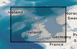
Marine geophysical and seismic data from around the UK (1966 onwards)
The British Geological Survey hold a collection of data recorded during marine geophysical surveys which includes digital data and analogue records. These data result from approximately 350,000 line kilometres of multi-instrument geophysical survey lines. The dataset includes seismic, sonar, magnetic, gravity, echo sounder, multibeam bathymetry and navigation data. The seismic data are mainly airgun, sparker, boomer and pinger data. Most of the data were collected by BGS, but the collection also includes some third party data. The data are primarily from the UKCS (United Kingdom Continental Shelf). The data are stored within the National Geoscience Data Centre (NGDC) as the Marine Environmental Data and Information Network (MEDIN) Data Archive Centre (DAC) for Geology and Geophysics. The majority of legacy geophysical paper records are available as scanned images. Other records can be scanned on request. Older records are of variable quality. Data not yet available online, including digital SEG-Y data, are available on request from enquiries@bgs.ac.uk. The data are applicable to a wide range of uses including environmental, geotechnical, geophysical and geological studies. For more information, refer to Fannin, N. G. T. (1989) Offshore Investigations 1966-87. British Geological Survey Technical Report WB/89/2, British Geological Survey.
Simple
- Date (Creation)
- 1966
- Citation identifier
- http://data.bgs.ac.uk/id/dataHolding/13605641
- Point of contact
-
Organisation name Individual name Electronic mail address Role British Geological Survey
Enquiries
Distributor British Geological Survey
Enquiries
Point of contact
- Maintenance and update frequency
- Irregular
-
GEMET - INSPIRE themes, version 1.0
-
BGS Thesaurus of Geosciences
-
-
Marine surveys
-
Geophysical data
-
Marine geology
-
Geology
-
Marine seismic surveys
-
Seismic data
-
Marine geophysics
-
- dataCentre
- Keywords
-
-
NERC_DDC
-
- Access constraints
- Other restrictions
- Use constraints
- Other restrictions
- Other constraints
-
The copyright of materials derived from the British Geological Survey's work is vested in the Natural Environment Research Council [NERC]. No part of this work may be reproduced or transmitted in any form or by any means, or stored in a retrieval system of any nature, without the prior permission of the copyright holder, via the BGS Intellectual Property Rights Manager. Use by customers of information provided by the BGS, is at the customer's own risk. In view of the disparate sources of information at BGS's disposal, including such material donated to BGS, that BGS accepts in good faith as being accurate, the Natural Environment Research Council (NERC) gives no warranty, expressed or implied, as to the quality or accuracy of the information supplied, or to the information's suitability for any use. NERC/BGS accepts no liability whatever in respect of loss, damage, injury or other occurence however caused.
- Other constraints
-
Available under the Open Government Licence subject to the following acknowledgement accompanying the reproduced NERC materials "Contains NERC materials ©NERC [year]"
- Spatial representation type
- Vector
- Language
- English
- Topic category
-
- Geoscientific information
- Geographic identifier
-
ENGLISH CHANNEL [id=2001401]
British Geological Survey Gazetteer: Gazetteer of sea areas 2010 revision
- Geographic identifier
-
IRISH SEA [id=2001430]
British Geological Survey Gazetteer: Gazetteer of sea areas 2010 revision
- Geographic identifier
-
NORTH SEA [id=2001452]
British Geological Survey Gazetteer: Gazetteer of sea areas 2010 revision
- Geographic identifier
-
NORTHEAST ATLANTIC OCEAN (40W) [id=2001453]
British Geological Survey Gazetteer: Gazetteer of sea areas 2010 revision
- Geographic identifier
-
UK CONTINENTAL SHELF [id=121701]
British Geological Survey Gazetteer: Geographical hierarchy from Geosaurus 1979 creation
))
- Begin date
- 1966
- Unique resource identifier
- WGS 84 (EPSG::4326)
- Distribution format
-
Name Version SEG-Y
Image (TIFF)
Image (JPEG2000)
Coda Octopus file (COD)
Extended Triton Format (.xtf)
- Distributor contact
-
Organisation name Individual name Electronic mail address Role British Geological Survey
Enquiries
Distributor
- OnLine resource
-
Protocol Linkage Name WWW:LINK-1.0-http--link
https://mapapps2.bgs.ac.uk/geoindex_offshore/home.html GeoIndex Offshore
- OnLine resource
-
Protocol Linkage Name OGC:WMS
https://map.bgs.ac.uk/arcgis/services/GeoIndex_Offshore/offshore_data/MapServer/WmsServer? GeoIndex_Offshore_offshore_data
- OnLine resource
-
Protocol Linkage Name OGC:WMS
https://map.bgs.ac.uk/arcgis/services/GeoIndex_Offshore/offshore_cultural/MapServer/WmsServer? British Geological Survey (BGS) GeoIndex - Offshore Cultural data theme
- OnLine resource
-
Protocol Linkage Name OGC:WMS-1.3.0-http-get-capabilities
https://map.bgs.ac.uk/arcgis/services/GeoIndex_Offshore/offshore_cultural/MapServer/WmsServer?service=WMS&request=GetCapabilities British Geological Survey (BGS) GeoIndex - Offshore Cultural data theme
- OnLine resource
-
Protocol Linkage Name OGC:WMS-1.3.0-http-get-capabilities
https://map.bgs.ac.uk/arcgis/services/GeoIndex_Offshore/offshore_data/MapServer/WmsServer?service=WMS&request=GetCapabilities GeoIndex_Offshore_offshore_data
- Hierarchy level
- Dataset
- Other
-
dataset
Conformance result
- Title
-
INSPIRE Implementing rules laying down technical arrangements for the interoperability and harmonisation of Geology
- Date (Publication)
- 2011
- Explanation
-
See the referenced specification
- Pass
- No
Conformance result
- Title
-
Commission Regulation (EU) No 1089/2010 of 23 November 2010 implementing Directive 2007/2/EC of the European Parliament and of the Council as regards interoperability of spatial data sets and services
- Date (Publication)
- 2010-12-08
- Explanation
-
See http://eur-lex.europa.eu/LexUriServ/LexUriServ.do?uri=OJ:L:2010:323:0011:0102:EN:PDF
- Pass
- No
- Statement
-
Data were collected during marine geophysical surveys. A variety of types of data (types of geophysical survey equipment) are available, including airgun, sparker, boomer, pinger, gravimeter, magnetometer, sidescan sonar and multibeam echosounder data. This dataset has been managed by BGS over a considerable period of time. Legacy paper records from earlier surveys were scanned and some have been transcribed to digital formats, with QC of the information captured and addition to the BGS database. Some hard-copy records have not yet been scanned. More recent data are captured digitally and loaded directly into the BGS database.
Metadata
- File identifier
- c35db9dd-2a09-6c2d-e044-0003ba9b0d98 XML
- Metadata language
- English
- Hierarchy level
- Dataset
- Date stamp
- 2026-07-27
- Metadata standard name
- UK GEMINI
- Metadata standard version
-
2.3
- Metadata author
-
Organisation name Individual name Electronic mail address Role British Geological Survey
Point of contact
- Dataset URI
)))
