 BGS Data Catalogue
Planning
Type of resources
Topics
Keywords
Contact for the resource
Provided by
Years
Formats
Representation types
Update frequencies
Scale
-
These are OS 1:25000 paper maps (approximately 1400) upon which the Ministry of Housing and Local Government (currently Department for Communities and Local Government (CLG)) recorded hand drawn boundaries for permitted, withdrawn and refused mineral planning permissions and worked ground for every local authority area in England. Accompanying the maps is an associated card index (see metadata for MHLG Cards). Priority was placed on areas that were given rise to then current casework issues thus, at the time when the maintenance of the maps ended some authority information had been updated recently but other areas had not been visited for many years. Therefore, the variable completeness of the data should be kept in mind when the material is being used. Both the maps and the card index have been used to create the digital mineral planning permissions polygons (see metadata for MHLG Planning Permission Polygons). Polygons for worked ground have not been captured.
-

Digital GIS mineral planning permission polygons from 1947 to 1985 as digitised from the Ministry of Housing and Local Government Planning Permission Maps and Cards (see associated metadata for MHLG Maps, Cards and Scanned Maps ). Data digitised included all planning permissions granted, withdrawn and refused for local authority areas for all of England. Currently 32,000 separate planning permission polygons have been captured from the maps and attributed using the associated card index.
-

A card index storing supplementary information regarding name, operator, dates and commodity worked for each planning permission boundary recorded (drawn) on the Ministry of Housing and Local Government (MHLG) Mineral Planning Permissions Maps (see associated metadata). Information on the cards has been used to attribute the Ministry of Housing and Local Government (MHLG) Mineral Planning Permission Polygons (see associated metadata for MHLG Planning Permission Polygons).
-
GIS Data Layer and Database including maps and detailed Indexes. Paper records and photographs, descriptive register is paper version from which the digital version was created. Data mainly captured in 1989, infrequent additions (approximately 1 entry per year) since then. Includes all man-made caves known to BGS in Nottingham, but there are many more to be located in the future.
-
The dataset is based on a 1 hectare(ha) vector grid which covers the whole of England. It has been populated with a series of environmental and cultural assets, reflecting the presence or absence of an asset in an individual cell. The dataset has been designed to enable a single asset to be displayed in a generalised fomat; total numbers of assets within a given cell; or the opportunity to create in unique combination of the assets based on the generalised 1 ha data. The data is also available at 1km.
-
The dataset is based on a 1 hectare(ha) vector grid which covers the whole of Wales. It has been populated with a series of environmental and cultural assets, reflecting the presence or absence of an asset in an individual cell. The dataset has been designed to enable a single asset to be displayed in a generalised fomat; total numbers of assets within a given cell; or the opportunity to create in unique combination of the assets based on the generalised 1 ha data. The data is also available at 1km.
-
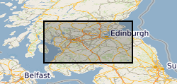
The British Geological Survey (BGS) was awarded a grant from the Scottish Government Aggregates Levy Fund in 2007 to provide a comprehensive, relevant and accessible information base to enhance the sustainability of mineral resources for 18 local authorities in the central belt of Scotland. BGS co-funded this project through its Sustainable Mineral Solutions project. This work was completed in March 2008. This dataset comprises the digital GIS files which were produced through this project. The major elements of minerals information presented are the geological distribution of all mineral resources in the Central Belt of Scotland. The BGS Mineral Resource data does not determine mineral reserves and therefore does not denote potential areas of extraction. Only onshore, mainland mineral resources are included in the dataset. This dataset has been produced by the collation and interpretation of mineral resource data principally held by the British Geological Survey. The mineral resource data presented are based on the best available information, but are not comprehensive and their quality is variable. The dataset should only be used to show a broad distribution of those mineral resources which may be of current or potential economic interest. The data should not be used to determine individual planning applications or in taking decisions on the acquisition or use of a particular piece of land, although they may give useful background information which sets a specific proposal in context.
-
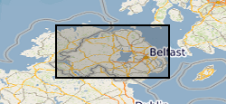
This mineral resource data was produced as part of the Mineral Resource Map of Northern Ireland via a commission from the Northern Ireland Department of the Environment. The work resulted in a series of 21 data layers which were used to generate a series of six digitally generated maps. This work was completed in 2012 with one map for each of the six counties (including county boroughs) of Northern Ireland at a scale of 1:100 000. This data and the accompanying maps are intended to assist strategic decision making in respect of mineral extraction and the protection of important mineral resources against sterilisation. They bring together a wide range of information, much of which is scattered and not always available in a convenient form. The data has been produced by the collation and interpretation of mineral resource data principally held by the Geological Survey of Northern Ireland and was funded via a commission from the Northern Ireland Department of the Environment. These layers display the spatial data of the mineral resources of Northern Ireland. There are a series of layers which consist of: Bedrock: Clay, Bauxitic clay, Coal & Lignite, Coal – lignite proven, Conglomerate, Dolomite, Igneous and meta-igneous rock, Limestone, a 100m buffer layer on the Ulster White Limestone, Meta-sedimentary rocks, Perlite, Salt, Sandstone and Silica Sand. Superficial (unconsolidated recent sediments) : Sand & gravel and Peat. The data except for the salt and proven lignite resource layers was derived from the 1:50 00 and 1:250 000 scale DigMap NI dataset. This version of the data retains the internal geological boundaries which are dissolved out in the accompanying dissolved version. A user guide 'The Mineral Resources of Northern Ireland digital dataset (version 1)' OR/12/039 describing the creation and use of the data is available.
-
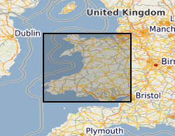
This dataset provides digital spatial information on the location of mineral resources in Wales at a scale of 1:50 000. The term ‘mineral resources’ has a definition under international standards that includes both an economic and geological dimension. These data are based primarily on mapped geology with limited assessment of economics. Therefore, the term ‘mineral resources’ is used here in a broad sense. The dataset allows users to visualise the extent and distribution of mineral resources and to relate them to other forms of land-use (such as urban areas or designated environmentally sensitive areas) or to other factors (such as transport infrastructure and conservation information). The British Geological Survey (BGS) was awarded a grant from the Welsh Assembly Government Aggregates Levy Fund in 2009 to provide a comprehensive, relevant and accessible information base to enhance the sustainability of mineral resources for Wales. BGS co-funded this project through its Sustainable Mineral Solutions project. This work was completed in 2010. This dataset comprises the digital GIS files which were produced through this project. The major elements of minerals information presented on the maps are; the geological distribution of all onshore mineral resources in Wales, the location of mineral extraction sites, the recorded occurrences of metallic minerals, the recorded location of former slate quarries and significant areas of slate waste and the recorded location of historic building stone quarries. In 2020 minor revisions to geometry and attributes were made in in response to minor corrections that were required. The paper maps were not re-released with these data updates. Point data for mineral occurrence and mine site data has not been included in this revision as these data are superseded by other BGS datasets, such as the BGS BritPits database of mines and quarries. The BGS Mineral Resource data does not determine mineral reserves and therefore does not denote potential areas of extraction. Only onshore, mainland mineral resources are included in the dataset. This dataset has been produced by the collation and interpretation of mineral resource data principally held by the British Geological Survey. The mineral resource data presented are based on the best available information, but are not comprehensive and their quality is variable. The dataset should only be used to show a broad distribution of those mineral resources which may be of current or potential economic interest.
-
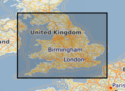
This dataset provides digital spatial information on the location of mineral resources in England at a scale of 1:50 000. The term ‘mineral resources’ has a definition under international standards that includes both an economic and geological dimension. These data are based primarily on mapped geology with limited assessment of economics. Therefore, the term ‘mineral resources’ is used here in a broad sense. The dataset allows users to visualise the extent and distribution of mineral resources and to relate them to other forms of land-use (such as urban areas or designated environmentally sensitive areas) or to other factors (such as transport infrastructure and conservation information). The dataset is derived from a set of commissioned projects to prepare a series of mineral resource maps based on counties or amalgamations of counties. Maps for England were commissioned by the central government department with responsibility for mineral planning at the time (Department of the Environment (DoE), Department of the Environment, Transport and the Regions (DETR), Department for Transport, Local Government and the Regions (DTLR), Office of the Deputy Prime Minister (ODPM), and the Department for Communities and Local Government (DCLG) between 1994 and 2006. Each map produced (with an accompanying report describing the mineral resources depicted on the map) is available to download, as a PDF file from the BGS-hosted website: www.MineralsUK.com. During 2011-2012 revisions were made to areas of the resource linework. These changes were made as a result of new research and release of a new version of DiGMap (v5). This work was on an ad hoc basis but affects all resource layers. In 2020 minor revisions to geometry and attributes were made in in response to minor corrections that were required. The paper maps were not re-released with these data updates. The BGS Mineral Resource data does not determine mineral reserves and therefore does not denote potential areas of extraction. Only onshore, mainland mineral resources are included in the dataset. This dataset has been produced by the collation and interpretation of mineral resource data principally held by the British Geological Survey. The mineral resource data presented are based on the best available information, but are not comprehensive and their quality is variable. The dataset should only be used to show a broad distribution of those mineral resources which may be of current or potential economic interest.