 BGS Metadata Catalogue
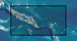
Solomon Islands regional geochemistry
Two geochemical surveys were undertaken in the Solomon Islands between 1976 and 1983 as part of a combined geological mapping and mineral exploration project. The survey of Choiseul and the Shortland Islands was carried out between 1976 and 1979 by the Institute of Geological Sciences (now the British Geological Survey) with support from staff of the Geology Division of the Ministry of Land, Energy and Natural Resources, Solomon Islands. The project produced 12 geological maps at 1:50,000 scale as well as a series of unpublished reports. The survey of the New Georgia Group of islands was undertaken between 1979 and 1983. The project produced 7 geological maps at a scale of 1:100,000 and a regional map of the entire island group at a scale of 1:250,000. A series of multielement geochemical anomaly maps were produced at a scale of 1:100,000 to accompany each of the published geological maps. Master copies of these are held at the Geological Survey in Honiara. Full descriptions of the methods used are described in the margins of the anomaly maps. A total of 8848 stream sediment samples were collected from Choiseul and 7441 from the New Georgia Group, resulting in an average sampling density for the two areas of 2.68 samples per km2 and 1.47 samples per km2 respectively. Sampling in the Shortland Islands was confined to the larger islands, 187 were collected from the Fauro Island group, 148 from Alu and 69 from Mono. The samples were dry sieved and the fraction passing -80 mesh B.S. (177 microns) was analysed. A hot concentrated nitric acid digestion was used prior to analysis by atomic absorbtion spectrophotometry (AAS) for Co, Cu, Pb, Zn, Ni, Ag, and Mn. Samples from the vicinity of the Siruka Ultramafic Complex were determined for Cr by AAS after digestion by a bisulphate fusion technique. Raw data can be obtained from the Geology Division, Ministry of Mines and Energy, PO Box G37, Honiara, Solomon Islands.
Simple
- Date (Creation)
- 1976
- Citation identifier
- http://data.bgs.ac.uk/id/dataHolding/13480404
- Point of contact
-
Organisation name Individual name Electronic mail address Role British Geological Survey
Enquiries
Distributor British Geological Survey
Enquiries
Originator British Geological Survey
Enquiries
Point of contact
- Maintenance and update frequency
- Not planned
-
GEMET - INSPIRE themes, version 1.0
-
BGS Thesaurus of Geosciences
-
-
Fluvial sediments
-
Geochemistry
-
Geochemical exploration
-
Geochemical maps
-
Geology
-
Exploration
-
- dataCentre
- Keywords
-
-
NERC_DDC
-
- Access constraints
- Other restrictions
- Other constraints
- Data licensed but use encouraged as The Department for International Development (DFID) data dissemination policy.
- Use constraints
- Other restrictions
- Other constraints
-
The copyright of materials derived from the British Geological Survey's work is vested in the Natural Environment Research Council [NERC]. No part of this work may be reproduced or transmitted in any form or by any means, or stored in a retrieval system of any nature, without the prior permission of the copyright holder, via the BGS Intellectual Property Rights Manager. Use by customers of information provided by the BGS, is at the customer's own risk. In view of the disparate sources of information at BGS's disposal, including such material donated to BGS, that BGS accepts in good faith as being accurate, the Natural Environment Research Council (NERC) gives no warranty, expressed or implied, as to the quality or accuracy of the information supplied, or to the information's suitability for any use. NERC/BGS accepts no liability whatever in respect of loss, damage, injury or other occurence however caused.
- Other constraints
-
Either: (i) the dataset is made freely available, e.g. via the Internet, for a restricted category of use (e.g. educational use only); or (ii) the dataset has not been formally approved by BGS for access and use by external clients under licence, but its use may be permitted under alternative formal arrangements; or (iii) the dataset contains 3rd party data or information obtained by BGS under terms and conditions that must be consulted in order to determine the permitted usage of the dataset. Refer to the BGS staff member responsible for the creation of the dataset if further advice is required. He / she should be familiar with the composition of the dataset, particularly with regard to 3rd party IPR contained in it, and any resultant use restrictions. This staff member should revert to the IPR Section ( ipr@bgs.ac.uk) for advice, should the position not be clear.
- Spatial representation type
- Grid
- Denominator
- 50000
- Denominator
- 100000
- Denominator
- 250000
- Language
- English
- Topic category
-
- Geoscientific information
- Geographic identifier
-
SOLOMON ISLAND GROUP [id=930500]
British Geological Survey Gazetteer: Geographical hierarchy from Geosaurus 1979 creation
))
- Begin date
- 1976
- End date
- 1983
- Supplemental Information
-
BGS (1999). Solomon Islands Regional Geochemical Survey CD-ROM: Choisuel and New Georgia. Version 1.0. BGS International Regional Geochemistry CD-ROM Series, No. 6 Solomon Islands and Vanuatu . British Geological Survey, Keyworth, Nottingham, UK Dunkley, P. N. 1986. Geology of the New Georgia group, Solomon Islands. British Geological Survey Overseas Geology Series WC/MP/86/6, 83pp. unpub. Contributors: D.A.Abraham, S.J. Booth, G.W. Hughes, R.L. Langford, P.R. Philip, J. Ridgway, A. Smith and P.J. Strange. - Held in box with 8 folded maps. Ridgway J and Coulson F.I.E. 1987. The geology of Choiseul and the Shortland Islands, Solomon Islands (Overseas Memoir British Geological Survey ; No.8) pub. London : HMSO, 134pp PUBLICATION: REPORT NO. 19. CHOISEUL AND THE SHORTLAND ISLANDS: SUMMARY OF THE GEOLOGY AND GEOCHEMICAL EXPLORATION RESULTS. (UNPUBLISHED REPORT AVAILABLE BGS LIBRARY).
- Unique resource identifier
- WGS 84 / UTM zone 57N (EPSG::32657)
- Distribution format
-
Name Version Data in various formats, MS Excel, MS Word and image files available on a CD-ROM
witheld
- Distributor contact
-
Organisation name Individual name Electronic mail address Role British Geological Survey
Enquiries
Distributor
- OnLine resource
-
Protocol Linkage Name WWW:LINK-1.0-http--link
https://www.bgs.ac.uk/geology-projects/applied-geochemistry/international-geochemistry-cd-rom/solomon-islands-regional-geochemical-survey/ Solomon Islands regional geochemical exploration survey CD-ROM version 2.0: September 2007
- Hierarchy level
- Dataset
- Other
-
dataset
Conformance result
- Title
-
INSPIRE Implementing rules laying down technical arrangements for the interoperability and harmonisation of Geology
- Date (Publication)
- 2011
- Explanation
-
See the referenced specification
- Pass
- No
Conformance result
- Title
-
Commission Regulation (EU) No 1089/2010 of 23 November 2010 implementing Directive 2007/2/EC of the European Parliament and of the Council as regards interoperability of spatial data sets and services
- Date (Publication)
- 2010-12-08
- Explanation
-
See http://eur-lex.europa.eu/LexUriServ/LexUriServ.do?uri=OJ:L:2010:323:0011:0102:EN:PDF
- Pass
- No
- Statement
-
First phase of the project commenced in 1976. New Georgia Group completed in 1983. Choiseul and the New Georgia Group had an average sampling density of 2.68 samples per km2 and 1.47 samples per km2 respectively. All data formatted and QAd to consistent standard. Data used to produce maps and reports at completion of projects in 1983. Data revived by R C Jones, C C Johnson, P Dunkley and J Ridgway for International CD-ROM series in 1999.
Metadata
- File identifier
- 9df8df52-d7cd-37a8-e044-0003ba9b0d98 XML
- Metadata language
- English
- Hierarchy level
- Dataset
- Date stamp
- 2026-07-10
- Metadata standard name
- UK GEMINI
- Metadata standard version
-
2.3
- Metadata author
-
Organisation name Individual name Electronic mail address Role British Geological Survey
Point of contact
- Dataset URI
)))
