 BGS Data Catalogue
Landslides
Type of resources
Available actions
Topics
Keywords
Contact for the resource
Provided by
Years
Formats
Representation types
Update frequencies
Service types
Scale
-
The Debris Flow Susceptibility Model for Great Britain version 6.0 (DFSM_GB_v6.0) provides information on the likelihood of debris flows occurring at a given location based on a combination of digital geological, hydrogeological and topographic data. It is a raster dataset at 50m resolution, showing susceptibility for debris flows on a scale A (lowest likelihood) to E (highest likelihood). The methodology develops an additional dimension to the BGS GeoSure Landslides surface layer (Dashwood et al., 2014) and is designed for users interested specifically in debris flow susceptibility. The identification of debris flow hazards can assist regional planners; rapidly identifying areas with potential problems and aid local government offices in making development plans by helping to define land suited to different uses. Other users of these data may include developers, homeowners, asset owners, solicitors, loss adjusters, the insurance industry, architects and surveyors. The DFSM (Debris Flow Susceptibility Model) GB v6.0 was completed in March 2017.
-

Imagery taken with a DJI Phantom 4 Pro drone using the as supplied RGB camera for part of the slopes above the A83 Rest and Be Thankful, Scotland in 2016. Images cover part of the slopes affected by Storms Desmond and Frank.
-
Polygon inventory of 481 landslides mapped along the Arniko Highway, Nepal (NERC Grant NE/L002582/1)
Polygon shapefile including 481 coseismic and climate triggered landslides mapped along the Arniko Highway, Nepal, using a combination of field mapping and remote sensing. All mapped landslides were those visible in the landscape during the period 2017 – 2018. Landslides were mapped using a combination of field and remote sensing methodologies (see lineage). The inventory includes the landslide locations, perimeters (Length field), areas, types (for field mapped landslides), and whether a given landslide was mapped in the field or remotely (source field). These landslides were mapped for a range of purposes, from conducting landslide susceptibility assessments, to investigating landslide processes and preconditioning.
-
This is a polygon shapefile inventory of 183 coseismic and climate-triggered landslides in the south-western portion of Langtang Valley Nepal. All mapped landslides were those visible in the landscape during the period 2017 – 2018. Landslides were mapped using a combination of field and remote sensing methodologies (see lineage). The inventory includes the landslide locations, perimeters (Length field), areas, types, and whether a given landslide was mapped in the field or remotely. These landslides were mapped for a range of purposes, from conducting landslide susceptibility assessments, to investigating landslide processes and preconditioning.
-

This is a polygon .shp file of 12,838 Asia Summer Monsoon (ASM) - triggered landslides that occurred across a ~45,000 km2 region of central-eastern Nepal in the period 1988 - 2018. This inventory includes the landslide locations, perimeters (Length field), areas and pre-/post- monsoon season satellite image dates used to map each landslide. Note, landslides were not mapped in the years 2011 and 2012 due to scan line errors in Landsat 7 imagery. These landslides were mapped for a range of purposes, from conducting landslide susceptibility assessments, to investigating landslide processes and preconditioning.
-

This is a polygon .shp file of 12,920 Asia Summer Monsoon (ASM) - triggered landslides that occurred across central-eastern Nepal in the period 1988 - 2018. This inventory includes the landslide locations, perimeters (Length field), areas and pre-/post- monsoon season satellite image dates used to map each landslide.Note, landslides were not mapped in the years 2011 and 2012 due to scan line errors in Landsat 7 imagery. These landslides were mapped for a range of purposes, from conducting landslide susceptibility assessments, to investigating landslide processes and preconditioning.
-
Text file containing the areas (of combined scar, deposition and runnout zones, and estimated scar zones alone) and volumes (for both total and scar areas) of 12,920 Asia Summer Monsoon (ASM) that occurred across central-eastern Nepal in the period 1988 - 2018. Note, landslides were not mapped in the years 2011 and 2012 due to scan line errors in Landsat 7 imagery.
-
Terrestrial laser scanning data of the slopes above the A83 Rest and Be Thankful collected by a Riegl LMS Z620i instrument in 2016 after Storms Desmond and Frank from 3 positions. These data are scanner centric coordinates which the end-user needs to align and (if required) align into a global coordinate system. Data are in raw format, supplied as .las with scaled intensity included.
-

This is a point (.txt) file of 12,838 Asia Summer Monsoon (ASM) - triggered landslides that occurred across central-eastern Nepal in the period 1988 - 2018. This inventory includes the landslide locations (x, y coordinates of landslide crests) and geometries, as well as the following landslide attributes, where each attribute was extracted at the position of the landslide crest: elevation (m), slope (o), aspect (o), planform and profile curvature, excess topography (m3), local relief (m), distance to channel (m), distance to road (m), near channel ksn, near channel specific stream power (SSP), average 30-year precipitation, total annual rainfall, peak monthly rainfall, landuse, Permafrost index, geology, and tectonic unit. Note, landslides were not mapped in the years 2011 and 2012 due to scan line errors in the Landsat 7 imagery. These landslides and associated attributes were collected for the purpose of assessing how landslide spatial distributions and susceptibility vary through time.
-
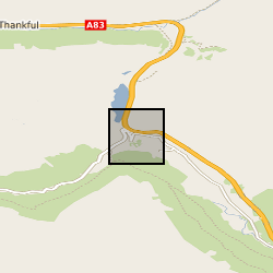
Fixed time lapse camera imagery with 15 minute interval during daytimes captured from Ben Donich (BNG: NN 2297 0637) looking towards the A83 Rest and Be Thankful / slope of Beinn Luibhean. Data were subsequently processed in https://doi.org/10.3390/rs13050893 for deformation tracking. There are data gaps during poor weather/outages, and, some camera shift requiring alignment.