 BGS Data Catalogue
GIS
Type of resources
Available actions
Topics
Keywords
Contact for the resource
Provided by
Years
Formats
Representation types
Update frequencies
Service types
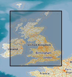
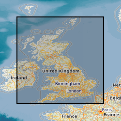
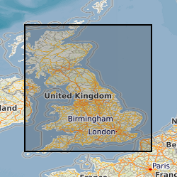
Scale
-
Data identifying landscape areas (shown as polygons) attributed with geological names. The scale of the data is 1:10 000 scale. Onshore coverage is partial with approximately 30% of England, Scotland and Wales available in this version 2 data release. BGS intend to continue developing coverage at this scale; current focus is to include all large priority urban areas, along with road and rail transport corridors. Data are supplied as five themes: bedrock, superficial deposits, mass movement, artificial ground and linear features. Bedrock geology describes the main mass of solid rocks forming the earth's crust. Bedrock is present everywhere, whether exposed at surface in outcrops or concealed beneath superficial deposits or water bodies. Geological names are based on the lithostratigraphic or lithodemic hierarchy. The lithostratigraphic scheme arranges rock bodies into units based on rock-type and geological time of formation. Where rock-types do not fit into the lithostratigraphic scheme, for example intrusive, deformed rocks subjected to heat and pressure resulting in new or changed rock types; then their classification is based on their rock type or lithological composition. This assesses visible features such as texture, structure, mineralogy. Superficial deposits are younger geological deposits formed during the most recent geological time; the Quaternary. These deposits rest on older rocks or deposits referred to as bedrock. The superficial deposits theme defines landscape areas (shown as polygons) attributed with a geological name and their deposit type or lithological composition. Mass movement describes areas where deposits have moved down slope under gravity to form landslips. These landslips can affect bedrock, superficial or artificial ground. Mass movement deposits are described in the BGS Rock Classification Scheme Volume 4. However the data also includes foundered strata, where ground has collapsed due to subsidence (this is not described in the Rock Classification Scheme). Caution should be exercised with this data; whilst mass movement events are recorded in this layer, due to the dynamic nature of occurrence significant changes may have occurred since the data was released, as such it should be viewed as a snapshot in time (data should be regarded as at 2008). Artificial (man-made) theme (shown as polygons) indicates areas where the ground surface has been significantly modified by human activity. Whilst artificial ground may not be considered as part of the 'real geology' of bedrock and superficial deposits it does affect them. Artificial ground impacts on the near surface ground conditions which are important to human activities and economic development. Due to the constantly changing nature of land use and re-use/redevelopment, caution must be exercised when using this data as it represents a snapshot in time rather than an evolving picture hence the data may become dated very rapidly. Linear features (shown as polylines) represent geological structural features e.g. faults, folds or landforms e.g. buried channels, glacial drainage channels at the ground or bedrock surface (beneath superficial deposits). Linear features are associated most closely with the bedrock theme either as an intrinsic part of it for example marine bands or affecting it in the case of faults. However landform elements are associated with both bedrock and superficial deposits. All five data themes are available in vector format (containing the geometry of each feature linked to a database record describing their attributes) as ESRI shapefiles and are available under BGS data licence.
-

Data identifying landscape areas (shown as polygons) attributed with geological names. The scale of the data is 1:25 000 scale. Onshore coverage is partial and BGS has no intention to create a national coverage at this scale. Areas covered are essentially special areas of 'classic' geology and include Llandovery (central Wales), Coniston (Lake District) and Cuillan Hills (Isle of Skye). Data are supplied as five themes: bedrock, superficial deposits, mass movement, artificial ground and linear features. Bedrock geology describes the main mass of solid rocks forming the earth's crust. Bedrock is present everywhere, whether exposed at surface in outcrops or concealed beneath superficial deposits or water bodies. The bedrock theme defines landscape areas (shown as polygons) attributed with geological names. Geological names are based on the lithostratigraphic or lithodemic hierarchy. The lithostratigraphic scheme arranges rock bodies into units based on rock-type and geological time of formation. Where rock-types do not fit into the lithostratigraphic scheme, for example intrusive, deformed rocks subjected to heat and pressure resulting in new or changed rock types; then their classification is based on their rock-type or lithological composition. This assesses visible features such as texture, structure, mineralogy. Superficial deposits are younger geological deposits formed during the most recent geological time; the Quaternary. These deposits rest on older rocks or deposits referred to as bedrock. The superficial deposits theme defines landscape areas (shown as polygons) attributed with a geological name and their deposit-type or lithological composition. Mass movement describes areas where deposits have moved down slope under gravity to form landslips. These landslips can affect bedrock, superficial or artificial ground. Mass movement deposits are described in the BGS Rock Classification Scheme Volume 4. However the data also includes foundered strata, where ground has collapsed due to subsidence (this is not described in the Rock Classification Scheme). Caution should be exercised with this data; whilst mass movement events are recorded in this layer, due to the dynamic nature of occurrence significant changes may have occurred since the data was released, as such it should be viewed as a snapshot in time (data should be regarded as at 2008). Artificial (man-made) theme (shown as polygons) indicates areas where the ground surface has been significantly modified by human activity. Whilst artificial ground may not be considered as part of the 'real geology' of bedrock and superficial deposits it does affect them. Artificial ground impacts on the near surface ground conditions which are important to human activities and economic development. Due to the constantly changing nature of land use and re-use/redevelopment, caution must be exercised when using this data as it represents a snapshot in time rather than an evolving picture hence the data may become dated very rapidly. Linear features (shown as polylines) represent geological structural features e.g. faults, folds or landforms e.g. buried channels, glacial drainage channels at the ground or bedrock surface (beneath superficial deposits). Linear features are associated most closely with the bedrock theme either as an intrinsic part of it for example marine bands or affecting it in the case of faults. However landform elements are associated with both bedrock and superficial deposits. All five data themes are available in vector format (containing the geometry of each feature linked to a database record describing their attributes) as ESRI shapefiles and are available under BGS data licence. Another batch of tiles was added to the data in 2012 to bring the total to 167 for this version 2 release.
-
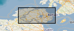
The data shows superficial polygons, bedrock polygons and fault linear geological information, sourced from published Geological Survey of Northern Ireland 1:250 000 scale maps - superficial (Quaternary 1991) and bedrock (Solid 1997). Full Northern Ireland coverage is available (Bedrock extends west into RI). The data is available in vector format. BGS licensing terms and conditions apply to external use of the data. New version available: 1:250K Geological Maps of Northern Ireland version 2
-

Data identifying landscape areas (shown as polygons) attributed with geological names and rock type descriptions. The scale of the data is 1:50 000 scale providing bedrock geology. Onshore coverage is provided for all of England, Wales, Scotland and the Isle of Man. Bedrock geology describes the main mass of solid rocks forming the earth's crust. Bedrock is present everywhere, whether exposed at surface in outcrops or concealed beneath superficial deposits or water bodies. The bedrock geology of Great Britain is very diverse and includes three broad classes based on their mode of origin: igneous, metamorphic and sedimentary. The data includes attribution to identify each rock type (in varying levels of detail) as described in the BGS Rock Classification Scheme (volumes 1-3 ). The bedrock has formed over long periods of geological time, from the Archean eon some 7500 million years ago, to the relatively young Pliocene, 58 million years ago. The age of the rocks is identified in the data through their BGS lexicon name (published for each deposit at the time of the original survey or subsequent digital data creation). For stratified rocks i.e. arranged in sequence, this will usually be of a lithostratigraphic type. Other rock types for example intrusive igneous bodies will be of a lithodemic type. More information on the formal naming of UK rocks is available in the BGS Lexicon of Named Rock Units. Geological names are based on the lithostratigraphic or lithodemic hierarchy. The lithostratigraphic scheme arranges rock bodies into units based on rock-type and geological time of formation. Where rock-types do not fit into the lithostratigraphic scheme, for example intrusive, deformed rocks subjected to heat and pressure resulting in new or changed rock types; then their classification is based on their rock-type or lithological composition, using visible features such as texture, structure, mineralogy. The data are available in vector format (containing the geometry of each feature linked to a database record describing their attributes) as ESRI shapefiles and are available under BGS data licence.
-

Data identifying linear features (shown as polylines) representing geological faults at the ground or bedrock surface (beneath superficial deposits). The scale of the data is 1:250 000 scale providing a generalised set of linear features. Onshore coverage is provided for all of England, Wales, Scotland, and the Isle of Man. Geological faults occur where a body of bedrock has been fractured and displaced by large scale processes affecting the earth's crust (tectonic forces). The digital data are attributed by fault type; two categories of fault are described in the data: contact and non-contact faults. Contact faults form a boundary between two different rock types whilst non-contact faults indicate a fault displacement within the same rock. The data has been generalised and shows only the location of major faults. All faults shown are inferred i.e. not exposed or seen at a locality, but derived from other evidence including linear depressions in the landscape, the truncation or displacement of topographical features. The data are available in vector format (containing the geometry of each feature linked to a database record describing their attributes) as ESRI shapefiles and are available under BGS data licence.
-

Data identifying landscape areas (shown as polygons) attributed with geological names and rock type descriptions. The scale of the data is 1:50 000 scale. Onshore coverage is provided for all of England, Wales, Scotland and the Isle of Man. Superficial deposits are the youngest geological deposits formed during the most recent period of geological time, the Quaternary, which extends back about 2.58 million years from the present. They lie on top of older deposits or rocks referred to as bedrock. Superficial deposits were laid down by various natural processes such as action by ice, water, wind and weathering. As such, the deposits are denoted by their BGS Lexicon name, which classifies them on the basis of mode of origin (lithogenesis) with names such as, 'glacial deposits', 'river terrace deposits' or 'blown sand'; or on the basis of their composition such as 'peat'. Most of these superficial deposits are unconsolidated sediments such as gravel, sand, silt and clay. The digital data includes attribution to identify each deposit type (in varying levels of detail) as described in the BGS Rock Classification Scheme (volume 4). The data are available in vector format (containing the geometry of each feature linked to a database record describing their attributes) as ESRI shapefiles and are available under BGS data licence.
-

Data identifying landscape areas (shown as polygons) attributed with geological names and rock type descriptions. The scale of the data is 1:25 000 scale. Onshore coverage is partial and BGS has no intention to create a national coverage at this scale. Areas covered are essentially special areas of 'classic' geology and include Llandovery (central Wales), Coniston (Lake District) and Cuillan Hills (Isle of Skye). Superficial deposits are the youngest geological deposits formed during the most recent period of geological time, the Quaternary, which extends back about 2.58 million years from the present. They lie on top of older deposits or rocks referred to as bedrock. Superficial deposits were laid down by various natural processes such as action by ice, water, wind and weathering. As such, the deposits are denoted by their BGS lexicon name, which classifies them on the basis of mode of origin (lithogenesis) with names such as, 'glacial deposits', 'river terrace deposits' or 'blown sand'; or on the basis of their composition such as 'peat'. Most of these superficial deposits are unconsolidated sediments such as gravel, sand, silt and clay. The digital data includes attribution to identify each deposit type (in varying levels of detail) as described in the BGS Rock Classification Scheme (volume 4). The data are available in vector format (containing the geometry of each feature linked to a database record describing their attributes) as ESRI shapefiles and are available under BGS data licence.
-

Data identifying landscape areas (shown as polygons) attributed with geological names and rock type descriptions. The scale of the data is 1:10 000 scale. Onshore coverage is partial with approximately 30% of England, Scotland and Wales available in the version 2 data release. BGS intend to continue developing coverage at this scale; current focus is to include all large priority urban areas, along with road and rail transport corridors. Superficial deposits are the youngest geological deposits formed during the most recent period of geological time, the Quaternary, which extends back about 2.58 million years from the present. They lie on top of older deposits or rocks referred to as bedrock. Superficial deposits were laid down by various natural processes such as action by ice, water, wind and weathering. As such, the deposits are denoted by their BGS lexicon name, which classifies them on the basis of mode of origin (lithogenesis) with names such as, 'glacial deposits', 'river terrace deposits' or 'blown sand'; or on the basis of their composition such as 'peat'. Most of these superficial deposits are unconsolidated sediments such as gravel, sand, silt and clay. The digital data includes attribution to identify each deposit type (in varying levels of detail) as described in the BGS Rock Classification Scheme (volume 4). The data are available in vector format (containing the geometry of each feature linked to a database record describing their attributes) as ESRI shapefiles and are available under BGS data licence.
-
Data identifying landscape areas (shown as polygons) attributed with geological names and rock type descriptions. The scale of the data is 1:50 000 scale providing bedrock geology. Onshore coverage is provided for all of England, Wales, Scotland and the Isle of Man. Bedrock geology describes the main mass of solid rocks forming the earth's crust. Bedrock is present everywhere, whether exposed at surface in outcrops or concealed beneath superficial deposits or water bodies. The bedrock geology of Great Britain is very diverse and includes three broad classes based on their mode of origin: igneous, metamorphic and sedimentary. The data includes attribution to identify each rock type (in varying levels of detail) as described in the BGS Rock Classification Scheme (volumes 1-3 ). The bedrock has formed over long periods of geological time, from the Archean eon some 7500 million years ago, to the relatively young Pliocene, 58 million years ago. The age of the rocks is identified in the data through their BGS lexicon name (published for each deposit at the time of the original survey or subsequent digital data creation). For stratified rocks i.e. arranged in sequence, this will usually be of a lithostratigraphic type. Other rock types for example intrusive igneous bodies will be of a lithodemic type. More information on the formal naming of UK rocks is available in the BGS Lexicon of Named Rock Units. Geological names are based on the lithostratigraphic or lithodemic hierarchy. The lithostratigraphic scheme arranges rock bodies into units based on rock-type and geological time of formation. Where rock-types do not fit into the lithostratigraphic scheme, for example intrusive, deformed rocks subjected to heat and pressure resulting in new or changed rock types; then their classification is based on their rock-type or lithological composition, using visible features such as texture, structure, mineralogy. The data are available in vector format (containing the geometry of each feature linked to a database record describing their attributes) as ESRI shapefiles and are available under BGS data licence.
-
Data identifies landscape areas (shown as polygons) attributed with type of artificial or man-made ground. It indicates areas where the ground surface has been significantly modified by human activity. Types of artificial ground include: Disturbed ground areas of ill-defined shallow or near surface mineral workings where distinction cannot be made between made and worked ground. Infilled ground areas where original geology has been removed and then wholly or partially back filled includes waste or landfill sites. Landscaped ground areas where surface has been reshaped includes former sand and gravel workings for recreation and amenity use. Made ground man made features including embankments and spoil heaps. Worked ground areas where ground has been removed including quarries and road cuttings. Disturbed ground areas of ill-defined shallow or near surface mineral workings where distinction cannot be made between made and worked ground. Whilst artificial ground may not be considered as part of the 'real geology' of bedrock and superficial deposits it does affect them. Artificial ground impacts on the near surface ground conditions which are important to human activities and economic development. Due to the constantly changing nature of land use and re-use/redevelopment, caution must be exercised when using this data as it represents a snapshot in time rather than an evolving picture hence the data may become dated very rapidly. The data are available in vector format (containing the geometry of each feature linked to a database record describing their attributes) as ESRI shapefiles and are available under BGS data licence.