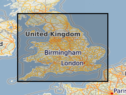
The BGS Property Subsidence Assessment (PSA) dataset provides insurers and homeowners access to a better understanding of the shrink-swell hazard at both the individual property and/or postcode level for England and Wales.

It builds upon the GeoSure shrink-swell data by mapping the hazard to the individual building polygon and considering the other susceptibility factors of building type, foundation depth, and drainage and tree proximity. The user receives GIS building polygons with an overall susceptibility to subsidence score between 1-100. Scores are also classified from non-plastic to very high. Each building polygon is also scored from 1-10 for each subsidence factor (geology, foundation, drainage, building type, building storey and tree proximity). Postcode data is also available as a table showing the ‘average’ PSA score for all buildings within the postcode. The identification of shrink-swell related subsidence prone areas, alongside the inclusion of potential sources to exacerbate this phenomena, can better inform insurers and homeowners and form the basis to make decisions concerning prevention and remediation. The product enhances geological information obtained from GIP and GeoSure via the inclusion of the crucial shrink-swell susceptibility factors (proximity to trees and foundation depth). This therefore allows the derivation of a risk element for the housing stock at Building level, which is then generalised to Postcode level.

Data

Summary

creation
2022
Maintenance Frequency
notPlanned

Informations

creation
2022
Unique resource identifier
http://data.bgs.ac.uk/id/dataHolding/13607951
Individual name
Enquiries
Organisation name
British Geological Survey
Voice
0115 936 3143
Facsimile
0115 936 3276
Delivery point
Environmental Science Centre, Nicker Hill, Keyworth
City
NOTTINGHAM
Administrative area
NOTTINGHAMSHIRE
Postal code
NG12 5GG
Country
United Kingdom
Electronic mail address
enquiries@bgs.ac.uk
Role code
distributor
Individual name
Enquiries
Organisation name
British Geological Survey
Voice
0115 936 3143
Facsimile
0115 936 3276
Delivery point
Environmental Science Centre, Nicker Hill, Keyworth
City
NOTTINGHAM
Administrative area
NOTTINGHAMSHIRE
Postal code
NG12 5GG
Country
United Kingdom
Electronic mail address
enquiries@bgs.ac.uk
Role code
pointOfContact
Individual name
Enquiries
Organisation name
British Geological Survey
Country
United Kingdom
Electronic mail address
not available
Role code
distributor
Individual name
Enquiries
Organisation name
British Geological Survey
Country
United Kingdom
Electronic mail address
not available
Role code
pointOfContact
Maintenance Frequency
notPlanned
Title
GEMET - INSPIRE themes, version 1.0
publication
2008-06-01
Keyword
Subsidence
Keyword
Foundations
Keyword
Property damage
Title
BGS Thesaurus of Geosciences
revision
2022
Keyword Type Code
dataCentre
Keyword
NERC_DDC
Access Restriction
otherRestrictions
Access Restriction
otherRestrictions
Other constraints
The copyright of materials derived from the British Geological Survey's work is vested in the Natural Environment Research Council [NERC]. No part of this work may be reproduced or transmitted in any form or by any means, or stored in a retrieval system of any nature, without the prior permission of the copyright holder, via the BGS Intellectual Property Rights Manager. Use by customers of information provided by the BGS, is at the customer's own risk. In view of the disparate sources of information at BGS's disposal, including such material donated to BGS, that BGS accepts in good faith as being accurate, the Natural Environment Research Council (NERC) gives no warranty, expressed or implied, as to the quality or accuracy of the information supplied, or to the information's suitability for any use. NERC/BGS accepts no liability whatever in respect of loss, damage, injury or other occurence however caused.
Other constraints
The dataset is made available to external clients under BGS Digital Data Licence terms and conditions. Revert to the IPR Section (iprdigital@bgs.ac.uk) if further advice is required with regard to permitted usage.
Spatial Representation Type
vector
ISO Language code
eng
Title
ISO 3166_2
revision
2009
Unique resource identifier
EAW
Title
British Geological Survey Gazetteer: Geographical hierarchy from Geosaurus
creation
1979
Unique resource identifier
ENGLAND & WALES [id=149000]

Download

Name
ESRI Shapefile
Version
1994
Name
Text file (TXT)
Version
witheld
Individual name
Enquiries
Organisation name
British Geological Survey
Voice
0115 936 3143
Facsimile
0115 936 3276
Delivery point
Environmental Science Centre, Nicker Hill, Keyworth
City
NOTTINGHAM
Administrative area
NOTTINGHAMSHIRE
Postal code
NG12 5GG
Country
United Kingdom
Electronic mail address
enquiries@bgs.ac.uk
Role code
distributor
Individual name
Enquiries
Organisation name
British Geological Survey
Country
United Kingdom
Electronic mail address
not available
Role code
distributor
Protocol
WWW:LINK-1.0-http--link
Name
BGS Datasets - Property subsidence assessment
Description
Resource page for dataset with contact and licensing details.
OnLine function code
offlineAccess
Protocol
WWW:LINK-1.0-http--related
Name
Citation Information - Digital Object Identifier (DOI)
Description
British Geological Survey. (2022). Property Subsidence Assessment dataset 2022. British Geological Survey. (Dataset). https://doi.org/10.5285/4265b377-0220-44a8-9496-eb2d2c0eb561
OnLine function code
information

More info

File identifier
e4ca40d4-a6bb-399b-e053-0937940aef71
ISO Language code
eng
Scope code
dataset
Organisation name
British Geological Survey
Voice
+44 115 936 3100
Delivery point
Environmental Science Centre,Keyworth
City
NOTTINGHAM
Administrative area
NOTTINGHAMSHIRE
Postal code
NG12 5GG
Country
United Kingdom
Electronic mail address
enquiries@bgs.ac.uk
Role code
pointOfContact
Metadata standard version
2.3
Dataset URI
http://data.bgs.ac.uk/id/dataHolding/13607951
Scope code
dataset
Other
dataset
Title
INSPIRE Implementing rules laying down technical arrangements for the interoperability and harmonisation of Geology
publication
2011
Explanation
See the referenced specification
Title
Commission Regulation (EU) No 1089/2010 of 23 November 2010 implementing Directive 2007/2/EC of the European Parliament and of the Council as regards interoperability of spatial data sets and services
publication
2010-12-08
Explanation
See http://eur-lex.europa.eu/LexUriServ/LexUriServ.do?uri=OJ:L:2010:323:0011:0102:EN:PDF
Statement
Input data: OS OpenMap Local building polygons GeoSure shrink-swell National Tree Map (Bluesky) Office for National Statistics (UK property build period) Office for National Statistics (UK property type) OS Code Point open Process: GeoSure and the other input datasets are mapped to the OS Open building polygons. Each building is then scored for each input factor. Input factors are then combined via a weighted algorithm to derive the PSA score for each building, this score is then classified into the PSA classes. Building polygon scores are aggregated to produce the postcode score. Processing was carried out using python scripts in ARCGIS.