 BGS Data Catalogue
Stratigraphy
Type of resources
Topics
Keywords
Contact for the resource
Provided by
Years
Formats
Representation types
Update frequencies
Scale
-
A digital geochronological index to act as a domain constraint for geochronology columns in corporate data tables. It decodes geochronology codes, models pseudo parent-child relationships between intervals (for example, find the epochs within a given period), allows range searches (for example, find the epochs between lower limiting and upper limiting epochs) and provides radiometric ages with ranges of uncertainty. Follows the recommendations of the BGS Stratigraphy Committee. Phanerozoic after Gradstein and Ogg (1996), with the Ordovician scheme of Fortey et al. (1995); Proterozoic after Cowie and Bassett (1989); Archaean after an unpublished decision of the Precambrian Subcommission of the IUGS. Covers the whole of geological time. Geochronological resolution usually to age level. Lower resolution in the Archaean, Proterozoic, Cambrian. Greater resolution in the Caradoc Epoch.
-
The data comprises information on the subsurface structure of stratigraphic levels and units in the United Kingdom, detailing depth to and thickness of the units. These result from projects in different parts of the UK performed at different times. Common working scales are 1:50 000 and 1:250 000 with appropriate differences in detail. Much mapping results from interpretation of seismic data, and as a result many of the structural maps are in time rather than depth, although some have been depth converted.
-
The Nirex Digital Geoscience Database (NDGD) holds extensive sets of data describing geoscientific, geographical, hydrogeological and logistical aspects of the Sellafield area in western Cumbria region. Some datasets comprise unmodified field data (as collected, measured or observed in the field). Others include values assessed during laboratory analysis or testing. Derived or interpolated information, resulting from modelling activity or the integration of several datasets, also accounts for a significant portion of the NDGD holding. The data consists of mainly borehole derived information including Borehole location and survey information, Sample location information, Logistics, Geological, geophysical (including borehole geophysical logs) and geotechnical borehole Geology datasets and Hydrological, hydrogeological and hydrochemical borehole datasets (though information from the down-hole monitoring strings and most groundwater related information is not held in the NDGD). The NDGD holds all of the raw and processed digital data arising from the Nirex (Nuclear Industry Radioactive Waste Executive) Sellafield Geological investigations boreholes drilled during their investigation programme into the suitability of Sellafield as a site for the disposal of intermediate and long-lived low level radioactive waste between 1989 and 1997. The ownership of Nirex (Nuclear Industry Radioactive Waste Executive) was transferred from the nuclear industry to the UK Government departments DEFRA and DTI in April 2005, and then to the UK's Nuclear Decommissioning Authority (NDA) in November 2006.
-
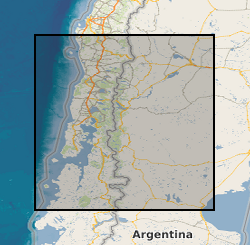
Stratigraphic and ecological data from tidal marsh sites in south-central Chile. Includes stratigraphy, diatom assemblages and radiocarbon dates from fossil cores and diatom assemblages from modern tidal marsh samples. Data were collected to provide evidence for multiple great earthquakes in south-central Chile, and enable the reconstruction of vertical land-level changes associated with these earthquakes. Data are from tidal marsh sites within the 1960 earthquake rupture area along the Chilean subduction zone (37.5 - 46 degrees South).
-
Fault and Horizon interpretations are provided for the Offshore Corinth Rift. The majority of the interpretations were based on 2D profiles from seismic reflection surveys collected by the R/V Maurice-Ewing in 2003, M.V. Vassilios in 1996 and 2003, and the R/V AEGEAO. Interpreted faults include major rift border faults as well as minor syn-rift faulting. Interpreted horizons include basement, a basin wide unconformity and five inferred transgressive surfaces based on variations in seismic character. Details of the fault and stratigraphic framework can be found in Nixon et al. (2016). Rapid spatiotemporal variations in rift structure during development of the Corinth Rift, central Greece. Tectonics, 35, 1225-1248.’ Published paper, Nixon, C. W., et al. (2016), Rapid spatiotemporal variations in rift structure during development of the Corinth Rift, central Greece, Tectonics, 35, 1225–1248, doi:10.1002/2015TC004026
-

This dataset (GSE_SPECIMENS) is an index of the specimens and palaeontological slides held in the Type and Stratigraphical (T&S) Collection of Scotland and Northern England. This index along with GSE_REFERENCES (List Of Specimens From The UK (North) Type And Stratigraphical Collection And Related Publications) and to some extent SMITH_GSE (Index To Specimens Transferred From The John Smith Collection To The UK (North) Type and Stratigraphical Collection) are the digital equivalents of the analogue card index (held in BGS Edinburgh). The latter contains c.16k records, of which perhaps 25% have been transcribed. The sporadically growing T&S Collection (which is derived from the Survey Collection) comprises some 16k specimens. About 11k are housed at BGS Keyworth and c.5k remain at BGS Edinburgh. The specimens are individually registered in 5 leather bound volumes. These are held in BGS Keyworth, but equivalent information (microfilm and paper records) is held in BGS Edinburgh. For each specimen, the MS Access database MTD_GSE_SPECS provides a link with the Survey Collection, gives nomenclatural, taxonomical, geographical and stratigraphical information, an indication on where the fossil is housed, and any comments, perhaps on the state of preservation.
-
PALSLIDES_ED is the BGS Edinburgh Palaeontological Slides Collection. It comprises two registration series. The MIC (microfossils) series, which is added to sporadically, includes c.950 individually registered slides (each with up to 100 cells) of microfossils (mainly foraminifera and ostracods). The PS (Palaeontological thin Sections) registration series, which has not been added to since 1987, comprises 4202 fossil thin sections and mounted slides, and includes various donated collections. Both the MIC register (10 volumes) and PS register (2 volumes) record the locality of each slide and any previous registration numbers. Stratigraphic information may also be given. Taxonomic information is not complete. There is, at present, no separate index (either analogue or digital) to the dataset, but it is included in FOSSLOC4. GSE_SPECIMENS and SMITH_GSE include those slides and thin sections transferred to the Type and Stratigraphical Collection from the Survey and John Smith collections.
-
Stored in Murchison House, this dataset (FAUNGRAPHLOG_ED) is the BGS UK (North) collection of paper graphic logs from boreholes and measured natural sections, particularly in the Carboniferous of Scotland and northern England. Some 18000 of these records include hand written macrofossil occurrences and assemblages from certain (often subsequently interpreted) stratigraphical levels in the borehole or section. There is at present no separate index (either analogue or digital) to FAUNGRAPHLOG_ED but a pathway to it is FOSSLOC, the index to the Survey Collection of fossils from UK (North).
-

Database of palaeontological specimens, world-wide coverage, including both "Museum" and "Survey" fossil collections from Keyworth and Edinburgh. Development commenced in Autumn 2000 and is ongoing. The database currently contains over 100,000 entries, including half of the taxonomic reference collection held at BGS Keyworth. Internet search access is available on the BGS web site. Key fields in the dataset, many of which can be searched for, include, sample number, nature of sample, confidentiality, collector/donator & year, register details, locality information (including grid reference, map sheet etc.), stratigraphy, type status, identifications & authority and publication details.
-

Our proposed research is based on cores collected during the recent, and very successful, Integrated Ocean Drilling Program (IODP) Expedition 340. The aims of this expedition were to investigate the volcanism and landslide history of the Lesser Antilles volcanic arc, by collecting a number of cores offshore Montserrat and Martinique. As a shipboard planktic foraminifera (single celled calcareous plankton) biostratigrapher (dating sediment cores using the appearances and disappearances of fossil plankton), Deborah Wall-Palmer (proposed PDRA) has access to these cores during the one year moratorium period. Until IODP Exp. 340, the longest continuous record (~250,000 years) of volcanic activity on Montserrat was a 5.75 m core collected to the south-west of the island in 2002, CAR-MON 2. This core revealed a more extensive and complete record of volcanic activity than that available in terrestrial cores. The longest continuous sediment record collected during Exp. 340 extends this record considerably. At 139.4 m in length, Hole U1396C records events back to 4.5 million years ago. The majority of this Hole will undergo stratigraphic analysis at low resolution, which will be carried out by other Exp. 340 scientists (Andrew Fraass, Mohammed Aljahdali). The upper 7 m section of this Hole is estimated to span 300,000 years and is comparable to the time period recovered in sediments for Holes U1394A/B (0 to 125 cm) and U1395B (0 to 30 cm). Holes U1394A/B and U1395B were collected close to Montserrat, in the main path of eruptive material from the Soufriere Hills volcano and contain a high resolution, but interrupted record of volcanic eruptions and landslides. Our proposed research is to provide a high resolution (every 2000 yrs) age framework across the upper ~300,000 year sections of these three cores. This will be achieved by collecting specimens of the planktic foraminifera Globigerinoides ruber and analysing the stable oxygen isotope ratios contained within their calcium carbonate tests (shells). Oxygen isotope ratios provide information about the global ice volume and global climate, and the standard record can be identified world-wide. Correlation to this record can therefore be used to provide an age framework for sediments, which is more detailed than using the biostratigraphic range of species alone. Producing this age framework is essential for achieving the overall aims of Exp. 340 as it will be used, in collaboration with several other Exp. 340 scientists, to reconstruct the volcanic and landslide history of Montserrat. In addition to this, to ensure the conservative use of samples, some further work will be carried out on samples requested from the upper 7 m of Hole U1396C. This will assist in constructing the low resolution stable isotope and biostratigraphic framework for the remainder of this Hole. The majority of this work is being carried out by Andrew Fraass (University of Massachusetts) and Mohammed Aljahdali (Florida State University). We will analyse the upper 7 m of Hole U1396C, at low resolution, for stable oxygen isotopes of the benthic foraminifera Cibicidoides spp. and for planktic foraminifera datum species.