 BGS Data Catalogue
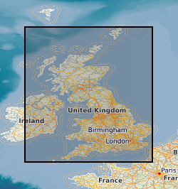
Observatories
Type of resources
Topics
Keywords
Contact for the resource
Provided by
Years
Formats
Representation types
Update frequencies
Scale
-
Magnetograms are records of variations in the strength and direction of the Earth’s magnetic field. Historically these magnetograms were recorded on paper using photographic techniques. In the UK, measurements were made at eight long-running observatories; Abinger, Eskdalemuir, Falmouth, Greenwich, Hartland, Kew, Lerwick, and Stonyhurst. BGS also hold magnetogram records from the Cape Evans observatory that ran continuously at Robert Falcon Scott’s Antarctic base camp during the British Antarctic Expedition 1910–13. The magnetogram collection, one of the longest running geomagnetic series in the world, provides a continuous record of more than 160 years of UK measurements. These magnetograms start in the 1840s and end in 1986 at which time digital recording of the magnetic field took over and magnetograms can be produced by computer graphic. The plots show variation in the Earth's magnetic field, typically over a 24-hour period. The collection is a valuable, partly untapped data resource for studying geomagnetic storms, space weather and the evolution of the Earth’s magnetic field. The magnetograms provide insight into: • the Earth’s outer core: long-term change (years to centuries) in the dynamo that sustains our magnetic field • space weather: short-term changes (seconds to days) in near-Earth space and on the ground • space climate: long-term change (decades to centuries) in solar activity and consequences for Earth’s environment All the above have an impact on human activities. For example, bad space weather affects technologies that we increasingly rely on, such as electrical power and GPS networks. In response to the threat of loss from degradation due to age and a desire to preserve and exploit old data, BGS undertook a programme of work to digitally photograph, archive and preserve the analogue paper records of magnetic field variation in the United Kingdom. Between 2009 and 2013, high-quality digital images of every available magnetogram were taken. These images are available to search online. Scientists and the general public around the world can now gain easy access to this historical dataset.
-
Hourly and minute means of the geomagnetic field vector components from observatories around the world from, respectively, 1883 and 1969, to the present day. At present there are about 160 observatories. These data are useful for tracking changes in the magnetic field generated inside and outside the Earth. Data are produced by a number of organisations around the world, including BGS. Data are available in plain text from www.wdc.bgs.ac.uk.
-

Digital one-minute values of the Geomagnetic field elements from Lerwick, Eskdalemuir and Hartland Observatories. Data are available from 1979 up to the present day. Most data are definitive, but recent data (within the last 2-3 years) and data between 1979 and 1982 are provisional and may be corrected in the future. The data from these observatories will not only aid scientific research into rates of change of the magnetic field and increase the accuracy of the BGS Global Geomagnetic Model, but will also provide data to exploration geophysicists engaged in current and future oil exploration.
-
This dataset presents meteorological records from 3 weather stations around a glacier in southeast Iceland from 2009-2020. The weather stations were installed as part of British Geological Survey’s Glacier Observatory project, and were positioned at different altitudes close to the ice to record glacier weather. The data is in text format, and records key meteorological parameters including temperature, relative humidity, atmospheric pressure, precipitation, wind speed and direction, and solar irradiance. The weather stations were placed around Virkisjökull-Falljökull, an outlet glacier of the Öraefajökull ice cap in south east Iceland (AWS1 at 16°48'19"W, 63°57'53"N; AWS3 at 16°47'5"W, 63°58'13"N, and AWS4 at 16°48'7"W , 63°59'52"N). AWS1 was installed in September 2009, with AWS3 installed in September 2010, and AWS4 in September 2011. AWS3 and AWS4 were decommissioned in August 2018, and AWS1 in May 2020. AWS1 was located 100m from the current glacier margin at 156m a.s.l.; AWS3 sat 50m from the icefall at 444m a.s.l.; and AWS4 was situated on a clifftop overlooking the glacier at 858m a.s.l., close to the Equilibrium Line Altitude of the glacier. These were positioned at different altitudes to determine changes in weather parameters with height, thus producing for example, temperature or humidity gradients. The three stations were wirelessly linked, allowing data from the upper stations to be offloaded to the datalogger on the lower station. On-site downloads were completed using Campbell Scientific LoggerNet 4.x series software. AWS1 maintained mobile phone telemetry enabling automatic remote downloads of data from all stations on a daily basis, and remote access for software updates and health checks. Each AWS supported a slightly different sensor array, depending on the requirements of the site, and were mounted on 1.5m Campbell Scientific tripods. All of the stations were designed around a Campbell Scientific CR800 datalogger, and were solar powered, using combinations of PV panels up to 100W, supplying a Campbell Scientific 25Ah battery mounted on the tripod, plus a 110Ah gel cell battery back up in a separate housing. The data will be of use to researchers and students interested in the weather of southeast Iceland, glacier climate, local influence of glaciers on more regional synoptic weather systems, glacier climate modellers, glacier hydrologists and hydrogeologists. The BGS project was led and coordinated by Dr Jez Everest, technical support and implementation by Heiko Buxel and data Quality Assurance and checking by Dr Jon Mackay. Any periods where equipment malfunction, testing or replacement meant that no or unreliable data were collected are indicated by a ‘NAN’ value in the datasets.