 BGS Data Catalogue
Hardness
Type of resources
Topics
Keywords
Contact for the resource
Provided by
Years
Formats
Representation types
Update frequencies
Scale
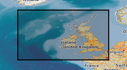
-
The Marine Hard Substrate dataset maps areas of rock or hard substrate outcropping or within 0.5m of the sea-bed. The interpretation was based on a variety of data sourced from within the British Geological Survey and externally. Data consulted includes archive sample and seismic records, side scan sonar, multibeam bathymetry and Olex datasets. The distribution of hard substrate at the seabed, or within 0.5 m is important in dictating the benthic assemblages found in certain areas. Therefore, an understanding of the distribution of these substrates is of primary importance in marine planning and designation of Marine Conservation Zones (MCZs) under the Marine and Coastal Access Act, 2009. In addition, a number of other users will value these data, including marine renewable companies, aggregate companies, the fishing and oil and gas industries. In order to address this issue it was necessary to update British Geological Survey sea-bed mapping to delineate areas where rock, boulders or cobbles are present at, or within 0.5m of the sea-bed surface. A polygon shape file showing areas of rock or hard substrate at, or within 0.5m of the sea-bed has been developed. The dataset has been created as vector polygons and are available in a range of GIS formats, including ArcGIS (.shp), ArcInfo Coverages and MapInfo (.tab). More specialised formats may be available but may incur additional processing costs.