Devonian
Type of resources
Topics
Keywords
Contact for the resource
Provided by
Years
Formats
Representation types
Update frequencies
-
Rock magnetic data corresponding to demagnetisation (LIV_DEMAG) and paleointensity (LIV_PI) data submitted as part of this grant. This data is divided into two subfolders, "Kappabridge" and "VFTB", corresponding to the instrument used to acquire the data. Those folders each contain one or more folders labelled with a four letter code, corresponding to a specific locality and/or experiment type, matching the letter codes in LIV_DEMAG and LIV_PI. The Kappabridge folders then contain raw data files of temperature-dependent magnetic susceptibility, and the VFTB folders contain raw data files of hysteresis, coercivity, isothermal remanent magnetisation and thermomagnetic curve measurements. CFEH corresponds to clinker samples from USA attempting to isolate an Epsilon Hematite phase. LPRM are data from Kinghorn and Wormit Bay volcanics in Scotland, ~330 Ma, specifically for samples given a lab TRM at 80uT and a PRM at 80uT. WTBY are Devonian volcanics from Wormit Bay, sampled in 2015. YDSR are data from Yandiniling Dike Swarm, Yilgarn Craton in Australia, sampled Nov 2018.
-

All paleointensity data gathered from the project at University of Liverpool. The data is divided into multiple four letter coded sections which refer to a specific locality and/or experiment type. The sections are as follows: CFEH - Thermal paleointensity experiment on natural clinkers from Montana, USA, looking primarily at the Epsilon Hematite phase, with an additional high-power alternating field demagnetisation step after each infield step of the experiment. LPRM - volcanic material from Kinghorn and Wormit Bay, Scotland (335 and 410 million years old). This was a specific experiment with samples given a prior high temperature applied field of 80 micro Tesla and a pressure remanent magnetisation of 80 micro Tesla. VFSS – a microwave paleointensity experiment carried out on Scottish vitrified fort material, sampled in the 1980s. WTBY – microwave paleointensity experiments carried out on Scottish volcanics from Wormit Bay. Sampled September 2015. YDSR – volcanics from Yandiniling Dike Swarm, in Yilgarn Craton, Australia, 2.6 billion years old. Sampled Nov 2018. Sampled with Yebo Li from the University of Curtin (Perth) as part of a collaboration, resampling of 16WDS sites from his palaeodirections paper. These were microwave demagnetisation (specimen orientation only) and paleointensities. NERC grant NE/P00170X/1.
-

The co-evolution and geographical spread of trees and deep-rooting systems is widely proposed to represent the 'Devonian engine' of global change that drove the weathering of soil minerals and biogeochemical cycling of elements to exert a major influence on the Earth's atmospheric CO2 history. If correct, this paradigm suggests the evolutionary appearance of forested ecosystems through the Devonian (418-360 Myr ago) constitutes the single most important biotic feedback on the geochemical carbon cycle to emerge during the entire 540 Myr duration of the Phanaerozoic. Crucially, no link has yet been established between the evolutionary advance of trees and their geochemical impacts on palaeosols. Direct evidence that one has affected the other is still awaited, largely because of the lack of cross-disciplinary investigations to date. Our proposal addresses this high level 'earth system science' challenge. The overarching objective is to provide a mechanistic understanding of how the evolutionary rise of deep-rotting forests intensified weathering and pedogenesis that constitute the primary biotic feedbacks on the long-term C-cycle. Our central hypothesis is that the evolutionary advance of trees left geochemical effects detectable in palaeosols as forested ecosystems increased the quantity and depth of chemical energy transported into the soil through roots, mycorrhizal fungi and litter. This intensified soil acidification, increased the strength of isotopic and elemental enrichment in surface soil horizons, enhanced the weathering of Ca-Si and Ca-P minerals, and the formation of pedogenic clays, leading to long-term sequestration of atmospheric CO2 through the formation of marine carbonates with the liberated terrestrial Ca. We will investigate this research hypothesis by obtaining and analysing well-preserved palaeosol profiles from a time sequence of localities in the eastern North America through the critical Silurian-Devonian interval that represents Earth's transition to a forested planet. These palaeosol sequences will then be subjected to targeted geochemical, clay mineralogical and palaeontological analyses. This will allow, for the first time, the rooting structures of mixed and monospecific Mid-Devonian forests to be directly linked to palaeosol weathering profiles obtained by drilling replicate unweathered profiles. Weathering by these forests will be compared with the 'control case' - weathering by pre-forest, early vascular land plants with diminutive/shallow rooting systems from Silurian and lower Devonian localities. These sites afford us the previously unexploited ability to characterize the evolution of plant-root-soil relationships during the critical Silurian-Devonian interval, whilst at the same time controlling for the effects of palaeogeography and provenance on palaeosol development. Applying geochemical analyses targeted at elements and isotopes that are strongly concentrated by trees at the surface of contemporary soils, and which show major changes in abundance through mineral weathering under forests, provides a powerful new strategy to resolve and reconstruct the intensity and depth of weathering and pedogenesis at different stages in the evolution of forested ecosystems. The project is tightly focused on "improving current knowledge of the interaction between the evolution of life and the Earth", which represents one of the three high level challenges within NERC's Earth System Science Theme.
-
GIS versions of a regional structural summary and palaeogeographic reconstructions describing the Palaeozoic geology of parts of the UK offshore and onshore, plus a set of summary posters and a summary presentation capturing the conventional petroleum systems. Devonian and Carboniferous rocks are the focus in and around the Mid North Sea High, Central North Sea, the Moray Firth and Orcadian Basin. In the greater Irish Sea area, Carboniferous rocks are described. The peer-reviewed products were produced for the 21CXRM Palaeozoic Project by BGS for DECC/OGA, Oil and Gas UK and oil company sponsors between November 2014 and May 2016, to improve regional digital datasets and knowledge of the underexplored Palaeozoic petroleum systems, and to stimulate exploration. The petroleum systems analysis was based on new interpretations of extensive well, seismic, gravity-magnetic and source rock datasets, integrated with petrophysical studies, basin modelling and UK onshore knowledge. Released data were collated and interpreted, and interpretations of unreleased data were included with agreement of the data owners. Unreleased raw data is excluded, as is the UK Government Seismic data released in 2016. The GIS layers were digitised from figures prepared for project reports and are applicable for use at scales between 1:1,000,000 and 1:3,000,000.
-
Reports, images, GIS and gridded products describing the Palaeozoic geology and conventional petroleum in and around the Mid North Sea High (Quadrants 25-44). Covering a large area of the Central North Sea from the Forth Approaches to the northern side of the Southern North Sea, the focus is on Devonian and Carboniferous rocks. The peer-reviewed products were produced for the 21CXRM Palaeozoic Project by BGS for DECC/OGA, Oil and Gas UK and oil company sponsors between November 2014 and May 2016, to improve regional digital datasets and knowledge of the underexplored Palaeozoic petroleum systems, and to stimulate exploration. The petroleum systems analysis was based on new interpretations of extensive well, seismic, gravity-magnetic and source rock datasets, integrated with petrophysical studies, basin modelling and UK onshore knowledge. Released data were collated and interpreted, and interpretations of unreleased data were included with agreement of the data owners. Unreleased raw data is excluded, as is the UK Government Seismic data released in 2016. The datasets are applicable for use at scales between 1:750,000 to 1: 3,000,000.
-
Reports, images, GIS and gridded products describing the Palaeozoic geology and conventional petroleum systems of parts of the UK offshore. Devonian and Carboniferous rocks are the focus in and around the Mid North Sea High, Central North Sea, the Moray Firth and Orcadian Basin. In the greater Irish Sea area, Carboniferous rocks are described. The peer-reviewed products were produced for the 21CXRM Palaeozoic Project by BGS for DECC/OGA, Oil and Gas UK and oil company sponsors between November 2014 and May 2016, to improve regional digital datasets and knowledge of the underexplored Palaeozoic petroleum systems, and to stimulate exploration. The petroleum systems analysis was based on new interpretations of extensive well, seismic, gravity-magnetic and source rock datasets, integrated with petrophysical studies, basin modelling and UK onshore knowledge. Released data were collated and interpreted, and interpretations of unreleased data were included with agreement of the data owners. Unreleased raw data is excluded, as is the UK Government Seismic data released in 2016. The datasets are applicable for use at scales between 1: 750,000 to 1: 3,000,000.
-
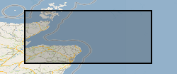
Reports, images, GIS and gridded products describing the Palaeozoic geology and conventional petroleum systems of parts of the UK offshore from the Orcadian Basin, Moray Firth to northern Forth Approaches (Quadrants 6-21). Devonian and Carboniferous rocks are the focus. The peer-reviewed products were produced for the 21CXRM Palaeozoic Project by BGS for DECC/OGA, Oil and Gas UK and oil company sponsors between November 2014 and May 2016, to improve regional digital datasets and knowledge of the underexplored Palaeozoic petroleum systems, and to stimulate exploration. The petroleum systems analysis was based on new interpretations of extensive well, seismic, gravity-magnetic and source rock datasets, integrated with petrophysical studies, basin modelling and UK onshore knowledge. Released data were collated and interpreted, and interpretations of unreleased data were included with agreement of the data owners. Unreleased raw data is excluded, as is the UK Government Seismic data released in 2016. The datasets are applicable for use at scales between 1:750,000 to 1: 3,000,000
 BGS Data Catalogue