 BGS Data Catalogue
DEM
Type of resources
Topics
Keywords
Contact for the resource
Provided by
Years
Formats
Representation types
Update frequencies
Scale
-
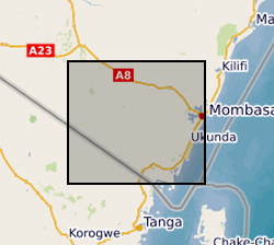
This dataset contains digital terrain data that describes the topography of the area under study at 90m resolution based on SRTM 90m Digital Elevation Data from the CGIAR-CSI (Consultative Group on International Agricultural Research - Consortium for Spatial Information). Gro for GooD: Groundwater Risk Management for Growth and Development, https://upgro.org/consortium/gro-for-good/
-
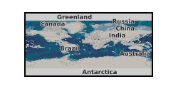
The database contains scanned photographs (at 1016dpi) of the UK and various locations around the world. Some are single band (black&white) others are 3 band colour. The images are stored in various formats on various types of magnetic media: .COT raw scans can only be used on the Intergraph ImageStation; .JPG (Intergraph format); .TIF. Processed scans may also be saved as stereomodels (with project data) and as orthophotographs. Mono coverage for most of the UK and we are constantly acquiring stereo data. Data is updated when unscanned areas are required by projects.
-
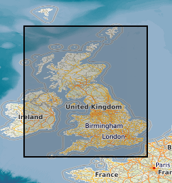
GeoScholar is a set of free geological data - available in GIS format - for UK universities and the higher education sector, to support teaching and learning within the geosciences. The dataset includes digital geological map data from BGS, aerial photos from Infoterra, NEXTmap digital terrain model from Intermap Technologies, borehole data and their corresponding logs, several BGS geological map sheets. Each Geoscholar teaching package will include 12 different geographical regions, including Assynt, Coniston and South West Wales.
-
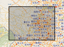
Hazards data in Sichuan (Dechang, Anning River catchment), China. Data include rainfall, earthquake, river catchment, boundary, geological map, soil map, land-cover map, road-map, DEM.