 BGS Data Catalogue
Climatology
Type of resources
Topics
Keywords
Contact for the resource
Provided by
Years
Formats
Representation types
Update frequencies
-
Published papers for NERC grant NE/I020571/2. Grant award abstract: How does the Earth's climate recover from events of rapid and extreme global warming or cooling? Why have the huge fluctuations in atmospheric CO2 in the geological past not caused runaway climate effects, making the Earth become Venus- or Mars-like? Silicate weathering of the continents is the main CO2 removal process, and therefore a dominant long-term climate control mechanism. However the debate on what controls silicate weathering, and therefore atmospheric CO2, is still contentious and ongoing. A correct understanding of the controls on weathering, and its link to atmospheric CO2 levels is critical, because 1) it is possible that weathering is the process that has kept Earth's climate in the relatively narrow bounds required for life over the past several hundred million years; 2) it is impossible to decipher the causes and consequences of long-term climate variations through Earth's history without accurate weathering data, which in turn impacts on our understanding of current climate; 3) comprehension of climate systems leads to more accurate modelling of future climate change; 4) rapid global climate change inevitably leads to large mass extinctions. Therefore it is important to unravel the link between extinctions and the Earth's climate systems, including CO2 control. Lithium isotopes have gained much interest over the past few years because large variations in the Li isotope ratio in rivers and clays are caused by silicate weathering processes. Furthermore, unlike tracers of weathering used previously, Li isotopes also respond to the intensity of weathering, and therefore can be linked directly to weathering rates. This is critical, because for the first time is gives us a window into the variation of weathering rates through time, which in turn means we can use the Earth's past climate variations as a natural laboratory. Three of the largest climate fluctuations and mass extinctions in Earth's history will be examined and modelled, primarily using Li isotopes, but also several other tracers, which will serve to reveal information on marine and volcanic conditions at the time. These geological periods (the end-Ordovician glaciation (450 Ma (million years ago)), the Permo-Triassic event (251 Ma) and the Cenomanian-Turonian Ocean Anoxic Event (94 Ma)), represent times when rapid warming or cooling of Earth's climate occurred, resulting in the extinction of up to 90% of life on Earth. Samples from these time periods exist in the form of marine calcium carbonate. This was precipitated (either inorganically, or via various life forms) in the oceans at the time, and provides a record of ocean chemistry, which in turn is directly linked to the atmospheric conditions. Analysing Li isotopes is a complex procedure, and will be undertaken at Oxford University. Collaborations will exist with Prof. Jan Veizer (Ottawa University) and Dr. Christoph Korte (Copenhagen University), who are specialists in the studied time periods, with Prof. Andy Ridgwell (Bristol University), who is an expert climate modeller, and with Prof. David Harper, who is an expert in mass extinctions. By understanding weathering and climatic responses to periods of rapid global warming and cooling we will gain critical information on Earth's climate feedbacks, and on processes that led to the extinction of vast proportions of the biosphere.
-

Collection of North Pacific core-top foraminifera census data. Grant abstract: The geological record offers an invaluable window into the different ways earth's climate can operate. The most recent large-scale changes in earth's climate, prior to modern climate change, were the Pleistocene glacial cycles, which feature growth and disintegration of large ice sheets, rapid shifts in major rain belts, and abrupt changes in ocean circulation. Changes in atmospheric CO2 concentrations, reconstructed from air bubbles in ice cores, are intimately linked with these ice age climate events. Indeed the close coupling of CO2 and temperature over glacial-interglacial cycles has become an iconic image in climate science, a poster child for the importance of CO2 in climate, and the natural template against which to compare current man-made CO2 rise. However despite the high profile of glacial-interglacial CO2 change, we still don't fully understand its cause. The leading hypotheses for glacial CO2 change involve increased CO2 uptake by the ocean during ice ages, which is vented to the atmosphere during deglaciation. However despite decades of work these hypotheses have had few direct tests, due to a lack of data on CO2 storage in the glacial ocean. One of the most glaring holes in our understanding of ice age CO2 and climate change is the behaviour of the Pacific. This basin contains half of global ocean volume, and ~30 times more CO2 than the atmosphere, and so its behaviour will have global impact. It has also recently been suggested that the North Pacific may play an active role in deglacial CO2 rise, with local deep water formation helping to release CO2 from the deep ocean to the atmosphere. If correct, this hypothesis provides a new view of Earth's climate system, with deep water able to form in each high latitude basin in the recent past, and the North Pacific potentially playing a pivotal role in deglaciation. However few data exist to test either the long-standing ideas on the Pacific's role in glacial CO2 storage, nor the more recent hypothesis that North Pacific deep water contributed to rapid deglacial CO2 rise. Given the size of the Pacific CO2 reservoir, our lack of knowledge on its behaviour is a major barrier to a full understanding of glacial-interglacial CO2 change and the climate of the ice ages. This proposal aims to transform our understanding of ice age CO2 and climate change, by investigating how the deep North Pacific stored CO2 during ice ages, and released it back to the atmosphere during deglaciations. We will use cutting-edge geochemical measurements of boron isotopes in microfossil shells (which record the behaviour of CO2 in seawater) and radiocarbon (which records how recently deep waters left the surface ocean), on recently collected samples from deep ocean sediment cores. By comparing these new records to other published data, we will be able to distinguish between different mechanisms of CO2 storage in the deep Pacific, and to test the extent of North Pacific deep water formation and CO2 release during the last deglaciation. We will also improve the techniques used to make boron isotope measurements, and add new constraints on the relationship between boron isotopes and seawater CO2 chemistry, which will help other groups using this technique to study CO2 change. To help us understand more about the mechanisms of changes in CO2 and ocean circulation, and provide synergy with scientists in other related disciplines, we will compare our data to results from earth system models, and collaborate with experts on nutrient cycling and climate dynamics. Our project will ultimately improve understanding of CO2 exchange between the ocean and the atmosphere, which is an important factor for predicting the path of future climate change.
-
Supplementary material and link to published paper - Colluvium Supply in Humid Regions limits the Frequency of storm-triggered Landslides. DOI:10.1038/srep34438 Colluvium depth observations measured in the apexes of colluvial hollows in Macon County, North Carolina. Colluvium depths were measured using a soil tile probe (STD>0) and in pits excavated to bedrock (STD=0). Hollow axis gradient and hollow concavity were measured from a 6 m LiDAR derived DEM. Citation: PARKER, R. N., HALES, T. C., MUDD, S. M., GRIEVE, S. W. D. & CONSTANTINE, J. A. 2016. Colluvium supply in humid regions limits the frequency of storm-triggered landslides. Scientific Reports, 6, 34438.
-

Ensemble of simulated groundwater levels for Iloilo, Philippines. The simulated time series of data covers the period December 1979 to December 2089 under two Representative Concentration Pathways (RCP2.6 and RCP 8.5). Each ensemble member csv file contains a timeseries of groundwater levels for thirteen locations within the Iloilo region. The textfile included in the folder shows the coordinates for these locations.
-
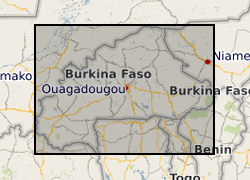
This dataset consists of reconstructions of daily groundwater levels for eight boreholes in Burkina Faso. Data for each borehole is provided in an individual csv file, with reconstructed groundwater level time series reported in metres above sea level (GWL, mASL). The groundwater level reconstructions were derived in 2019 as a part of the BRAVE project (NE/M008827/1 and NE/M008983/1) to develop an improved understanding of temporal variability in groundwater levels in sub-Saharan Africa. The reconstructions were derived using the lumped conceptual groundwater model AquiMod. Observed groundwater level time series for the eight boreholes were modelled using AquiMod, and the calibrated models were used with historic precipitation and potential evapotranspiration data to derive the reconstructions. The length of the time series of reconstructed groundwater levels varies between the boreholes due to differences in the length of the precipitation time series used to derive the reconstructions. Full details of this dataset are reported by Ascott et al. (2020). Ascott, M.J., Macdonald, D.M.J., Black, E., Verhoef, A., Nakohoun, P., Tirogo, J., Sandwidi, W.J.P., Bliefernicht, J., Sorensen, J.P.R., Bossa, A.Y., 2020. In Situ Observations and Lumped Parameter Model Reconstructions Reveal Intra-Annual to Multidecadal Variability in Groundwater Levels in Sub-Saharan Africa. Water Resour. Res., 56(12): e2020WR028056. DOI:https://doi.org/10.1029/2020WR028056
-

The datasets consist of a spreadsheets containing sporomorph and biomarker data for 145 samples from Eocene sediments recovered by Integrated Ocean Drilling Programme Expedition 318. We studied palynology (pollen and dinocysts) and palaeothermometry based on Glycerol Dialkyal Glycerol Tetraethers (GDGTs) to a sedimentary record from the Wilkes Land margin, East Antarctica, recovered by the Integrated Ocean Drilling Program (IODP Expedition 318 Site U1356). These data sets provide the framework for a terrestrial climate reconstruction for the early Eocene of Antarctica. Further details of the data and their interpretation may be found in Pross et al. (2012), doi:10.1038/nature11300 and Bijl et al. (2013), PNAS, doi/10.1073/pnas.1220872110 The associated NERC grant is NE/I00646X/1 and NE/I00646X/2.
-
The dataset is the output of a NERC fellowship aimed to understand the long-term dynamics of tropical vegetation through palaeoecological analysis. For doing this, two sedimentary archives (Laguna Pindo and Laguna Baños) from Ecuador were radiocarbon dated and analysed for pollen, non-pollen palynomorphs, charcoal, chironomids, stable isotopes and XRF of tephra deposits. Each proxy was analysed at different resolution. Laguna Pindo is a mid-elevation lake (1250 m asl) that spans the last 50,000 years. Laguna Baños is an Andean lake located at 3800 m asl and contains sediments representative of the last 6500 years. Both water bodies are very shallow. The data is presented mainly in excel spreadsheets as raw data (except for radiocarbon dating data, which are the PDF files provided by NRCF), without any math treatment or conversion. Publication associated with NERC grant, Frazer Matthews-Bird, Stephen J. Brooks, Philip B. Holden, Encarni Montoya, and William D. Gosling (2016), Inferring late-Holocene climate in the Ecuadorian Andes using a chironomid-based temperature inference model. Clim. Past, 12, 1263-1280, 2016. doi:10.5194/cp-12-1263-2016
-

This dataset spans the Sinemurian-Pliensbachian boundary of the Llanbedr (Mochras Farm) drill core that was drilled onshore in the Cardigan Bay Basin, Wales, UK. This dataset contains 1. Micro-, macro-charcoal data and palynofacies, obtained at the University of Exeter (Streatham campus), UK, 2. Clay mineralogical data (X-ray diffraction (XRD)) obtained at the University of Burgundy, France, in collaboration with Jean-François Deconinck, 3. Carbon-isotope data, TOC and carbonate content, obtained at the University of Exeter (Penryn campus), UK. The dataset was created within the scope of the JET project (Integrated understanding of Early Jurassic Earth system and timescale) - https://gtr.ukri.org/projects?ref=NE%2FN018508%2F This project has received funding from the International Continental Scientific Drilling Programme (ICDP) and the UK Natural Environment Research Council (NERC). The PhD-project within this dataset was created is funded by the University of Exeter, UK.
-
This dataset comprises a map of groundwater recharge for Africa and a database of the 134 observations used to generate the map. The map shows long term average annual groundwater recharge in mm per annum relevant to the period 1970 to 2020. It is in the form of a GIS shapefile and is available as a layer package for ESRI and also as a georeferenced TIFF and BIL file for easy exchange with other software. The database contains 134 sites for which ground based observations for groundwater recharge are available. These 134 sites are from previously published material and have gone through a QA procedure and been accurately geolocated to be included in the dataset. For each record there is a latitude, longitude, recharge estimate, recharge range, time period for the measurement; scale for which the estimate is made, methods used, a confidence rating and reason for this rating, and the reference from where the data originate. In addition, the database includes for each observation information from other continental datasets including: climate data, landcover, aquifer type, soil group and the normalized difference vegetation index (NDVI).
-

Temperature reconstructions indicate that the Pliocene was ~3 degrees C warmer globally than today, and several recent reconstructions of Pliocene atmospheric CO2 indicate that it was above pre-industrial levels and similar to those likely to be seen this century. However, many of these reconstructions have been of relatively low temporal resolution, meaning that these records may have failed to capture variations associated with the 41 Kyr glacial-interglacial cycles thought to operate in the Pliocene. These data represent new, high temporal resolution alkenone carbon isotope based record of pCO2 spanning 0 to 0.2 and 2.6 to 3.3 million years ago from ODP Site 999 (supplementing our other data repository focused on 2.8 to 3.3 million years ago). Our record allows a) direct comparison of alkenone-derived pCO2 from the Pleistocene to that of the Pliocene and b) comparison of the former to the ice core record. The raw data are sea surface temperature estimates from the Uk'37 proxy, foraminiferal and alkenone d13C values, from which carbon isotope fractionation during photosynthesis (ep) can be calculated. Using nutrient concentrations (growth rate correction) and SSTs, these ep values can be converted into [CO2(aq)] which in turn can be used to calculate pCO2.