mp4
Type of resources
Topics
Keywords
Contact for the resource
Provided by
Years
Formats
Representation types
Update frequencies
-

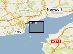
MEDIN Data. Within the project (WFA-CPC EMFF Protecting Our Seas), benthic and geophysical surveys were undertaken in the Severn Esturary/Môr Hafren SAC to explore the location of Sabellaria alveolata reefs, and collected bathymetry, sidescan sonar, AGDS and acoustic imagery data (ARIS) to identify areas of variable ground or potential features. A ten-day survey was undertaken in July 2020 to collect broad-scale acoustic data using an interferometric swath bathymetric system (GeoSwath Plus) and Acoustic Ground Discrimination System (RoxAnn™ AGDS). Twelve secondary survey areas were selected to be investigated in greater detail using high frequency sidescan sonar and an Acoustic Resonance Inspection System (ARIS Explorer 3000) camera in a second ten-day survey conducted in August 2020 (https://www.envision.uk.com/wp-content/uploads/2022/03/2018-1008-NRW-WFA-Protecting_Our_Seas_Final_Report_20210201.pdf) The data sets include: SSS (.tif) collected using Trident SeaStar MBES (.xyz) collected using GeoSwath Plus, AGDS (.csv and .asc) collected using RoxAnn™ AGDS ARIS imagery (.png and .mp4) collected using ARIS Explorer 3000 camera Shapefiles (.shp etc)
 BGS Data Catalogue