Hardcopy
Type of resources
Topics
Keywords
Contact for the resource
Provided by
Years
Formats
Update frequencies
-
NIGL (NERC Isotope Geosciences Laboratories) is a comprehensive stable and radiogenic isotope laboratory facility that undertakes environmental, life, archaeological and earth science research, and educates and trains PhD students, in a collaborative research environment. This dataset contains project records undertaken by NIGL since its formation in 1987. It includes projects approved by the NERC Isotope Geoscience Facilities Steering Committee, projects with BGS, BAS and other NERC institutes, and commercial work.
-
The NIGL (NERC Isotope Geosciences Laboratories) laboratory records comprise paper output from mass spectrometers, which is retained for 5 years from the date of analysis, and mass spectrometer loading sheets, which are retained indefinitely. NIGL is a comprehensive stable and radiogenic isotope laboratory facility that undertakes environmental, life, archaeological and earth science research, and educates and trains PhD students, in a collaborative research environment.
-
This dataset of paper records holds details of analysis of all the sample batches (from both internal and external customers) analysed by the Analytical Geochemistry Laboratory of the BGS since June 1996. It was installed to underpin the UKAS (United Kingdom Accreditation Service) accreditation of the geochemistry laboratories at Keyworth, which was awarded in August 1999. There is a file for each batch of samples submitted for analysis. The file documents the progress of the samples through the laboratories, including sample registration, sample processing, raw data from analytical instruments and the data reported to the client. The records are archived to provide supporting evidence for any query regarding geochemical data provided by the laboratories.
-
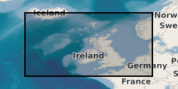
The Marine Maps and Chart Archive held by BGS contains maps created by BGS (the majority of which result from BGS offshore mapping projects) and also maps acquired from various other sources (e.g. UK Hydrographic Office and MCA Civil Hydrography Programme survey charts). The maps which date from the 1960s onwards are very variable in subject type and scale ranging from survey navigation to geological interpretation. The maps are primarily for the UKCS (United Kingdom Continental Shelf). The coverage of some map types is the entire UKCS whilst other have only regional or localised extent. The maps which are a mix of paper and digital are applicable to a wide range of uses including environmental, geotechnical, geophysical and geological studies. range of uses including environmental, geotechnical, geophysical and geological studies. Scanned maps can be viewed via the BGS maps portal http://www.bgs.ac.uk/data/maps.
-
The Marine Reports Archive held by BGS includes published and unpublished reports created by BGS and acquired from various sources. The reports which date from the 1960s onwards include the BGS Marine Reports Series, Marine Commercial reports and associated records, Palaeontology reports and other specialist reports. Examples of report types are data acquisition and processing reports, site investigation reports and interpretation reports. The reports are primarily for the UKCS (United Kingdom Continental Shelf). The coverage of some reports is the entire UKCS whilst other have only regional or very localised extent. The reports are applicable to a wide range of uses including environmental, geotechnical, geophysical and geological studies.
 BGS Data Catalogue