 BGS Metadata Catalogue
iHydrogeology shale and aquifer surfaces (vertical separation maps and data)
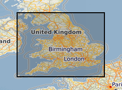
These maps provide an overview, at the national scale, of the spatial relationships between principal aquifers and some of the major shale and clay units in England and Wales. The data comprises a series of occurrence maps shows the distribution of rock units that form the principal aquifers and some major shale and clay units in England and Wales. In addition, a series of separation maps show the vertical separation between pairs of shales or clays and overlying aquifers. If shale gas resources are to be developed in the UK, the implications for groundwater will need to be considered as part of any risk assessment. A step in such an assessment will be to understand and quantify the spatial relationships between the potential shale gas source rocks (including both shales and some clay units) and overlying aquifers. The datasets used to produce the aquifer maps, the shale and clay occurrence maps and the separation maps are available to download for your own use. As with other BGS data sets available for download, this will enable you to work offline to develop your own systems and methodologies using BGS data. The data used to produce the aquifer, shale and clay maps are available below as ESRI GIS and KML files.
Simple
- Date (Creation)
- 2014-07
- Citation identifier
- http://data.bgs.ac.uk/id/dataHolding/13606280
- Point of contact
-
Organisation name Individual name Electronic mail address Role British Geological Survey
Enquiries
Distributor British Geological Survey
Enquiries
Point of contact British Geological Survey
Enquiries
Distributor British Geological Survey
Enquiries
Point of contact
- Maintenance and update frequency
- As needed
-
GEMET - INSPIRE themes, version 1.0
-
BGS Thesaurus of Geosciences
-
-
Shale
-
Shale oil
-
Hydrogeology
-
Aquifers
-
- dataCentre
- Keywords
-
-
NERC_DDC
-
- Access constraints
- Other restrictions
- Use constraints
- Other restrictions
- Other constraints
-
The copyright of materials derived from the British Geological Survey's work is vested in the Natural Environment Research Council [NERC]. No part of this work may be reproduced or transmitted in any form or by any means, or stored in a retrieval system of any nature, without the prior permission of the copyright holder, via the BGS Intellectual Property Rights Manager. Use by customers of information provided by the BGS, is at the customer's own risk. In view of the disparate sources of information at BGS's disposal, including such material donated to BGS, that BGS accepts in good faith as being accurate, the Natural Environment Research Council (NERC) gives no warranty, expressed or implied, as to the quality or accuracy of the information supplied, or to the information's suitability for any use. NERC/BGS accepts no liability whatever in respect of loss, damage, injury or other occurence however caused.
- Other constraints
-
Either: (i) the dataset is made freely available, e.g. via the Internet, for a restricted category of use (e.g. educational use only); or (ii) the dataset has not been formally approved by BGS for access and use by external clients under licence, but its use may be permitted under alternative formal arrangements; or (iii) the dataset contains 3rd party data or information obtained by BGS under terms and conditions that must be consulted in order to determine the permitted usage of the dataset. Refer to the BGS staff member responsible for the creation of the dataset if further advice is required. He / she should be familiar with the composition of the dataset, particularly with regard to 3rd party IPR contained in it, and any resultant use restrictions. This staff member should revert to the IPR Section ( ipr@bgs.ac.uk) for advice, should the position not be clear.
- Spatial representation type
- Vector
- Denominator
- 100000
- Language
- English
- Topic category
-
- Geoscientific information
- Geographic identifier
-
EAW
ISO 3166_2 2009 revision
- Geographic identifier
-
ENGLAND & WALES [id=149000]
British Geological Survey Gazetteer: Geographical hierarchy from Geosaurus 1979 creation
))
- End date
- 2014-07 Before
- Supplemental Information
-
These surfaces have been developed by the British Geological Survey as part of the iHydrogeology project (a co-funded project between BGS and the Environment Agency). It was developed, in partial fulfilment of work package 3 of the iHydrogeology project, with the aim of providing a tool to visualise regional-scale spatial and depth relationships between Principal Aquifers in England and Wales and potential shale gas source rocks.
- Unique resource identifier
- OSGB 1936 / British National Grid (EPSG::27700)
- Distribution format
-
Name Version ESRI Files
witheld
KML
- Distributor contact
-
Organisation name Individual name Electronic mail address Role British Geological Survey
Enquiries
Distributor
- Distributor contact
-
Organisation name Individual name Electronic mail address Role British Geological Survey
Enquiries
Distributor
- OnLine resource
-
Protocol Linkage Name WWW:LINK-1.0-http--link
https://www2.bgs.ac.uk/groundwater/shaleGas/aquifersAndShales/home.html Aquifers and shales Homepage
- Hierarchy level
- Dataset
- Other
-
dataset
Conformance result
- Title
-
INSPIRE Implementing rules laying down technical arrangements for the interoperability and harmonisation of Geology
- Date (Publication)
- 2011
- Explanation
-
See the referenced specification
- Pass
- No
Conformance result
- Title
-
Commission Regulation (EU) No 1089/2010 of 23 November 2010 implementing Directive 2007/2/EC of the European Parliament and of the Council as regards interoperability of spatial data sets and services
- Date (Publication)
- 2010-12-08
- Explanation
-
See http://eur-lex.europa.eu/LexUriServ/LexUriServ.do?uri=OJ:L:2010:323:0011:0102:EN:PDF
- Pass
- No
- Statement
-
The original surfaces were derived from the National Geological Fence Model. Data from crossections was extracted and interpolated in order to create the surfaces. The top surfaces of the shale gas source rocks were produced from the GB 3D fence diagram (v2012) using GSI3D and GOCAD software. The top of the shale gas units were identified from the cross-sections and grouped based on information provided by Geologists, e.g Upper Jurassic Clays. The cross-section correlation lines from the sections were exported as pline files from GSI3D and imported into GOCAD. Using a combination of the DigMap 1:625 000 Bedrock Map (V5) to constrain the units at outcrop and the correlation points from the GB 3D cross-sections, surfaces were generated using the Discrete Smoothing Interpolation in GOCAD. The subcrop was constrained by the spatial extent of these units identified in cross-section. Surfaces were exported and converted to ESRI grids at 3000 m cell size.
Metadata
- File identifier
- fedb8a5b-b74c-6ec1-e044-002128a47908 XML
- Metadata language
- English
- Hierarchy level
- Dataset
- Date stamp
- 2026-07-10
- Metadata standard name
- UK GEMINI
- Metadata standard version
-
2.3
- Metadata author
-
Organisation name Individual name Electronic mail address Role British Geological Survey
Point of contact
- Dataset URI
)))
