 BGS Metadata Catalogue
Airborne geophysical data from the Tellus South West project
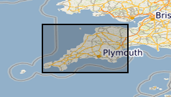
Airborne geophysical data acquired as part of the BGS-NERC TellusSW project ( http://www.tellusgb.ac.uk/) during the second half of 2013. The survey comprised a high resolution magnetic/magnetic gradient survey combined with a multichannel (256 channel) radiometric survey. The survey was carried out using 200m (N-S) line separations at a mean elevation of 91m. Encompassing the counties of Cornwall and parts of Devon and Somerset, the survey provided 60,323 line-km of data. Digital data and derived (e.g. spatial derivatives) maps of the geophysical information are provided to facilitate spatial modelling of the soil, geological and environmental aspects of the data.
Simple
- Date (Creation)
- 2014
- Citation identifier
- http://data.bgs.ac.uk/id/dataHolding/13606207
- Point of contact
-
Organisation name Individual name Electronic mail address Role British Geological Survey
Enquiries
Distributor British Geological Survey
Enquiries
Custodian British Geological Survey
Enquiries
Distributor British Geological Survey
Enquiries
Point of contact
- Maintenance and update frequency
- Not planned
-
GEMET - INSPIRE themes, version 1.0
-
BGS Thesaurus of Geosciences
-
-
Aerial surveys
-
Geophysics
-
Magnetic surveys
-
Geophysical surveys
-
- dataCentre
- Keywords
-
-
NERC_DDC
-
- Access constraints
- Other restrictions
- Use constraints
- Other restrictions
- Other constraints
-
The copyright of materials derived from the British Geological Survey's work is vested in the Natural Environment Research Council [NERC]. No part of this work may be reproduced or transmitted in any form or by any means, or stored in a retrieval system of any nature, without the prior permission of the copyright holder, via the BGS Intellectual Property Rights Manager. Use by customers of information provided by the BGS, is at the customer's own risk. In view of the disparate sources of information at BGS's disposal, including such material donated to BGS, that BGS accepts in good faith as being accurate, the Natural Environment Research Council (NERC) gives no warranty, expressed or implied, as to the quality or accuracy of the information supplied, or to the information's suitability for any use. NERC/BGS accepts no liability whatever in respect of loss, damage, injury or other occurence however caused.
- Other constraints
-
There are no restrictions on the use that may be made of the dataset, although an appropriate copyright acknowledgement must be made when any part of the dataset is reproduced. Either no third party data / information is contained in the dataset or BGS has secured written permission from the owner of any third party data / information contained in the dataset to make the dataset freely available without any use constraints - inclusion of any third party data / information will affect the copyright acknowledgement that needs to be made.
- Spatial representation type
- Grid
- Language
- English
- Topic category
-
- Geoscientific information
- Geographic identifier
-
Cornwall County [id=24167]
British Geological Survey Gazetteer: OS Boundary Line 2009 revision
- Geographic identifier
-
Devon County [id=23147]
British Geological Survey Gazetteer: OS Boundary Line 2009 revision
- Geographic identifier
-
Somerset County [id=10578]
British Geological Survey Gazetteer: OS Boundary Line 2009 revision
))
- Begin date
- 2013-08
- End date
- 2014-01
- Supplemental Information
-
Further information can be found at the project website http://www.tellusgb.ac.uk/
- Unique resource identifier
- OSGB 1936 / British National Grid (EPSG::27700)
- Distribution format
-
Name Version ASCII (.csv)
witheld
Image (GeoTIFF)
- Distributor contact
-
Organisation name Individual name Electronic mail address Role British Geological Survey
Enquiries
Distributor
- Distributor contact
-
Organisation name Individual name Electronic mail address Role British Geological Survey
Enquiries
Distributor
- OnLine resource
-
Protocol Linkage Name WWW:LINK-1.0-http--related
https://doi.org/10.5285/73848363-57c1-480a-a64e-c732e15c4b37 Citation Information - Digital Object Identifier (DOI)
- OnLine resource
-
Protocol Linkage Name WWW:LINK-1.0-http--link
https://www.tellusgb.ac.uk/data/home.html Data
- Hierarchy level
- Dataset
- Other
-
dataset
Conformance result
- Title
-
INSPIRE Implementing rules laying down technical arrangements for the interoperability and harmonisation of Geology
- Date (Publication)
- 2011
- Explanation
-
See the referenced specification
- Pass
- No
Conformance result
- Title
-
Commission Regulation (EU) No 1089/2010 of 23 November 2010 implementing Directive 2007/2/EC of the European Parliament and of the Council as regards interoperability of spatial data sets and services
- Date (Publication)
- 2010-12-08
- Explanation
-
See http://eur-lex.europa.eu/LexUriServ/LexUriServ.do?uri=OJ:L:2010:323:0011:0102:EN:PDF
- Pass
- No
- Statement
-
The lineage is reported in a BGS technical report: http://nora.nerc.ac.uk/506870/
Metadata
- File identifier
- faeaeb7a-af7d-4159-e044-002128a47908 XML
- Metadata language
- English
- Hierarchy level
- Dataset
- Date stamp
- 2026-06-27
- Metadata standard name
- UK GEMINI
- Metadata standard version
-
2.3
- Metadata author
-
Organisation name Individual name Electronic mail address Role British Geological Survey
Point of contact
- Dataset URI
)))
