 BGS Metadata Catalogue
A comprehensive suite of earthquake catalogues for the 2016-2017 Central Italy seismic sequence
A set of six large catalogues documenting the seismic sequence that occurred in central Italy between 2016 and 2017, characterized by a cascade of four MW5.5–6.5 events. The earthquake catalogues possess different levels of resolution and completeness that result from progressive enhancements in both detection sensitivity and hypocentral location determination. These quality differences reflect the subsequent application of advanced methods.
Simple
- Date (Creation)
- 2022-06-29
- Citation identifier
- http://data.bgs.ac.uk/id/dataHolding/13607959
- Point of contact
-
Organisation name Individual name Electronic mail address Role British Geological Survey
Enquiries
not available
Distributor British Geological Survey
Enquiries
not available
Point of contact
- Maintenance and update frequency
- notApplicable
-
GEMET - INSPIRE themes, version 1.0
-
BGS Thesaurus of Geosciences
-
-
Fault geometry
-
Earthquakes
-
- dataCentre
- Keywords
-
-
NERC_DDC
-
- Access constraints
- Other restrictions
- Other constraints
- licenceOGL
- Use constraints
- Other restrictions
- Other constraints
-
The copyright of materials derived from the British Geological Survey's work is vested in the Natural Environment Research Council [NERC]. No part of this work may be reproduced or transmitted in any form or by any means, or stored in a retrieval system of any nature, without the prior permission of the copyright holder, via the BGS Intellectual Property Rights Manager. Use by customers of information provided by the BGS, is at the customer's own risk. In view of the disparate sources of information at BGS's disposal, including such material donated to BGS, that BGS accepts in good faith as being accurate, the Natural Environment Research Council (NERC) gives no warranty, expressed or implied, as to the quality or accuracy of the information supplied, or to the information's suitability for any use. NERC/BGS accepts no liability whatever in respect of loss, damage, injury or other occurence however caused.
- Other constraints
-
Available under the Open Government Licence subject to the following acknowledgement accompanying the reproduced NERC materials "Contains NERC materials ©NERC [year]"
- Language
- English
- Topic category
-
- Geoscientific information
- Geographic identifier
-
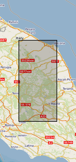
CENTRAL ITALY [id=287500]
British Geological Survey Gazetteer: Geographical hierarchy from Geosaurus 1979 creation
))
- Begin date
- 2016-08-15
- End date
- 2018-01-17
- Unique resource identifier
- WGS 84 (EPSG::4326)
- Distribution format
-
Name Version
- Distributor contact
-
Organisation name Individual name Electronic mail address Role British Geological Survey
Enquiries
not available
Distributor
- OnLine resource
-
Protocol Linkage Name WWW:DOWNLOAD-1.0-http--download
https://webapps.bgs.ac.uk/services/ngdc/accessions/index.html#item174924 Data
- OnLine resource
-
Protocol Linkage Name WWW:LINK-1.0-http--related
https://doi.org/10.5285/5afccfe5-142e-4e93-a6cc-55216fa1db06 Citation Information - Digital Object Identifier (DOI)
- Hierarchy level
- Dataset
- Other
-
dataset
Conformance result
- Title
-
INSPIRE Implementing rules laying down technical arrangements for the interoperability and harmonisation of Geology
- Date (Publication)
- 2011
- Explanation
-
See the referenced specification
- Pass
- No
Conformance result
- Title
-
Commission Regulation (EU) No 1089/2010 of 23 November 2010 implementing Directive 2007/2/EC of the European Parliament and of the Council as regards interoperability of spatial data sets and services
- Date (Publication)
- 2010-12-08
- Explanation
-
See http://eur-lex.europa.eu/LexUriServ/LexUriServ.do?uri=OJ:L:2010:323:0011:0102:EN:PDF
- Pass
- No
- Statement
-
The presented catalogues were retrieved by using different location methods: the IpoP code (internal linearized method) (CAT0), the NonLinLoc code (CAT1, CAT3) and the double-difference technique (with or without the use of cross-correlation measurements) (CAT2, CAT4 and CAT5). CAT0, CAT1 and CAT2 are based on the dataset of P- and S-waves picks revised in nearly real-time in the INGV seismic monitoring room, while CAT3 and CAT4 are based on the dataset of Spallarossa et al. (2020) , composed of P- and S-picks and maximum amplitudes, automatically estimated using the Complete Automatic Seismic Processor (CASP) combined with the RSNI-Picker2. CAT5' dataset derives from the PhaseNet picker, used for detecting earthquakes and measuring P- and S-waves arrival times, associated to individual events with REAL package.
Metadata
- File identifier
- e5673dc8-3d27-574d-e053-0937940ae180 XML
- Metadata language
- English
- Hierarchy level
- Dataset
- Date stamp
- 2026-07-11
- Metadata standard name
- UK GEMINI
- Metadata standard version
-
2.3
- Metadata author
-
Organisation name Individual name Electronic mail address Role British Geological Survey
Point of contact
- Dataset URI
)))
