 BGS Metadata Catalogue
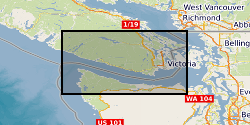
Detections of tremor at a set of template locations, Vancouver Island, Canada, over the course of four slow slip events in 2004, 2008, 2009, and 2010 (NERC Grant NE/P012507/1)
Detections of tremor at a set of template locations over the course of four slow slip events in 2004, 2008, 2009, and 2010. As well as identified bursts of tremor within these windows. The dataset consists of: Detected spikes in the tremor time series Each file contains a list of identified spikes in the inter-component coherence time series. LFE (Low frequency earthquakes) locations The locations of LFEs identified by Bostock, M. G., Royer, A. A., Hearn, E. H., and Peacock, S. M. (2012), Low frequency earthquakes below southern Vancouver Island, Geochem. Geophys. Geosyst., 13, Q11007, doi:10.1029/2012GC004391. Cp values through time 12 files containing time series of inter-component and/or inter-station coherence at a range of LFE locations Further descriptions are available in the README and in the preprint hosted on EarthArxiv: Gombert and Hawthorne, Rapid tremor migration during few minute-long slow earthquakes in Cascadia, 2022, doi: 10.31223/X56623.
Simple
- Date (Creation)
- 2022-03-21
- Citation identifier
- http://data.bgs.ac.uk/id/dataHolding/13607936
- Point of contact
-
Organisation name Individual name Electronic mail address Role University of Oxford
Jessica Hawthorne
not available
Originator University of Oxford
Jessica Hawthorne
not available
Principal investigator British Geological Survey
Enquiries
not available
Distributor British Geological Survey
Enquiries
not available
Point of contact
- Maintenance and update frequency
- Not planned
-
GEMET - INSPIRE themes, version 1.0
- dataCentre
- Keywords
-
-
NERC_DDC
-
- Access constraints
- Other restrictions
- Other constraints
- licenceOGL
- Use constraints
- Other restrictions
- Other constraints
-
The copyright of materials derived from the British Geological Survey's work is vested in the Natural Environment Research Council [NERC]. No part of this work may be reproduced or transmitted in any form or by any means, or stored in a retrieval system of any nature, without the prior permission of the copyright holder, via the BGS Intellectual Property Rights Manager. Use by customers of information provided by the BGS, is at the customer's own risk. In view of the disparate sources of information at BGS's disposal, including such material donated to BGS, that BGS accepts in good faith as being accurate, the Natural Environment Research Council (NERC) gives no warranty, expressed or implied, as to the quality or accuracy of the information supplied, or to the information's suitability for any use. NERC/BGS accepts no liability whatever in respect of loss, damage, injury or other occurence however caused.
- Other constraints
-
There are no restrictions on the use that may be made of the dataset, although an appropriate copyright acknowledgement must be made when any part of the dataset is reproduced. Either no third party data / information is contained in the dataset or BGS has secured written permission from the owner of any third party data / information contained in the dataset to make the dataset freely available without any use constraints - inclusion of any third party data / information will affect the copyright acknowledgement that needs to be made.
- Spatial representation type
- Text, table
- Language
- English
- Topic category
-
- Geoscientific information
- Geographic identifier
-
BRITISH COLUMBIA [id=743700]
British Geological Survey Gazetteer: Geographical hierarchy from Geosaurus 1979 creation
- Geographic identifier
-
CA
ISO 3166_1 alpha-2 2009 revision
- Geographic identifier
-
CAN
ISO 3166_1 alpha-3 2009 revision
- Geographic identifier
-
CANADA [id=710000]
British Geological Survey Gazetteer: Geographical hierarchy from Geosaurus 1979 creation
))
- Begin date
- 2004-02-01
- End date
- 2022-03-10
- Unique resource identifier
- WGS 84 (EPSG::4326)
- Distribution format
-
Name Version .h5
witheld
Text file (TXT)
witheld
- Distributor contact
-
Organisation name Individual name Electronic mail address Role British Geological Survey
Enquiries
not available
Distributor
- OnLine resource
-
Protocol Linkage Name WWW:DOWNLOAD-1.0-http--download
https://webapps.bgs.ac.uk/services/ngdc/accessions/index.html#item172860 Data
- Hierarchy level
- Dataset
- Other
-
dataset
Conformance result
- Title
-
INSPIRE Implementing rules laying down technical arrangements for the interoperability and harmonisation of Geology
- Date (Publication)
- 2011
- Explanation
-
See the referenced specification
- Pass
- No
Conformance result
- Title
-
Commission Regulation (EU) No 1089/2010 of 23 November 2010 implementing Directive 2007/2/EC of the European Parliament and of the Council as regards interoperability of spatial data sets and services
- Date (Publication)
- 2010-12-08
- Explanation
-
See http://eur-lex.europa.eu/LexUriServ/LexUriServ.do?uri=OJ:L:2010:323:0011:0102:EN:PDF
- Pass
- No
- Statement
-
The tremor was identified with a phase coherence method, which compares the signals of known templates with observed seismograms.
Metadata
- File identifier
- dfbe0934-e6a4-1d07-e053-0937940aca0c XML
- Metadata language
- English
- Hierarchy level
- Dataset
- Date stamp
- 2026-06-27
- Metadata standard name
- UK GEMINI
- Metadata standard version
-
2.3
- Metadata author
-
Organisation name Individual name Electronic mail address Role British Geological Survey
Point of contact
- Dataset URI
)))
