BGS Data Catalogue
Estimated Urban Soil Chemistry
The Estimated Urban Soil Chemistry data are derived by spatial interpolation of the Measured Urban Soil Chemistry data. A unique feature of this dataset is the inclusion for the first time of estimated bioaccessible arsenic and lead data. The Estimated Urban Soil Chemistry data indicates the estimated geometric mean concentrations (mg kg-1) of Arsenic, Cadmium, Chromium, Nickel and Lead in topsoil derived by spatial interpolation of the Measured Urban Soil Chemistry data. Estimated bioaccessible As and Pb concentrations are derived using linear regression models of the relationship between total and bioaccessible concentrations. The Estimated Urban Soil Chemistry data can be used to assist Local Planning Authorities to identify those areas where a risk assessment may need to be carried out by developers. Comparison of this spatially referenced geochemical data with information on current or historic land use and geological information might help environmental professionals decide whether high potentially harmful element (PHE) concentrations in topsoils can be attributed to geogenic or anthropogenic sources. The dataset is based on, and limited to, an interpretation of the records in the possession of the BGS at the time the dataset was created. This dataset consists of two shape files Estimated Urban Soil Chemistry (As, Cr, Ni) and Estimated Urban Soil Chemistry (Cd, Pb).
INSPIRE
Identification
- File identifier
- cfa052c4-6d04-4905-e044-0003ba9b0d98 XML
- Resource type
- dataset
Online resource
Resource identifier
- Metadata Language
- English (en)
- Spatial representation type
- vector
Encoding
Projection
Classification of data and services
- Topic category
-
- Geoscientific information
Classification of data and services
Coupled resource
Coupled resource
Classification of data and services
Coupled resource
Coupled resource
Keywords
- GEMET - INSPIRE themes, version 1.0
- BGS Thesaurus of Geosciences
-
-
UK Location (INSPIRE)
-
Soil chemistry
-
Lead
-
Chromium
-
Nickel
-
Arsenic
-
Cadmium
-
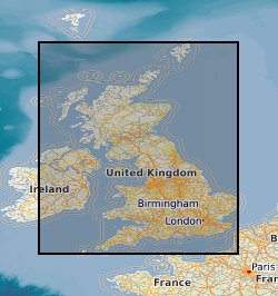
Geographic coverage
))
Temporal reference
Temporal extent
Temporal extent
- Dataset Reference Date ()
- 2012
Quality and validity
- Lineage
-
Soil geochemical surveys have been carried out at 24 urban centres in England, Scotland and Wales. Most of the surveys were undertaken by the BGS as part of the Geochemical Surveys of Urban Environments (GSUE) project (Fordyce et al., 2005), whereas London, Wolverhampton, Manchester and Glasgow were sampled as part of larger multi-disciplinary projects. The concentrations of many potentially harmful elements including arsenic (As), cadmium (Cd), chromium (Cr), nickel (Ni), and lead (Pb) are above 'natural' background in urban environments as a result of a range of contaminative processes. Urban geochemical surveying is based on the collection of samples on a 500 m grid at a density of approximately 4 samples per km2 across the urban areas. Samples were collected from open ground as close as possible to the centre of each 500 m grid cell. At each sample site, composite samples based on 5 sub-samples taken at the centre and four corners of a 20m square, were collected from the topsoil ('A' soil sample; 5-20 cm depth) and subsurface ('S' soil sample; 35-50 cm depth). Approximately 40 chemical elements were determined in the <2mm size fraction of the 'A' soils. The Measured Urban Soil Chemistry data contain analysed results from these sampling campaigns. The Estimated Urban Soil Chemistry indicates the estimated topsoil total As, Cd, Cr, Ni and Pb concentrations (mg kg-1) derived by spatial interpolation of the point source urban soil chemistry data. Urban soil geochemical data generally have large positive skewness coefficients so were transformed by taking natural logarithms. To overcome the bias associated with traditional measures of location (mean) and scale (standard deviation) for log-normal data, the inverse distance weighted (IDW) mean and standard deviation of log transformed.
- Denominator
- 50000
Conformity
Conformity
Conformity
Conformity
Conformity
Conformity
- Explanation
-
See the referenced specification
Restrictions on access and use
- Access constraints
- Available to 3rd parties under licence.
- Access constraints
-
The copyright of materials derived from the British Geological Survey's work is vested in the Natural Environment Research Council [NERC]. No part of this work may be reproduced or transmitted in any form or by any means, or stored in a retrieval system of any nature, without the prior permission of the copyright holder, via the BGS Intellectual Property Rights Manager. Use by customers of information provided by the BGS, is at the customer's own risk. In view of the disparate sources of information at BGS's disposal, including such material donated to BGS, that BGS accepts in good faith as being accurate, the Natural Environment Research Council (NERC) gives no warranty, expressed or implied, as to the quality or accuracy of the information supplied, or to the information's suitability for any use. NERC/BGS accepts no liability whatever in respect of loss, damage, injury or other occurence however caused.
- Access constraints
-
The dataset is made available to external clients under BGS Digital Data Licence terms and conditions. Revert to the IPR Section (iprdigital@bgs.ac.uk) if further advice is required with regard to permitted usage. iprdigital@bgs.ac The dataset is made available to external clients under BGS Digital Data Licence terms and conditions. Revert to the IPR Section (iprdigital@bgs.ac.uk) if further advice is required with regard to permitted usage.
Responsible organization (s)
Contact for the resource
- Organisation name
-
British Geological Survey
-
enquiries@bgs.ac enquiries@bgs.ac.uk
- Organisation name
-
British Geological Survey
-
enquiries@bgs.ac enquiries@bgs.ac.uk
- Organisation name
-
British Geological Survey
-
enquiries@bgs.ac enquiries@bgs.ac.uk
Metadata information
Contact for the metadata
- Organisation name
-
British Geological Survey
-
enquiries@bgs.ac enquiries@bgs.ac.uk
- Metadata Date
- 2024-04-18
- Metadata Language
- English (en)