 BGS Metadata Catalogue
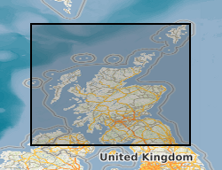
Estimated Ambient Background Soil Chemistry Scotland
The BGS Estimated Ambient Background Soil Chemistry Scotland digital soil chemistry data indicates the estimated geometric mean topsoil concentrations (mg kg-1) of Arsenic (As), Cadmium (Cd), Chromium (Cr), Nickel (Ni) and Lead (Pb). The soil chemistry data is based on GBASE (Geochemical Baseline Survey of the Environment) stream sediment data converted to top soil equivalent potentially harmful element(PHE) concentrations. This dataset covers Scotland but data is available for the whole of Great Britain, with the exception of the London area where an inadequate number of geochemical samples are available at the moment.
Simple
- Date (Creation)
- 2009
- Citation identifier
- http://data.bgs.ac.uk/id/dataHolding/13605687
- Point of contact
-
Organisation name Individual name Electronic mail address Role British Geological Survey
Enquiries
Distributor British Geological Survey
Enquiries
Point of contact
- Maintenance and update frequency
- As needed
-
GEMET - INSPIRE themes, version 1.0
-
BGS Thesaurus of Geosciences
-
-
Nickel
-
Arsenic
-
Cadmium
-
Chromium
-
Lead
-
- dataCentre
- Keywords
-
-
NERC_DDC
-
- Access constraints
- Other restrictions
- Other constraints
- license
- Use constraints
- Other restrictions
- Other constraints
-
The copyright of materials derived from the British Geological Survey's work is vested in the Natural Environment Research Council [NERC]. No part of this work may be reproduced or transmitted in any form or by any means, or stored in a retrieval system of any nature, without the prior permission of the copyright holder, via the BGS Intellectual Property Rights Manager. Use by customers of information provided by the BGS, is at the customer's own risk. In view of the disparate sources of information at BGS's disposal, including such material donated to BGS, that BGS accepts in good faith as being accurate, the Natural Environment Research Council (NERC) gives no warranty, expressed or implied, as to the quality or accuracy of the information supplied, or to the information's suitability for any use. NERC/BGS accepts no liability whatever in respect of loss, damage, injury or other occurence however caused.
- Other constraints
-
The dataset is made available to external clients under BGS Digital Data Licence terms and conditions. Revert to the IPR Section ( iprdigital@bgs.ac.uk) if further advice is required with regard to permitted usage.
- Spatial representation type
- Vector
- Denominator
- 50000
- Language
- English
- Topic category
-
- Geoscientific information
- Geographic identifier
-
SCOTLAND [id=140000]
British Geological Survey Gazetteer: Geographical hierarchy from Geosaurus 1979 creation
- Geographic identifier
-
SCT
ISO 3166_1 alpha-3 2009 revision
))
- Begin date
- 1968
- End date
- 1993
- Supplemental Information
-
User Guide for the BGS Soil Chemistry Data for Environmental Assessments (BGS Open Report OR/12/050)
- Unique resource identifier
- OSGB 1936 / British National Grid (EPSG::27700)
- Distribution format
-
Name Version ESRI Shapefile
1994
- Distributor contact
-
Organisation name Individual name Electronic mail address Role British Geological Survey
Enquiries
Distributor
- OnLine resource
-
Protocol Linkage Name WWW:LINK-1.0-http--link
https://www.bgs.ac.uk/ BGS Homepage
- Hierarchy level
- Dataset
- Other
-
dataset
Conformance result
- Title
-
INSPIRE Implementing rules laying down technical arrangements for the interoperability and harmonisation of Geology
- Date (Publication)
- 2011
- Explanation
-
See the referenced specification
- Pass
- No
Conformance result
- Title
-
Commission Regulation (EU) No 1089/2010 of 23 November 2010 implementing Directive 2007/2/EC of the European Parliament and of the Council as regards interoperability of spatial data sets and services
- Date (Publication)
- 2010-12-08
- Explanation
-
See http://eur-lex.europa.eu/LexUriServ/LexUriServ.do?uri=OJ:L:2010:323:0011:0102:EN:PDF
- Pass
- No
- Statement
-
The soil chemistry data is based on GBASE soil geochemical data where these are available. Elsewhere the stream sediment data are converted to surface soil equivalent potentially harmful element(PHE) concentrations using delineations of PM polygons as the soil geochemistry mapping unit and the statistical relationships between soil and stream sediment data to derive the equivalent soil PHE concentration from the stream sediment data. Geometric mean ambient background concentrations (ABCs) for PHEs in mineral soils are mapped within delineations of PM polygons to produce a seamless data set covering the whole of Great Britain, with the exception of the London area where an inadequate number of geochemical samples are available at the moment. PHE concentrations in organic soils (i.e. with more than 15-20% organic carbon) are likely to be significantly lower than those indicated by the soil chemistry data.
Metadata
- File identifier
- cf7749a3-2bcc-4943-e044-0003ba9b0d98 XML
- Metadata language
- English
- Hierarchy level
- Dataset
- Date stamp
- 2026-07-10
- Metadata standard name
- UK GEMINI
- Metadata standard version
-
2.3
- Metadata author
-
Organisation name Individual name Electronic mail address Role British Geological Survey
Point of contact
- Dataset URI
)))
