 BGS Metadata Catalogue
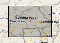
Historic reconstructions of daily groundwater levels for eight boreholes in Burkina Faso (NERC Grant NE/M008827/1)
This dataset consists of reconstructions of daily groundwater levels for eight boreholes in Burkina Faso. Data for each borehole is provided in an individual csv file, with reconstructed groundwater level time series reported in metres above sea level (GWL, mASL). The groundwater level reconstructions were derived in 2019 as a part of the BRAVE project (NE/M008827/1 and NE/M008983/1) to develop an improved understanding of temporal variability in groundwater levels in sub-Saharan Africa. The reconstructions were derived using the lumped conceptual groundwater model AquiMod. Observed groundwater level time series for the eight boreholes were modelled using AquiMod, and the calibrated models were used with historic precipitation and potential evapotranspiration data to derive the reconstructions. The length of the time series of reconstructed groundwater levels varies between the boreholes due to differences in the length of the precipitation time series used to derive the reconstructions. Full details of this dataset are reported by Ascott et al. (2020). Ascott, M.J., Macdonald, D.M.J., Black, E., Verhoef, A., Nakohoun, P., Tirogo, J., Sandwidi, W.J.P., Bliefernicht, J., Sorensen, J.P.R., Bossa, A.Y., 2020. In Situ Observations and Lumped Parameter Model Reconstructions Reveal Intra-Annual to Multidecadal Variability in Groundwater Levels in Sub-Saharan Africa. Water Resour. Res., 56(12): e2020WR028056. DOI: https://doi.org/10.1029/2020WR028056
Simple
- Date (Creation)
- 2021-10-12
- Citation identifier
- http://data.bgs.ac.uk/id/dataHolding/13607829
- Point of contact
-
Organisation name Individual name Electronic mail address Role British Geological Survey
Enquiries
Distributor British Geological Survey
Enquiries
Originator British Geological Survey
Enquiries
Principal investigator British Geological Survey
Enquiries
not available
Distributor British Geological Survey
Enquiries
not available
Point of contact
- Maintenance and update frequency
- notApplicable
-
GEMET - INSPIRE themes, version 1.0
-
BGS Thesaurus of Geosciences
-
-
Groundwater
-
Aquifers
-
Climatology
-
Simulation
-
- dataCentre
- Keywords
-
-
NERC_DDC
-
- Access constraints
- Other restrictions
- Other constraints
- licenceOGL
- Use constraints
- Other restrictions
- Other constraints
-
The copyright of materials derived from the British Geological Survey's work is vested in the Natural Environment Research Council [NERC]. No part of this work may be reproduced or transmitted in any form or by any means, or stored in a retrieval system of any nature, without the prior permission of the copyright holder, via the BGS Intellectual Property Rights Manager. Use by customers of information provided by the BGS, is at the customer's own risk. In view of the disparate sources of information at BGS's disposal, including such material donated to BGS, that BGS accepts in good faith as being accurate, the Natural Environment Research Council (NERC) gives no warranty, expressed or implied, as to the quality or accuracy of the information supplied, or to the information's suitability for any use. NERC/BGS accepts no liability whatever in respect of loss, damage, injury or other occurence however caused.
- Other constraints
-
Available under the Open Government Licence subject to the following acknowledgement accompanying the reproduced NERC materials "Contains NERC materials ©NERC [year]"
- Spatial representation type
- Vector
- Language
- English
- Topic category
-
- Geoscientific information
- Geographic identifier
-
BF
ISO 3166_1 alpha-2 2009 revision
- Geographic identifier
-
BFA
ISO 3166_1 alpha-3 2009 revision
- Geographic identifier
-
BURKINA FASO [id=626000]
British Geological Survey Gazetteer: Geographical hierarchy from Geosaurus 1979 creation
))
- Begin date
- 2019-10-01
- End date
- 2019-12-31
- Unique resource identifier
- WGS 84 (EPSG::4326)
- Distribution format
-
Name Version Comma-separated values (CSV)
witheld
- Distributor contact
-
Organisation name Individual name Electronic mail address Role British Geological Survey
Enquiries
Distributor
- Distributor contact
-
Organisation name Individual name Electronic mail address Role British Geological Survey
Enquiries
not available
Distributor
- OnLine resource
-
Protocol Linkage Name WWW:DOWNLOAD-1.0-http--download
https://webapps.bgs.ac.uk/services/ngdc/accessions/index.html#item169011 Data
- OnLine resource
-
Protocol Linkage Name WWW:LINK-1.0-http--related
https://doi.org/10.5285/c9262369-4db1-48e1-9660-3ef8667ab19b Citation Information - Digital Object Identifier (DOI)
- Hierarchy level
- Dataset
- Other
-
dataset
Conformance result
- Title
-
INSPIRE Implementing rules laying down technical arrangements for the interoperability and harmonisation of Geology
- Date (Publication)
- 2011
- Explanation
-
See the referenced specification
- Pass
- No
Conformance result
- Title
-
Commission Regulation (EU) No 1089/2010 of 23 November 2010 implementing Directive 2007/2/EC of the European Parliament and of the Council as regards interoperability of spatial data sets and services
- Date (Publication)
- 2010-12-08
- Explanation
-
See http://eur-lex.europa.eu/LexUriServ/LexUriServ.do?uri=OJ:L:2010:323:0011:0102:EN:PDF
- Pass
- No
- Statement
-
Observed groundwater level time series for each of the boreholes were modelled using the lumped conceptual model AquiMod. The models were calibrated using Monte Carlo sampling, which resulted in a series of parameter sets which produced behavioural models. The top ten behavioural models were then used for groundwater level reconstruction by applying historic rainfall and potential evapotranspiration data as inputs. The results of the best fit behavioural model are presented here. For full details of the methodology please see Ascott et al. (2020).
Metadata
- File identifier
- cf66e46f-6738-26fb-e054-002128a47908 XML
- Metadata language
- English
- Hierarchy level
- Dataset
- Date stamp
- 2026-07-11
- Metadata standard name
- UK GEMINI
- Metadata standard version
-
2.3
- Metadata author
-
Organisation name Individual name Electronic mail address Role British Geological Survey
Point of contact
- Dataset URI
)))
