 BGS Metadata Catalogue
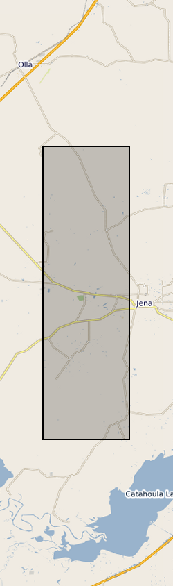
Geochemical Data for the Olla and Nebo-Hemphill Oil Fields, Louisiana (NERC grant NE/L002612/1)
Formation water geochemistry and gas geochemistry from 6 wells in the Olla Oil Field and 7 wells in the Nebo-Hemphill Oil Field Louisiana (Longitude range: -92.2297 to -92.1487, Latitude range: 31.83128 to 31.56586.), sampled in 2015. Formation water geochemistry for cation and anions and in mmol/l and ppm, these were measured at an internal ExxonMobil facility. Casing gases were used to make the remaining measurements. Stable noble gas isotopes (He, Ne, Ar, Kr, Xe) were measured at the University of Oxford Noble Lab for ratios and abundances (in cm3(STP)/cm3). Stable C isotopes of CO2 and CH4 and C2, C3 and C4 alkanes in ‰ VDPB as well as their mol% of the casing gas were measured by Isotech Inc.. Methane clumped isotopes are given as Δ12CH2D2 and Δ13CH3D and were measured at the California Institute of Technology. Where no data is present, no measurements were taken for that well. N.D. refers to not detectable.
Simple
- Date (Creation)
- 2021-07-19
- Citation identifier
- http://data.bgs.ac.uk/id/dataHolding/13607789
- Point of contact
-
Organisation name Individual name Electronic mail address Role University of Oxford
Chris Ballentine
not available
Originator University of Oxford
Rebecca Tyne
not available
Originator Woods Hole Oceanographic Institution
Peter H Barry
not available
Originator ExxonMobil Upstream Business Development
Michael Lawson
not available
Originator California Institute of Technology
Hao Xie
not available
Originator University of Oxford
Darren J Hillegonds
not available
Originator California Institute of Technology
John M Eiler
not available
Originator British Geological Survey
Enquiries
not available
Distributor British Geological Survey
Enquiries
not available
Point of contact
- Maintenance and update frequency
- notApplicable
-
GEMET - INSPIRE themes, version 1.0
-
BGS Thesaurus of Geosciences
-
-
Geochemistry
-
Reservoir fluids
-
- dataCentre
- Keywords
-
-
NERC_DDC
-
- Access constraints
- Other restrictions
- Other constraints
- licenceOGL
- Use constraints
- Other restrictions
- Other constraints
-
The copyright of materials derived from the British Geological Survey's work is vested in the Natural Environment Research Council [NERC]. No part of this work may be reproduced or transmitted in any form or by any means, or stored in a retrieval system of any nature, without the prior permission of the copyright holder, via the BGS Intellectual Property Rights Manager. Use by customers of information provided by the BGS, is at the customer's own risk. In view of the disparate sources of information at BGS's disposal, including such material donated to BGS, that BGS accepts in good faith as being accurate, the Natural Environment Research Council (NERC) gives no warranty, expressed or implied, as to the quality or accuracy of the information supplied, or to the information's suitability for any use. NERC/BGS accepts no liability whatever in respect of loss, damage, injury or other occurence however caused.
- Other constraints
-
Available under the Open Government Licence subject to the following acknowledgement accompanying the reproduced NERC materials "Contains NERC materials ©NERC [year]"
- Spatial representation type
- Text, table
- Language
- English
- Topic category
-
- Geoscientific information
- Geographic identifier
-
LA SALLE PARISH (LA) [id=781520]
British Geological Survey Gazetteer: Geographical hierarchy from Geosaurus 1979 creation
- Geographic identifier
-
LOUISIANA [id=781500]
British Geological Survey Gazetteer: Geographical hierarchy from Geosaurus 1979 creation
))
- Begin date
- 2015-03-03
- End date
- 2020-01-31
- Unique resource identifier
- WGS 84 (EPSG::4326)
- Distribution format
-
Name Version Comma-separated values (CSV)
- Distributor contact
-
Organisation name Individual name Electronic mail address Role British Geological Survey
Enquiries
not available
Distributor
- OnLine resource
-
Protocol Linkage Name WWW:DOWNLOAD-1.0-http--download
https://webapps.bgs.ac.uk/services/ngdc/accessions/index.html#item167342 Data
- OnLine resource
-
Protocol Linkage Name WWW:LINK-1.0-http--related
https://doi.org/10.5285/a4070f5d-2064-4caf-a82c-79a786d6af9e Citation Information - Digital Object Identifier (DOI)
- Hierarchy level
- Dataset
- Other
-
dataset
Conformance result
- Title
-
INSPIRE Implementing rules laying down technical arrangements for the interoperability and harmonisation of Geology
- Date (Publication)
- 2011
- Explanation
-
See the referenced specification
- Pass
- No
Conformance result
- Title
-
Commission Regulation (EU) No 1089/2010 of 23 November 2010 implementing Directive 2007/2/EC of the European Parliament and of the Council as regards interoperability of spatial data sets and services
- Date (Publication)
- 2010-12-08
- Explanation
-
See http://eur-lex.europa.eu/LexUriServ/LexUriServ.do?uri=OJ:L:2010:323:0011:0102:EN:PDF
- Pass
- No
- Statement
-
Noble gas samples were collected in Cu tubes and analysed by mass spectrometry in the Noble Lab at the University of Oxford. Clumped methane and stable isotope samples were collected in pre-evacuated gas cylinders and analysed by mass spectrometry at the California Institute of Technology and Isotech Inc. respectively.
Metadata
- File identifier
- c8584b23-32ab-511a-e054-002128a47908 XML
- Metadata language
- English
- Hierarchy level
- Dataset
- Date stamp
- 2026-07-11
- Metadata standard name
- UK GEMINI
- Metadata standard version
-
2.3
- Metadata author
-
Organisation name Individual name Electronic mail address Role British Geological Survey
Point of contact
- Dataset URI
)))
