 BGS Metadata Catalogue
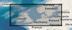
BIRPS (British Institutes Reflection Profiling Syndicate) Deep Seismic Reflection Data from the UK and North-West European Continental Shelf (1981-1991)
The British Institutions Reflection Profiling Syndicate (BIRPS) shot approximately 12,000 km of deep, multi-channel seismic reflection data around the British Isles from 1981 to 1991 during 14 surveys. Recording depths vary depending on the purpose of the survey but range from 15 s to 40 s two-way time. Raw and processed digital data are archived by BGS who make the data available subject to the cost of reproduction and handling. Seismic sections and other analogue ancillary data are available for some surveys. Gravity and magnetic data may also be available.
Simple
- Date (Creation)
- 1981
- Citation identifier
- http://data.bgs.ac.uk/id/dataHolding/13605653
- Point of contact
-
Organisation name Individual name Electronic mail address Role Natural Enironmental Research Council
not available
Owner British Geological Survey
Enquiries
Distributor British Geological Survey
Enquiries
Point of contact British Geological Survey
Enquiries
not available
Custodian British Geological Survey
Enquiries
not available
Distributor
- Maintenance and update frequency
- Not planned
-
GEMET - INSPIRE themes, version 1.0
-
BGS Thesaurus of Geosciences
-
-
Geological data
-
Geophysical data
-
Marine surveys
-
Marine seismic surveys
-
Sea floor
-
Geological surveys
-
Marine geophysics
-
Geophysics
-
Seismic data
-
Seismic reflection surveys
-
Geology
-
Geophysical surveys
-
Marine geology
-
Seismic surveys
-
- dataCentre
- Keywords
-
-
NERC_DDC
-
- Access constraints
- Other restrictions
- Use constraints
- Other restrictions
- Other constraints
-
The copyright of materials derived from the British Geological Survey's work is vested in the Natural Environment Research Council [NERC]. No part of this work may be reproduced or transmitted in any form or by any means, or stored in a retrieval system of any nature, without the prior permission of the copyright holder, via the BGS Intellectual Property Rights Manager. Use by customers of information provided by the BGS, is at the customer's own risk. In view of the disparate sources of information at BGS's disposal, including such material donated to BGS, that BGS accepts in good faith as being accurate, the Natural Environment Research Council (NERC) gives no warranty, expressed or implied, as to the quality or accuracy of the information supplied, or to the information's suitability for any use. NERC/BGS accepts no liability whatever in respect of loss, damage, injury or other occurence however caused.
- Other constraints
-
Either: (i) the dataset is made freely available, e.g. via the Internet, for a restricted category of use (e.g. educational use only); or (ii) the dataset has not been formally approved by BGS for access and use by external clients under licence, but its use may be permitted under alternative formal arrangements; or (iii) the dataset contains 3rd party data or information obtained by BGS under terms and conditions that must be consulted in order to determine the permitted usage of the dataset. Refer to the BGS staff member responsible for the creation of the dataset if further advice is required. He / she should be familiar with the composition of the dataset, particularly with regard to 3rd party IPR contained in it, and any resultant use restrictions. This staff member should revert to the IPR Section ( ipr@bgs.ac.uk) for advice, should the position not be clear.
- Spatial representation type
- Vector
- Denominator
- 250000
- Language
- English
- Topic category
-
- Geoscientific information
- Geographic identifier
-
BALTIC SEA [id=2002255]
British Geological Survey Gazetteer: Gazetteer of sea areas 2010 revision
- Geographic identifier
-
CELTIC SEA [id=2001353]
British Geological Survey Gazetteer: Gazetteer of sea areas 2010 revision
- Geographic identifier
-
ENGLISH CHANNEL [id=2001401]
British Geological Survey Gazetteer: Gazetteer of sea areas 2010 revision
- Geographic identifier
-
INNER SEAS OFF THE WEST COAST OF SCOTLAND [id=2001428]
British Geological Survey Gazetteer: Gazetteer of sea areas 2010 revision
- Geographic identifier
-
IRISH SEA [id=2001430]
British Geological Survey Gazetteer: Gazetteer of sea areas 2010 revision
- Geographic identifier
-
NORTH ATLANTIC OCEAN [id=2002262]
British Geological Survey Gazetteer: Gazetteer of sea areas 2010 revision
- Geographic identifier
-
NORTH SEA [id=2001452]
British Geological Survey Gazetteer: Gazetteer of sea areas 2010 revision
- Geographic identifier
-
NORTHEAST ATLANTIC OCEAN (40W) (aggregate) [id=2002274]
British Geological Survey Gazetteer: Gazetteer of sea areas 2010 revision
- Geographic identifier
-
NORTHEAST ATLANTIC OCEAN (40W) [id=2001453]
British Geological Survey Gazetteer: Gazetteer of sea areas 2010 revision
- Geographic identifier
-
NORTHWEST EUROPEAN CONTINENTAL SHELF [id=121700]
British Geological Survey Gazetteer: Geographical hierarchy from Geosaurus 1979 creation
- Geographic identifier
-
UK CONTINENTAL SHELF [id=121701]
British Geological Survey Gazetteer: Geographical hierarchy from Geosaurus 1979 creation
))
- Begin date
- 1981
- End date
- 1991
- Supplemental Information
-
The following links provide more details regarding the surveys undertaken by BIRPS, some of its history and publications: http://www.earthscrust.org.au/science/startups/birps-su.html; http://bullard.esc.cam.ac.uk/~birps/; SNYDER, D. & HOBBS, R. 1991. The BIRPS Atlas: Deep Seismic Reflection Profiles Around the British Isles. http://books.google.co.uk/books?id=wO2LMRXAbSkC&printsec=frontcover&dq=isbn:0521418283; SNYDER, D. & HOBBS, R. 1999. The BIRPS Atlas II. A Second Decade of Deep Seismic Reflection Profiling. http://www.geolsoc.org.uk/MPB42; All the final stack BIRPS data are on the Virtual Seismic Atlas hosted by Leeds University. The following link lists all the BIRPS profiles ever acquired http://see-atlas.leeds.ac.uk:8080/search/advancedSearch.jsp?N=0&Ntk=all&Ntx=mode+matchall&Nty=1&Ntt=BIRPS
- Unique resource identifier
- OSGB 1936 / British National Grid (EPSG::27700)
- Unique resource identifier
- ED50 (EPSG::4230)
- Unique resource identifier
- WGS 84 (EPSG::4326)
- Distribution format
-
Name Version SEG-Y
witheld
- Distributor contact
-
Organisation name Individual name Electronic mail address Role British Geological Survey
Enquiries
Distributor
- Distributor contact
-
Organisation name Individual name Electronic mail address Role British Geological Survey
Enquiries
not available
Distributor
- OnLine resource
-
Protocol Linkage Name WWW:LINK-1.0-http--link
https://www.bgs.ac.uk/ BGS Homepage
- Hierarchy level
- Dataset
- Other
-
dataset
Conformance result
- Title
-
INSPIRE Implementing rules laying down technical arrangements for the interoperability and harmonisation of Geology
- Date (Publication)
- 2011
- Explanation
-
See the referenced specification
- Pass
- No
Conformance result
- Title
-
Commission Regulation (EU) No 1089/2010 of 23 November 2010 implementing Directive 2007/2/EC of the European Parliament and of the Council as regards interoperability of spatial data sets and services
- Date (Publication)
- 2010-12-08
- Explanation
-
See http://eur-lex.europa.eu/LexUriServ/LexUriServ.do?uri=OJ:L:2010:323:0011:0102:EN:PDF
- Pass
- No
- Statement
-
The British Institutions Reflection Profiling Syndicate (BIRPS) shot approximately 12,000 km of deep, multi-channel seismic reflection data around the British Isles from 1981 to 1991 during 14 surveys. Recording depths vary depending on the purpose of the survey but range from 15 s to 40 s two-way time.
Metadata
- File identifier
- c425c9fc-cb6c-352c-e044-0003ba9b0d98 XML
- Metadata language
- English
- Hierarchy level
- Dataset
- Date stamp
- 2026-07-11
- Metadata standard name
- UK GEMINI
- Metadata standard version
-
2.3
- Metadata author
-
Organisation name Individual name Electronic mail address Role British Geological Survey
Point of contact
- Dataset URI
)))
