BGS Data Catalogue
Marine Sediment Particle Size Data from around the UK (1966 Onwards)
The data set consists of the results of particle size analysis (PSA) performed on approximetaly 29,000 sea-bed sediment samples collected by BGS from the UK Continental Shelf and adjacent deep water areas, mostly using sediment grabs, but also sediment corers on occasions. Measurements were also made on approximately 8000 downhole sub-samples from shallow cores and boreholes. Data from other UK organisations have also been added to the PSA dataset. The data are stored as part of the National Geoscience Data Centre (NGDC) and the Marine Environmental Data and Information Network (MEDIN) Data Archive Centre (DAC) for Geology and Geophysics. Data are delivered via the BGS Offshore GeoIndex www.bgs.ac.uk/GeoIndex/offshore.htm Seabed Sediment Data layers.
INSPIRE
Identification
- File identifier
- c35e3405-9db0-6d8b-e044-0003ba9b0d98 XML
- Resource type
- dataset
Online resource
Resource identifier
- Metadata Language
- English (en)
- Spatial representation type
- vector
Encoding
- Format
-
CSV
- Format
-
Excel
- Format
-
GIS
Classification of data and services
- Topic category
-
- Geoscientific information
Classification of data and services
Coupled resource
Coupled resource
Classification of data and services
Coupled resource
Coupled resource
Keywords
- GEMET - INSPIRE themes, version 1.0
- BGS Thesaurus of Geosciences
-
-
MEDIN
-
Marine sediments
-
Bottom sampling
-
Geological data
-
Sea floor sediments
-
UK Location (INSPIRE)
-
Marine geology
-
Marine surveys
-
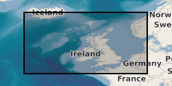
Geographic coverage
))
Temporal reference
Temporal extent
Temporal extent
- Dataset Reference Date ()
- 1966
Quality and validity
- Lineage
-
Seabed sediment samples were collected by BGS during offshore surveys mainly using grabs, but also sediment corers on occasions (vibrocores, gravity cores). Particle size analysis was performed on approximately 29,000 samples. The dried samples were split into gravel, sand and mud fractions using seives and the weights recorded. The carbonate content of each fraction was then measured. The grain size of the sand fractions from a subset of the samples has been analysed in more detail at either whole or half phi intervals. For some locations more detailed measurements were made for both the gravel and sand fractions also. Measurements were also made on approximately 8000 downhole sub-samples from shallow cores and boreholes. Most test results are available digitally, although there is still a significant amount of legacy results stored on paper. Data are stored as part of the National Geoscience Data Centre (NGDC). Core material are managed as part of the BGS Materials collection and are available for examination, testing or subsampling.
- Denominator
- 250000
Conformity
Conformity
Conformity
Conformity
Conformity
Conformity
- Explanation
-
See the referenced specification
Restrictions on access and use
- Access constraints
- licenceOGL
- Access constraints
- Available under the Open Government Licence subject to the following acknowledgement accompanying the reproduced NERC materials "Contains NERC materials ©NERC [year]"
- Access constraints
-
The copyright of materials derived from the British Geological Survey's work is vested in the Natural Environment Research Council [NERC]. No part of this work may be reproduced or transmitted in any form or by any means, or stored in a retrieval system of any nature, without the prior permission of the copyright holder, via the BGS Intellectual Property Rights Manager. Use by customers of information provided by the BGS, is at the customer's own risk. In view of the disparate sources of information at BGS's disposal, including such material donated to BGS, that BGS accepts in good faith as being accurate, the Natural Environment Research Council (NERC) gives no warranty, expressed or implied, as to the quality or accuracy of the information supplied, or to the information's suitability for any use. NERC/BGS accepts no liability whatever in respect of loss, damage, injury or other occurence however caused.
- Access constraints
-
Available under the Open Government Licence subject to the following acknowledgement accompanying the reproduced NERC materials "Contains NERC materials ©NERC [year]"
Responsible organization (s)
Contact for the resource
- Organisation name
-
British Geological Survey
-
enquiries@bgs.ac enquiries@bgs.ac.uk
- Organisation name
-
British Geological Survey
-
enquiries@bgs.ac enquiries@bgs.ac.uk
- Organisation name
-
British Geological Survey
-
enquiries@bgs.ac enquiries@bgs.ac.uk
- Organisation name
-
British Geological Survey
-
enquiries@bgs.ac enquiries@bgs.ac.uk
- Organisation name
-
British Geological Survey
-
enquiries@bgs.ac enquiries@bgs.ac.uk
Metadata information
Contact for the metadata
- Organisation name
-
British Geological Survey
-
enquiries@bgs.ac enquiries@bgs.ac.uk
- Metadata Date
- 2024-04-24
- Metadata Language
- English (en)