BGS Data Catalogue
Marine Geotechnical Data from around the UK (1975 Onwards)
The data consist of the results of geotechnical testing carried out at various depth intervals on shallow cores or boreholes collected BGS from the UK Continental Shelf. The bulk of the data north of 56N are in digital form and result from testing carried out on board survey vessels using hand-held test equipment (penetrometers and shear vanes). These values are averaged for each test interval, and are expressed in kiloPascals. There are approximately 6000 test results in the data set. Some more detailed test information, in non-digital and report form is held for selected sites. Also for most sites where digital data is not available, geological descriptions of core material will also contains semi-quantitative information on the stiffness of the material. Geotechnical knowledge is required to understand and interpret the results if they are to be used as a basis for engineering studies. Core material are managed as part of the BGS Materials collection and are available for examination, testing or subsampling. The data are stored as part of the National Geoscience Data Centre (NGDC) and the Marine Environmental Data and Information Network (MEDIN) Data Archive Centre (DAC) for Geology and Geophysics. Data are delivered via BGS Offshore GeoIndex www.bgs.ac.uk/GeoIndex/offshore.htm geotechnical layers. Reference: Fannin, NGT. (1989) Offshore Investigations 1966-87. British Geological Survey Technical Report WB/89/2, British Geological Survey.
INSPIRE
Identification
- File identifier
- c35e3405-9dae-6d8b-e044-0003ba9b0d98 XML
- Resource type
- dataset
Online resource
Resource identifier
- Metadata Language
- English (en)
- Spatial representation type
- vector
Encoding
- Format
-
PDF
- Format
-
CSV
- Format
-
Excel
Classification of data and services
- Topic category
-
- Geoscientific information
Classification of data and services
Coupled resource
Coupled resource
Classification of data and services
Coupled resource
Coupled resource
Keywords
- GEMET - INSPIRE themes, version 1.0
- BGS Thesaurus of Geosciences
-
-
Geology
-
Marine geology
-
Marine sediments
-
Marine surveys
-
Sea floor sediments
-
MEDIN
-
Core drilling
-
Boreholes
-
UK Location (INSPIRE)
-
Bottom sampling
-
Marine geotechnical assessment
-
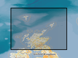
Geographic coverage
))
Temporal reference
Temporal extent
Temporal extent
- Dataset Reference Date ()
- 1975
Quality and validity
- Lineage
-
Borehole and shallow core material were collected by BGS during offshore surveys using various sampling techniques such as vibrocore, gravity core and wireline drilling. Geotechnical tests were carried out using hand-held test equipment (penetrometers and shear vanes). This dataset has been managed by BGS over a considerable period of time. Legacy paper records have undergone selective scanning and/or transcription to digital formats, with ongoing QC of the information captured and migration to the BGS Database. More recent data is captured digitally and, where appropriate, loaded to the database. Data are stored as part of the National Geoscience Data Centre (NGDC) and information is delivered via the BGS web site.
- Denominator
- 250000
Conformity
Conformity
Conformity
Conformity
Conformity
Conformity
- Explanation
-
See the referenced specification
Restrictions on access and use
- Access constraints
- licenceOGL
- Access constraints
- Available under the Open Government Licence subject to the following acknowledgement accompanying the reproduced NERC materials "Contains NERC materials ©NERC [year]"
- Access constraints
-
The copyright of materials derived from the British Geological Survey's work is vested in the Natural Environment Research Council [NERC]. No part of this work may be reproduced or transmitted in any form or by any means, or stored in a retrieval system of any nature, without the prior permission of the copyright holder, via the BGS Intellectual Property Rights Manager. Use by customers of information provided by the BGS, is at the customer's own risk. In view of the disparate sources of information at BGS's disposal, including such material donated to BGS, that BGS accepts in good faith as being accurate, the Natural Environment Research Council (NERC) gives no warranty, expressed or implied, as to the quality or accuracy of the information supplied, or to the information's suitability for any use. NERC/BGS accepts no liability whatever in respect of loss, damage, injury or other occurence however caused.
- Access constraints
-
Available under the Open Government Licence subject to the following acknowledgement accompanying the reproduced NERC materials "Contains NERC materials ©NERC [year]"
Responsible organization (s)
Contact for the resource
- Organisation name
-
British Geological Survey
-
enquiries@bgs.ac enquiries@bgs.ac.uk
- Organisation name
-
British Geological Survey
-
enquiries@bgs.ac enquiries@bgs.ac.uk
- Organisation name
-
British Geological Survey
-
enquiries@bgs.ac enquiries@bgs.ac.uk
- Organisation name
-
British Geological Survey
-
enquiries@bgs.ac enquiries@bgs.ac.uk
- Organisation name
-
British Geological Survey
-
enquiries@bgs.ac enquiries@bgs.ac.uk
Metadata information
Contact for the metadata
- Organisation name
-
British Geological Survey
-
enquiries@bgs.ac enquiries@bgs.ac.uk
- Metadata Date
- 2024-04-21
- Metadata Language
- English (en)