BGS Data Catalogue
Marine Geological Sample Data from around the UK (1966 onwards)
The British Geological Survey has collected over 50000 offshore samples using grabs, dredges and shallow coring devices (to a maximum depth of 6m below the sea bed). The collection also includes additional third party data and has assisted in the creation of BGS Marine Geology Maps. The distribution is variable, but in general there are sample stations spaced about every 5 - 10km across the entire UK Continental Shelf (UKCS). In some localised areas the sampling density is much higher. The data held includes digital data and analogue records (sample data sheets), plus associated physical sample material. Sample data sheets which have been scanned contain index information and geological descriptions and are more detailed from 1983 onwards. Coded geological descriptions were entered on sheets which were subsequently digitised, and this information is available for about 10,000 samples. The data also includes results of analyses such as micropalaeontological examination or age dating. Particle Size Analysis, geochemistry and geotechnical data are described in separate metadata entries. Sample material are managed as part of the BGS Materials collection and are available for examination and subsampling. The data are stored within the National Geoscience Data Centre (NGDC) and Marine Environmental Data and Information Network (MEDIN) Data Archive Centre (DAC) for Geology and Geophysics. Data are delivered via the BGS Offshore GeoIndex www.bgs.ac.uk/GeoIndex/offshore.htm.The activity and scan layers contains location information, metadata and links to scanned sample datasheets/core logs, and the geological, geotechnical, geochemical and sea-bed sediment data layers contain observations and/or measurements as digital values. The data are applicable to a wide range of uses including environmental, geotechnical and geological studies. Reference: Fannin, NGT. (1989) Offshore Investigations 1966-87. British Geological Survey Technical Report WB/89/2, British Geological Survey.
INSPIRE
Identification
- File identifier
- c35e3405-9dad-6d8b-e044-0003ba9b0d98 XML
- Resource type
- dataset
Online resource
Resource identifier
- Metadata Language
- English (en)
- Spatial representation type
- vector
Encoding
- Format
-
PDF
- Format
-
CSV
- Format
-
GIS
Classification of data and services
- Topic category
-
- Geoscientific information
Classification of data and services
Coupled resource
Coupled resource
Classification of data and services
Coupled resource
Coupled resource
Keywords
- GEMET - INSPIRE themes, version 1.0
- BGS Thesaurus of Geosciences
-
-
Core drilling
-
Geological data
-
Marine surveys
-
Marine geology
-
Bottom sampling
-
Core logs
-
Geological surveys
-
Geology
-
Absorbents
-
Marine sediments
-
Boreholes
-
MEDIN
-
Sea floor sediments
-
UK Location (INSPIRE)
-
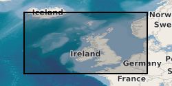
Geographic coverage
))
Temporal reference
Temporal extent
Temporal extent
- Dataset Reference Date ()
- 1966
Quality and validity
- Lineage
-
Core material and seabed samples were collected during offshore surveys using various sampling techniques. Sampling equipment used includes shallow coring devices such as vibrocore, gravity core, seabed drill and seabed sampling devices such as grabs and dredges. Sample material was then described/analysed. This dataset has been managed by BGS over a considerable period of time. Legacy paper records from have been scanned and transcribed to digital formats where appropriate, with ongoing QC of the information captured and migration to the BGS Database System. More recent data is captured digitally and, where appropriate, loaded to the database and network file system. Information is delivered via the BGS web site.
- Denominator
- 250000
Conformity
Conformity
Conformity
Conformity
Conformity
Conformity
- Explanation
-
See the referenced specification
Restrictions on access and use
- Access constraints
- licenceOGL
- Access constraints
- Available under the Open Government Licence subject to the following acknowledgement accompanying the reproduced NERC materials "Contains NERC materials ©NERC [year]"
- Access constraints
-
The copyright of materials derived from the British Geological Survey's work is vested in the Natural Environment Research Council [NERC]. No part of this work may be reproduced or transmitted in any form or by any means, or stored in a retrieval system of any nature, without the prior permission of the copyright holder, via the BGS Intellectual Property Rights Manager. Use by customers of information provided by the BGS, is at the customer's own risk. In view of the disparate sources of information at BGS's disposal, including such material donated to BGS, that BGS accepts in good faith as being accurate, the Natural Environment Research Council (NERC) gives no warranty, expressed or implied, as to the quality or accuracy of the information supplied, or to the information's suitability for any use. NERC/BGS accepts no liability whatever in respect of loss, damage, injury or other occurence however caused.
- Access constraints
-
Available under the Open Government Licence subject to the following acknowledgement accompanying the reproduced NERC materials "Contains NERC materials ©NERC [year]"
Responsible organization (s)
Contact for the resource
- Organisation name
-
British Geological Survey
-
enquiries@bgs.ac enquiries@bgs.ac.uk
- Organisation name
-
British Geological Survey
-
enquiries@bgs.ac enquiries@bgs.ac.uk
- Organisation name
-
British Geological Survey
-
enquiries@bgs.ac enquiries@bgs.ac.uk
- Organisation name
-
British Geological Survey
-
enquiries@bgs.ac enquiries@bgs.ac.uk
- Organisation name
-
British Geological Survey
-
enquiries@bgs.ac enquiries@bgs.ac.uk
Metadata information
Contact for the metadata
- Organisation name
-
British Geological Survey
-
enquiries@bgs.ac enquiries@bgs.ac.uk
- Metadata Date
- 2024-04-23
- Metadata Language
- English (en)