BGS Data Catalogue
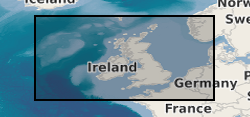
Marine Borehole Logs, Data and Materials from around the UK (1969 Onwards)
BGS has drilled almost 600 boreholes to prove seismic interpretations of the marine Quaternary geology and bedrock from the UK Continental Shelf (UKCS). The collection also includes additional third party data and has assisted in the creation of BGS Marine Geology Maps. The boreholes penetrate beneath the sea bed to depths ranging from about 10m to over 300m depending on the target depth or technical problems associated with drilling the borehole. The data includes descriptive geological core logs and data which has been captured from these and in some cases natural gamma logs. A variety of analyses has been conducted on the core material such as Particle Size Analysis, micropalaeontological, geotechnical, palaeomagnetic and age dating. Core material are managed as part of the BGS Materials collection and are available for examination and subsampling. The data are stored as part of the National Geoscience Data Centre (NGDC) and the Marine Environmental Data and Information Network (MEDIN) Data Archive Centre (DAC) for Geology and Geophysics. Data are delivered via the BGS Offshore GeoIndex http://www.bgs.ac.uk/GeoIndex/offshore.htm. The activity and scan layers contains location information, metadata and links to scanned borehole logs, and the geological data layers contain observations and/or measurements as digital values. The data are applicable to a wide range of uses including environmental, geotechnical and geological studies. Reference: Fannin, NGT. (1989) Offshore Investigations 1966-87 British Geological Survey Technical Report WB/89/02, British Geological Survey.
- Identification
- Distribution
- Quality
- Spatial rep.
- Ref. system
- Content
- Portrayal
- Metadata
- Md. constraints
- Md. maintenance
- Schema info
Identification
Data identification
Citation
- Date (Creation)
- 1969
- Citation identifier
- http://data.bgs.ac.uk/id/dataHolding/13605642
0115 936 3276
0115 936 3276
0115 936 3276
0115 936 3276
0115 936 3276
- Maintenance and update frequency
- Irregular
-
GEMET - INSPIRE themes, version 1.0
-
BGS Thesaurus of Geosciences
-
-
UK Location (INSPIRE)
-
Geochemical data
-
Marine geology
-
Marine surveys
-
Offshore drilling
-
Sea floor
-
MEDIN
-
Geological data
-
Boreholes
-
Bottom sampling
-
Data
-
Marine sediments
-
Marine geochemistry
-
Geochemistry
-
Graphic logs
-
Drilling
-
Geology
-
- dataCentre
- Keywords
-
-
NERC_DDC
-
Legal constraints
- Access constraints
- Other restrictions
- Other constraints
- licenceOGL
Legal constraints
- Use constraints
- Other restrictions
- Other constraints
-
The copyright of materials derived from the British Geological Survey's work is vested in the Natural Environment Research Council [NERC]. No part of this work may be reproduced or transmitted in any form or by any means, or stored in a retrieval system of any nature, without the prior permission of the copyright holder, via the BGS Intellectual Property Rights Manager. Use by customers of information provided by the BGS, is at the customer's own risk. In view of the disparate sources of information at BGS's disposal, including such material donated to BGS, that BGS accepts in good faith as being accurate, the Natural Environment Research Council (NERC) gives no warranty, expressed or implied, as to the quality or accuracy of the information supplied, or to the information's suitability for any use. NERC/BGS accepts no liability whatever in respect of loss, damage, injury or other occurence however caused.
- Other constraints
-
Available under the Open Government Licence subject to the following acknowledgement accompanying the reproduced NERC materials "Contains NERC materials ©NERC [year]"
- Spatial representation type
- Vector
- Denominator
- 250000
- Language
- English
- Topic category
-
- Geoscientific information
Extent
- Geographic identifier
-
BRISTOL CHANNEL [id=2001350]
British Geological Survey Gazetteer: Gazetteer of sea areas 2010
- Geographic identifier
-
CELTIC SEA [id=2001353]
British Geological Survey Gazetteer: Gazetteer of sea areas 2010
- Geographic identifier
-
ENGLISH CHANNEL [id=2001401]
British Geological Survey Gazetteer: Gazetteer of sea areas 2010
- Geographic identifier
-
INNER SEAS OFF THE WEST COAST OF SCOTLAND [id=2001428]
British Geological Survey Gazetteer: Gazetteer of sea areas 2010
- Geographic identifier
-
IRISH SEA [id=2001430]
British Geological Survey Gazetteer: Gazetteer of sea areas 2010
- Geographic identifier
-
NORTH ATLANTIC OCEAN [id=2002262]
British Geological Survey Gazetteer: Gazetteer of sea areas 2010
- Geographic identifier
-
NORTH SEA [id=2001452]
British Geological Survey Gazetteer: Gazetteer of sea areas 2010
- Geographic identifier
-
NORTHEAST ATLANTIC OCEAN (40W) [id=2001453]
British Geological Survey Gazetteer: Gazetteer of sea areas 2010
- Geographic identifier
-
UK CONTINENTAL SHELF [id=121701]
British Geological Survey Gazetteer: Geographical hierarchy from Geosaurus 1979
))
- Begin date
- 1969
- End date
- 1969 After
Distribution
Distribution
- Distribution format
-
-
PDF
()
-
CSV
()
-
GIS
()
-
PDF
()
0115 936 3276
- OnLine resource
- Offshore GeoIndex
- OnLine resource
- Offshore GeoIndex
- OnLine resource
- Offshore Theme
- OnLine resource
- Offshore (cultural data) theme
Quality
Data quality
Scope
- Hierarchy level
- Dataset
- Other
-
dataset
Conformance result
Citation
- Date (Publication)
- 2011
- Explanation
-
See the referenced specification
- Pass
- No
Conformance result
Citation
- Date (Publication)
- 2010-12-08
- Explanation
-
See http://eur-lex.europa.eu/LexUriServ/LexUriServ.do?uri=OJ:L:2010:323:0011:0102:EN:PDF
- Pass
- No
- Statement
-
Borehole core material were collected during offshore wireline drilling operations. Material was then described/analysed. This dataset has been managed by BGS over a considerable period of time. Legacy paper records have been scanned and transcribed to digital formats where appropriate, with ongoing QC of the information captured and migration to the BGS Database System. More recent data is captured digitally and, where appropriate, loaded to the database. Information is delivered via the BGS web site.
Ref. system
- Unique resource identifier
- OSGB 1936 / British National Grid (EPSG::27700)
- Unique resource identifier
- WGS 84 / UTM zone 29N (EPSG::32629)
- Unique resource identifier
- WGS 84 / UTM zone 30N (EPSG::32630)
- Unique resource identifier
- WGS 84 / UTM zone 31N (EPSG::32631)
- Unique resource identifier
- ED50 (EPSG::4230)
- Unique resource identifier
- WGS 84 (EPSG::4326)
Metadata
Metadata
- File identifier
- c35e3405-9dac-6d8b-e044-0003ba9b0d98 XML
- Metadata language
- English
- Hierarchy level
- Dataset
- Date stamp
- 2024-05-01T09:01:05.419362Z
- Metadata standard name
- UK GEMINI
- Metadata standard version
-
2.3
- Dataset URI